 wolfgangloeffler – weitgereist
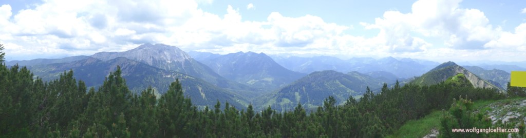
Halserspitz – panoramic summit in the Blauberge

Halfway between the lakes of Tegernsee and Achensee sits this rarely visited summit in the „Blauberge“ (Blue Mountains). There are three routes leading to the top which differ much when it comes to condition needed. Most of the time you will be recommended to take the route leading through the Wolfsschlucht. This is the most scenic way but since you will have to cope with a very difficult ascent at the end of the canyon this is also the one for which you will have to be in good shape. The second route leads uphill from Siebenhuetten. On this route the most difficult part is just below the summit. The easiest way runs from the Schwaigeralm through the „Lange Au“ with only a short steep track to the top. Once you have left this behind you will have the choice between the shorter but more difficult ascent straight to the summit or the longer track beieng more comfortable via the Bayrische Wildalm. Your reward will be in any of the three routes a fantastic view from the top of the Halserspitz.
- Ascent: 3700 feet
- Length: about 10 miles
- Duration: 7.5 hours
After the lockdown has been lifted in spring and it was possible again to go to the mountains I took the chance on the first day with good weather and went to get some fresh mountain air. So I packed my mask in the backpack, went to the station and took the train to Tegernsee. From there I continued on a bus to the parking lot for hikers in Wildbad Kreuth. It took me two hours to get there. In the morning the train and bus were pretty empty and social distancing was easily possible. But on the way back the bus was packed as well as the train. This was the point when I decided to take the car to get to the mountains the next time. My health is more important than environment protection.
On my first try to get to the summit I ended up in dense undergrowth on the top of a rock wall since the signs weren’t easy to read and I had lost the path. On this tour I came via the „Lange Au“. 10 days later I started the second try and took the route via Siebenhuetten. From there the path was easily to be found. In this psot I will combine both tours and describe the ascent via Siebenhuetten and take my first try via the „Lange Au“ as descent which I actually walked exactly this way on my second try. If you want to know more about the ascent via the Wolfschlucht you can read it here.

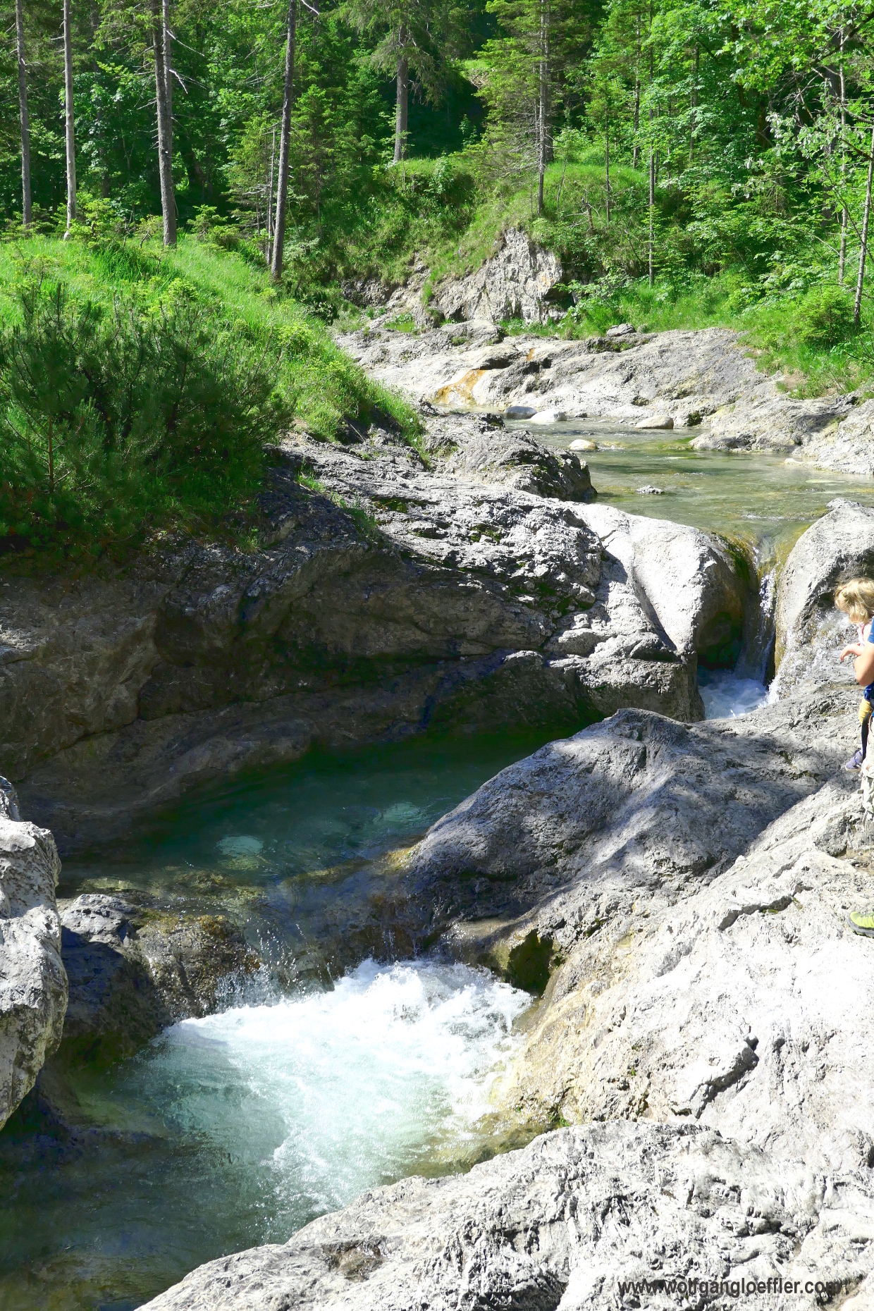
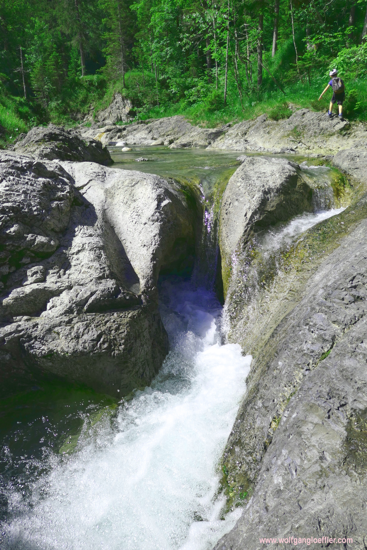
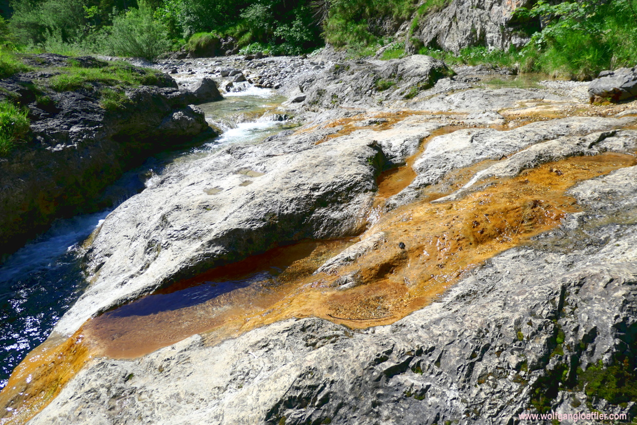
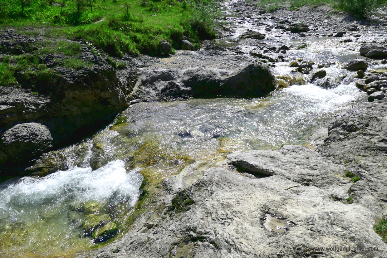
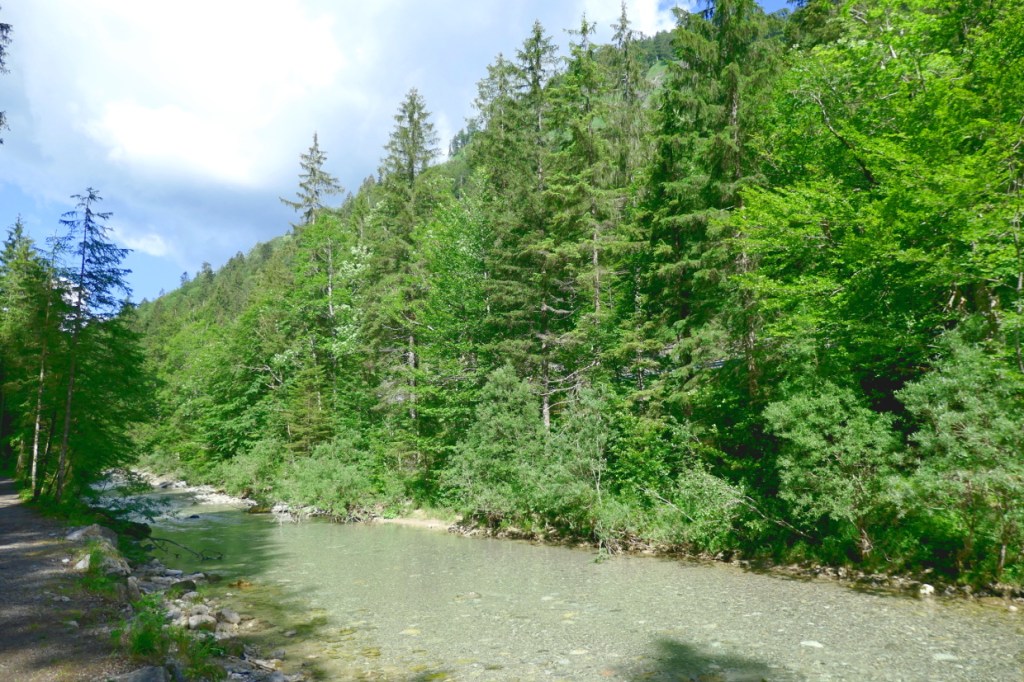
It still is early in the morning when I reach the parking for hikers in Wildbad Kreuth. Since my last visit they have added a new restroom hut which is very clean. For such a service I gladly pay a parking fee. Despite being here on a regular weekday the parking fills pretty fast. I was hoping that only a few would go on a tour this day. But social distancing is still possible. So I start my tour and follow the signs to Siebenhuetten. Once you reach the „Fischzucht“ (fish farm) you have the choice of following a well pepared gravel road or a small path running closer to the creek. The rapids you will only see when you take the path.


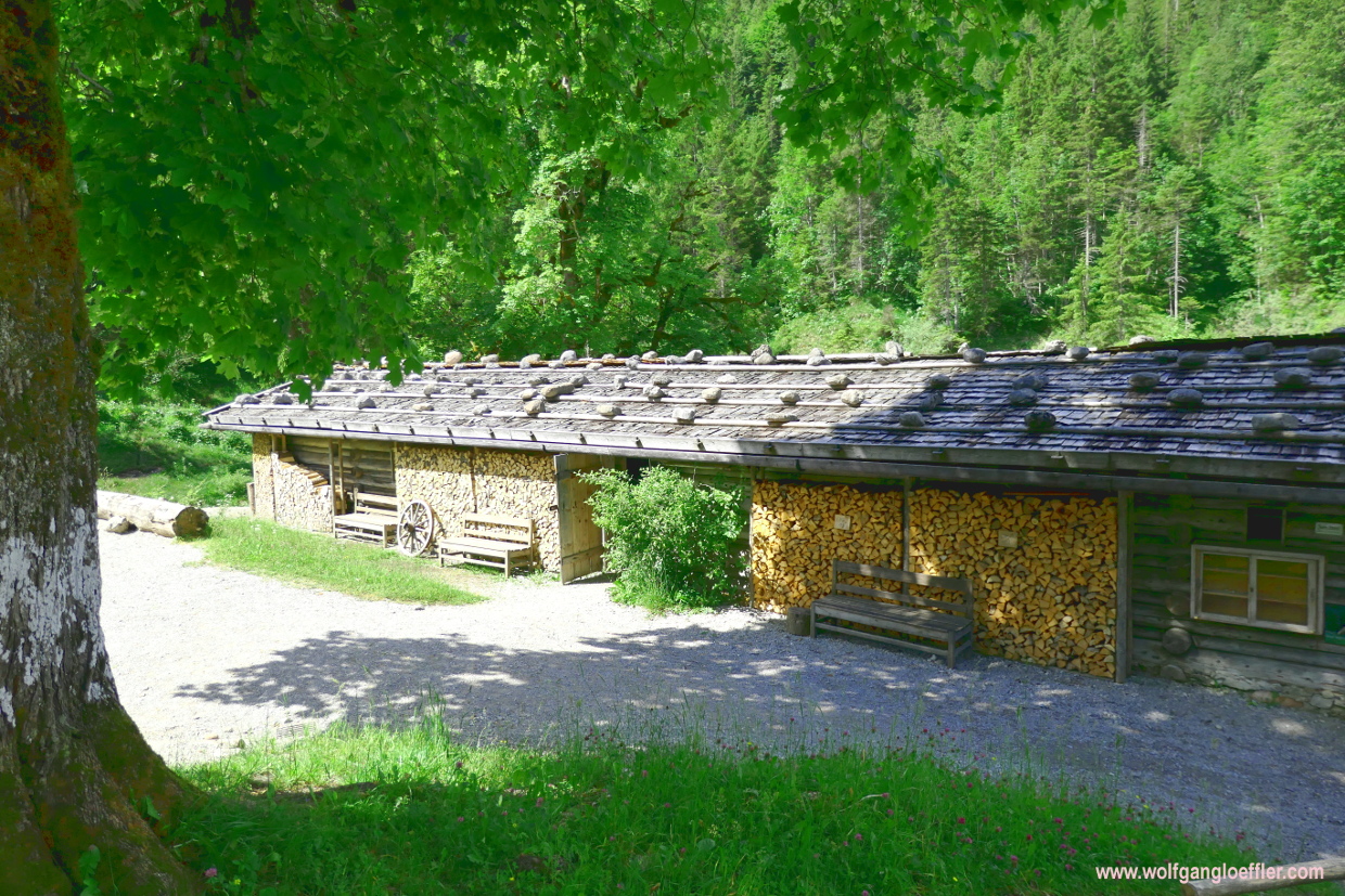
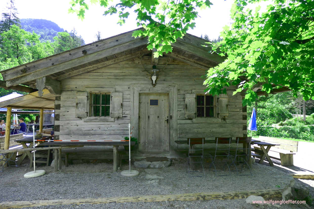
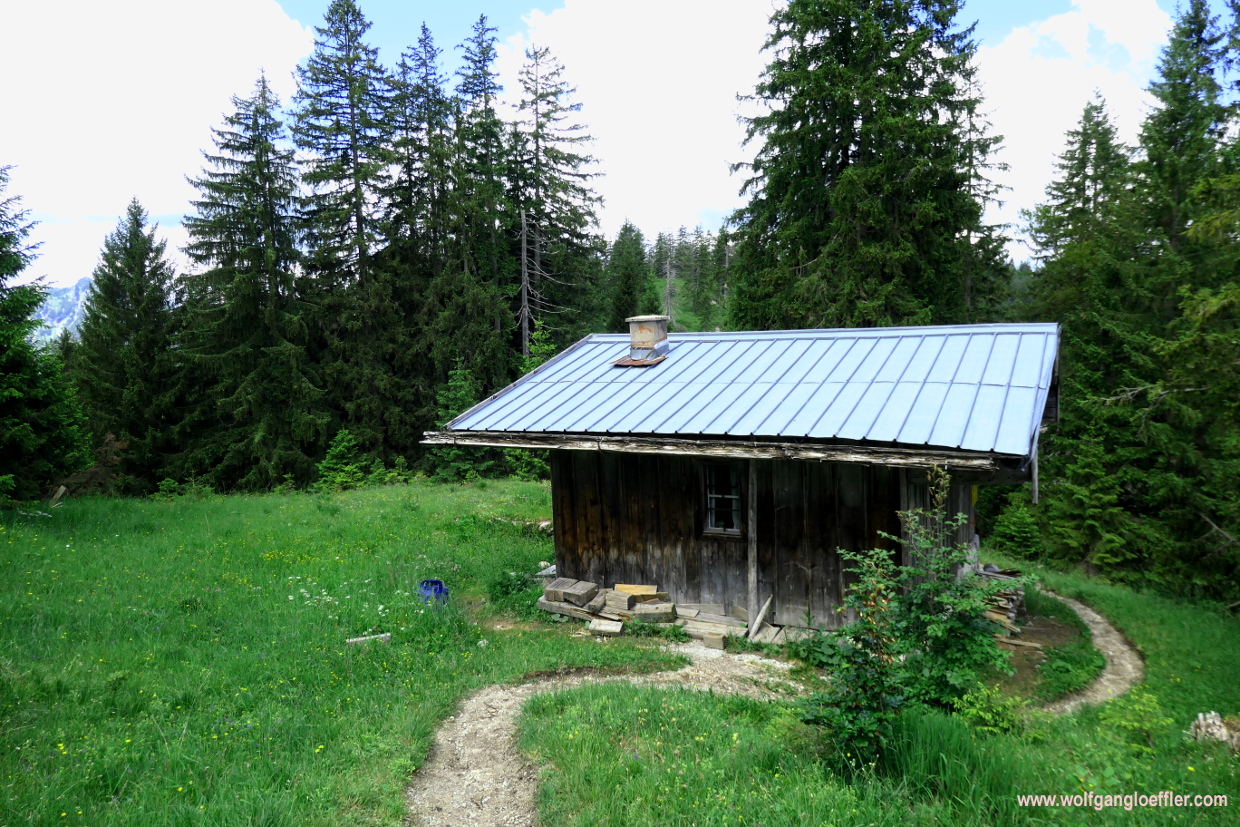
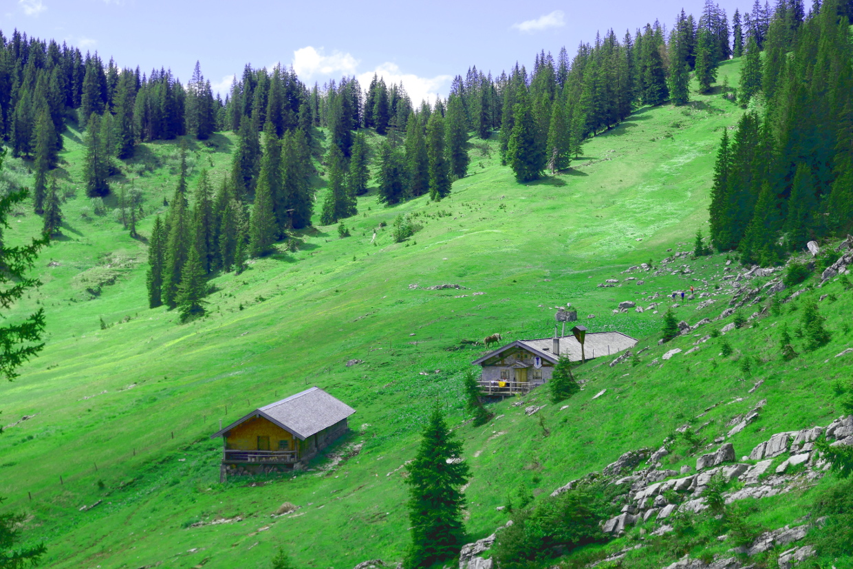
After about half an hour later I reach Siebenhütten. Originally there were seven huts and in the heydays about 500 goats. Today there are only three huts left. One of them is operating as a typical alpine snack cabin. But since the tour so far was more of a stroll I am not taking a rest this time. Looks very nice though, despite the offerings being somewhat limited due to COVID-19. The next operating cabin will be at the end of my tour. But I have brought water and food with me.


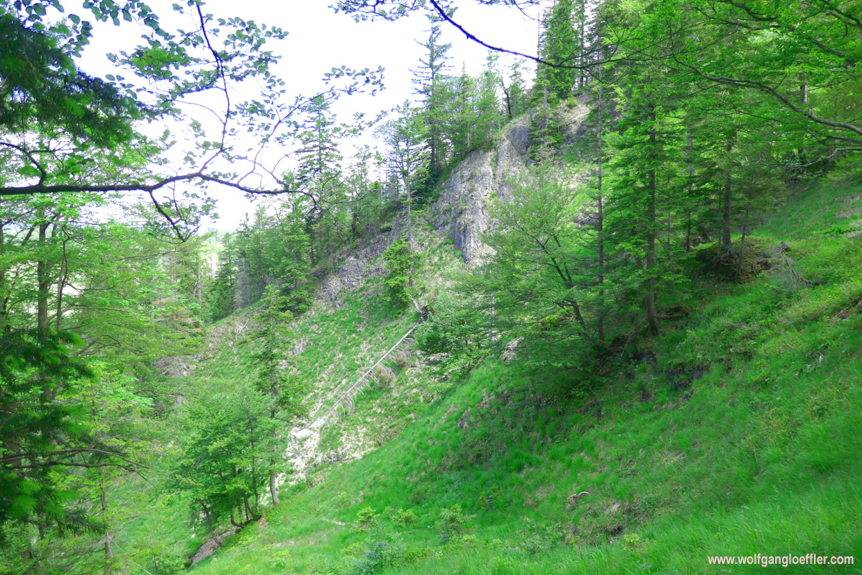
Shortly after the alp comes a furcation. To the right the path leads into the Wolfsschlucht. I have taken this before. At the beginning it is not that impressive but towards the end the canyon gets pretty spectacular. If it wouldn’t be for the strenous ascent at the end I would have taken this route. So I continue to the left following th signs towards Halserspitz. Still within sight of the Siebenhuetten I come across a meadow where cotton grass is growing and this butterfly that is sitting down on a flower and asks for being taken in a great shot.


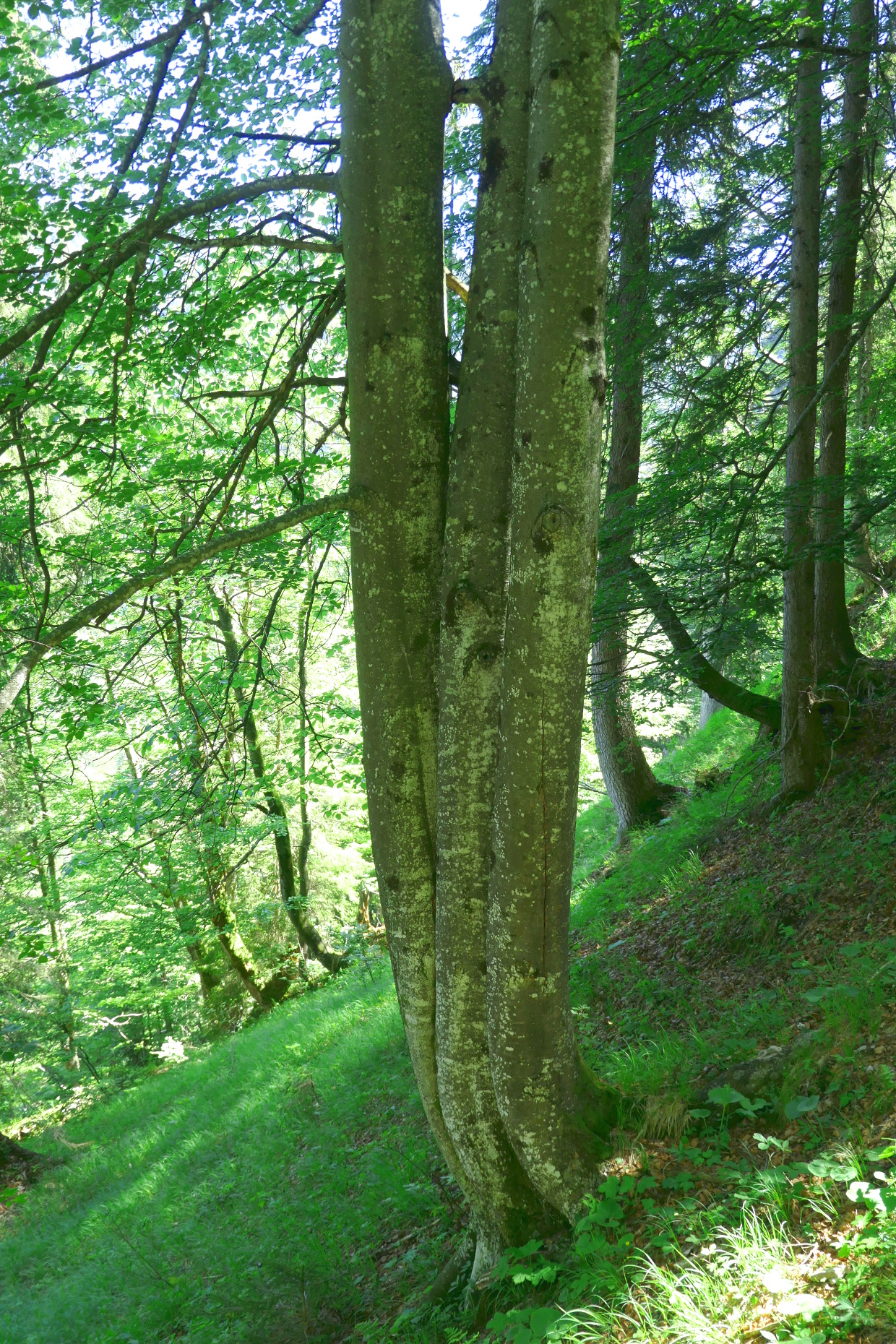
Behind this meadow follows a short stretch with a bit steeper path leading uphil in serpentines. But soon I do reach a small valley with a gurgling creek in the middle. The path mounts slowly along this creek. Pretty quaint. Once again I am asking myself how I am supposed to make the elevation when I am not gaining in height. Will there be a real steep stretch later? At one point the path turns right into the woods and is getting steeper. But not dramatically.


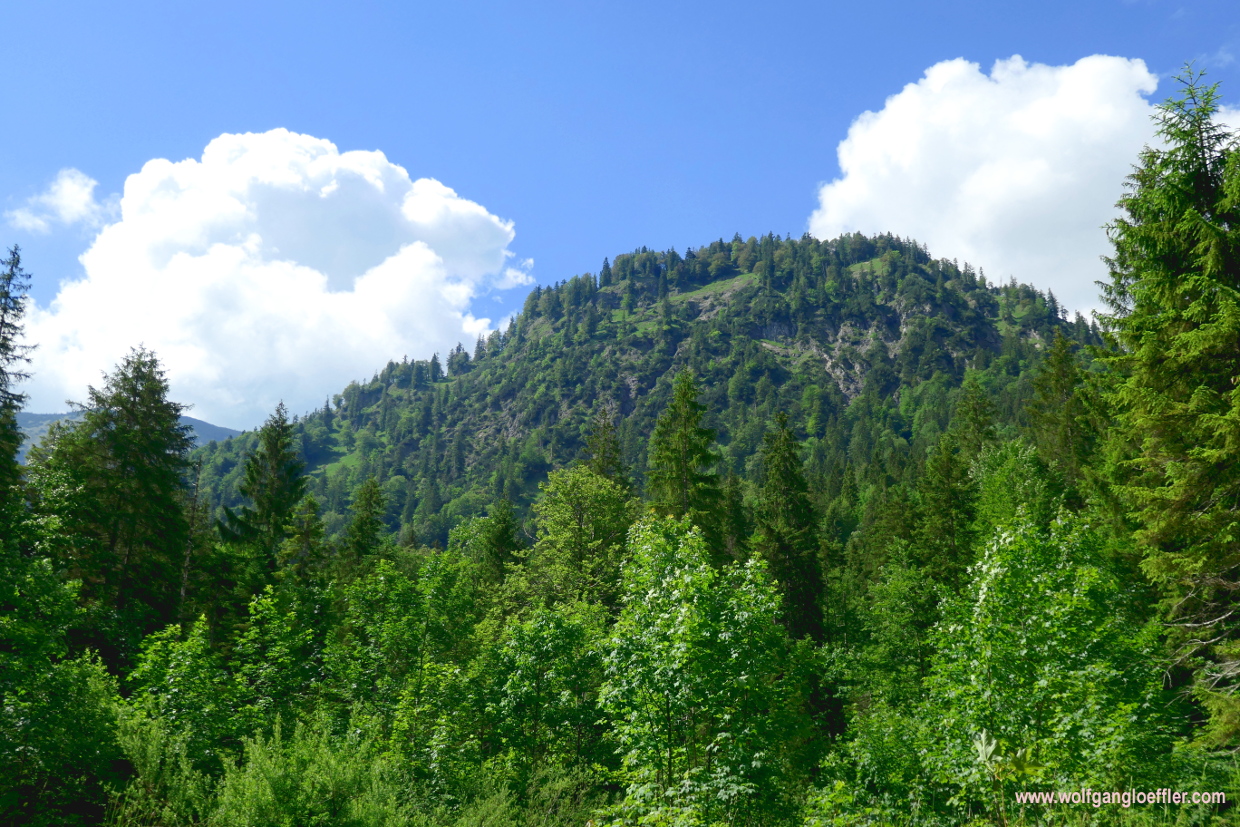
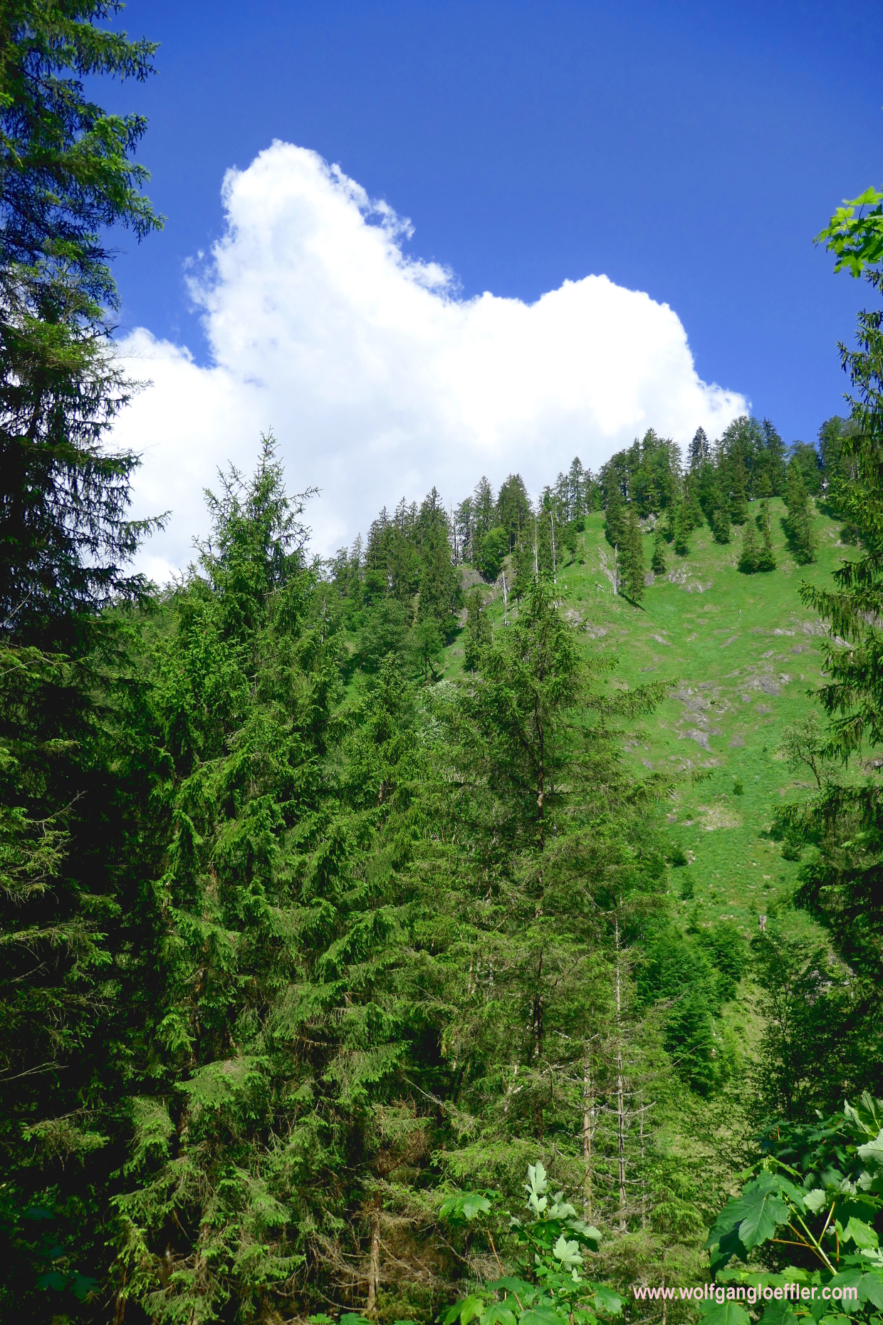
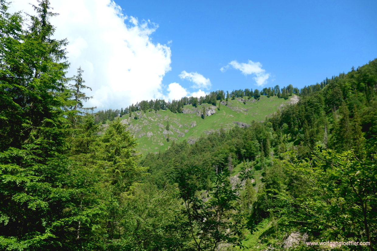
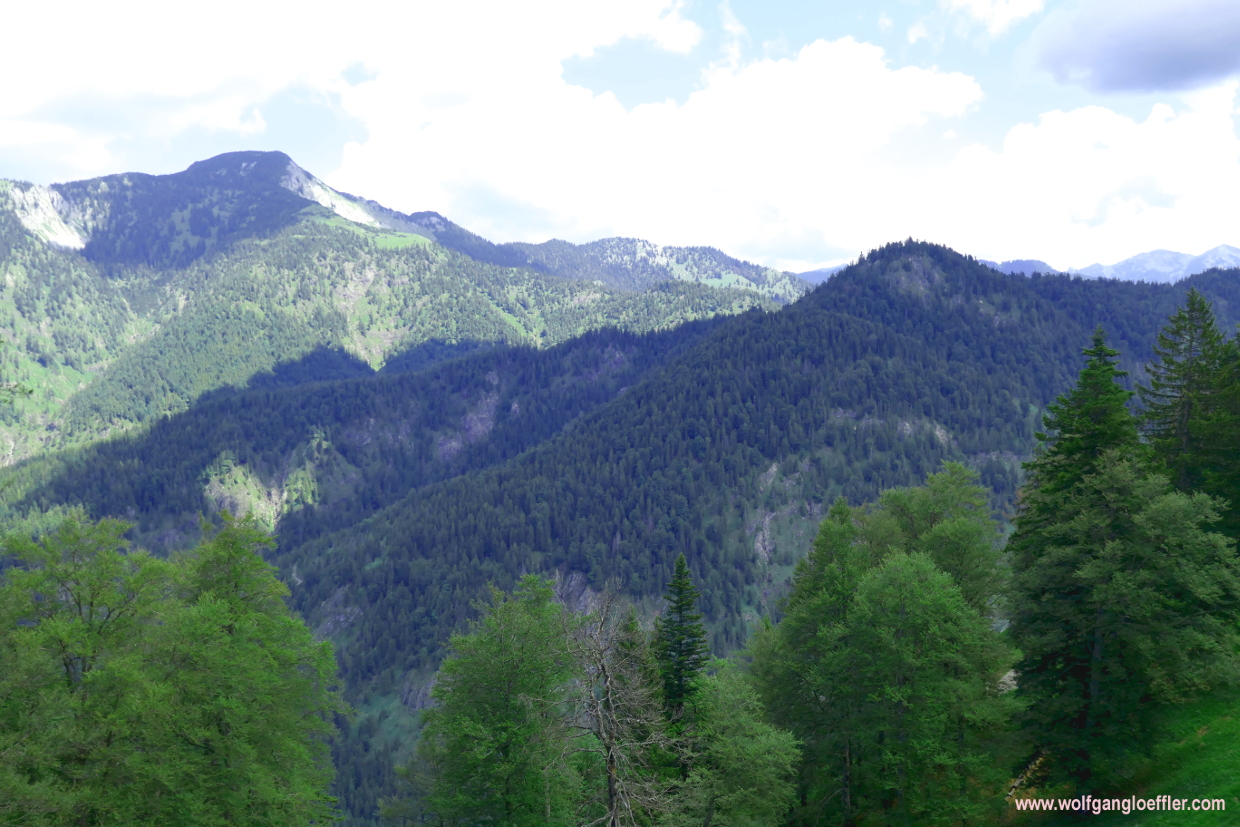
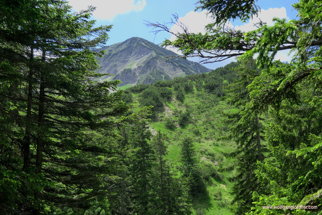
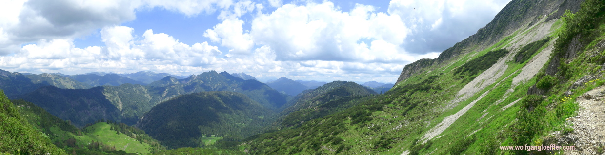
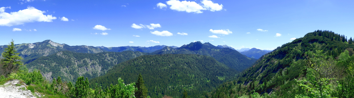
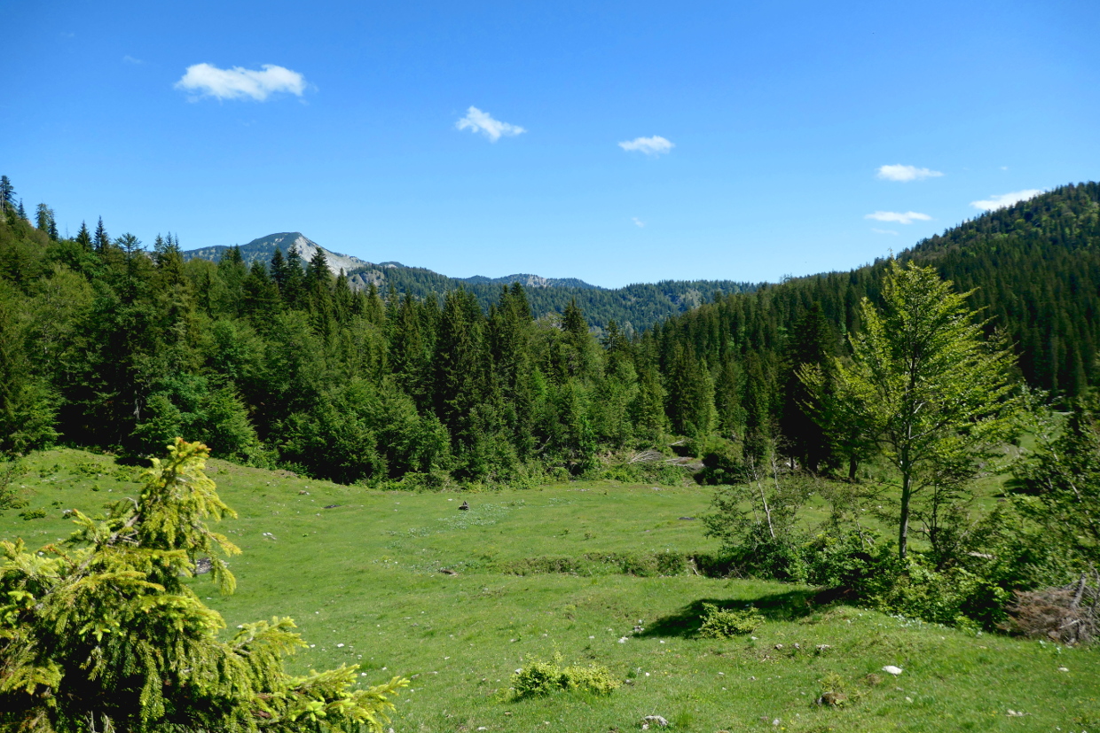
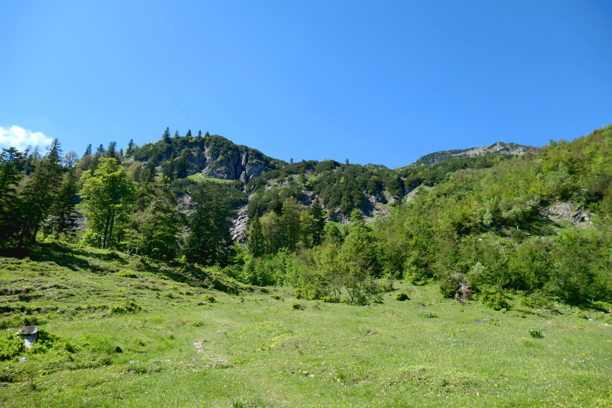
About half an hour after leaving Siebenhuetten I reach between the Wenig- and Zwieselberg a longer stretch leading over more even terrain and am walking through dense forest towards the Weißenbachkopf. At least I get the first panoramic glimpses of the bavarian mountains from time to time. This vastness fascinates me again and again. So I take a deep breath and enjoy the tangy air.
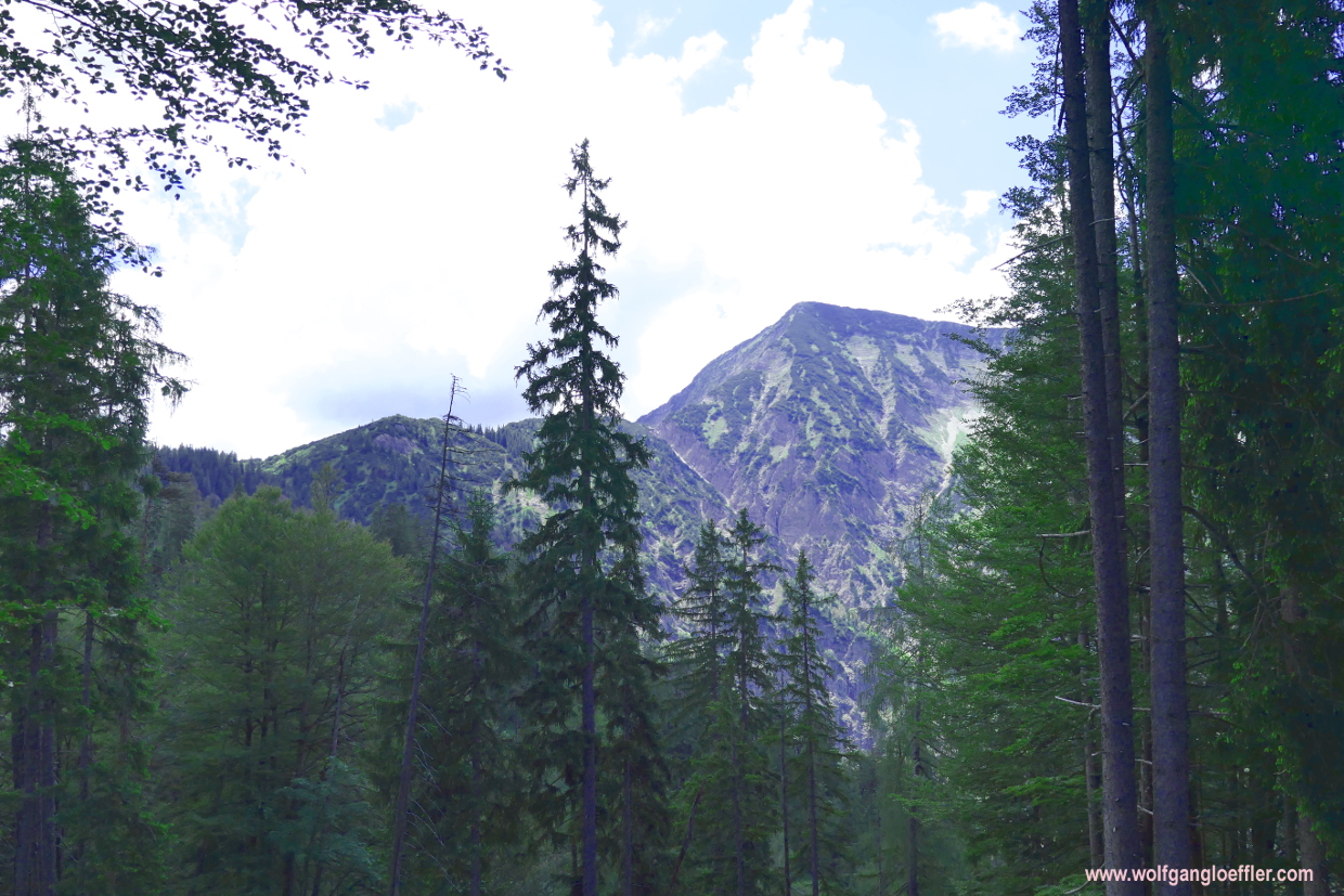


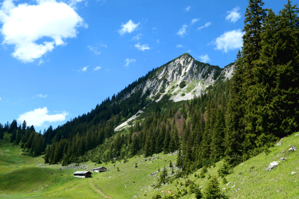
And then I see the summit of the Halserspitz for the first time. And realise that I have to climb a few more feet. A look on my plan tells me about 1650. Since it is not that hot today and the path so far lead mostly through the shades in the woods this shouln’t pose a problem. A bit of a challenge is always welcome. The last stretch leading to the summit looks a bit more difficult from here. I will see this later.


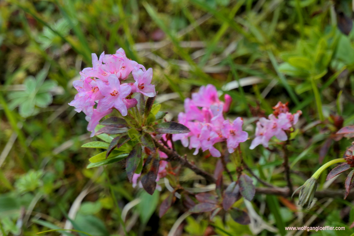
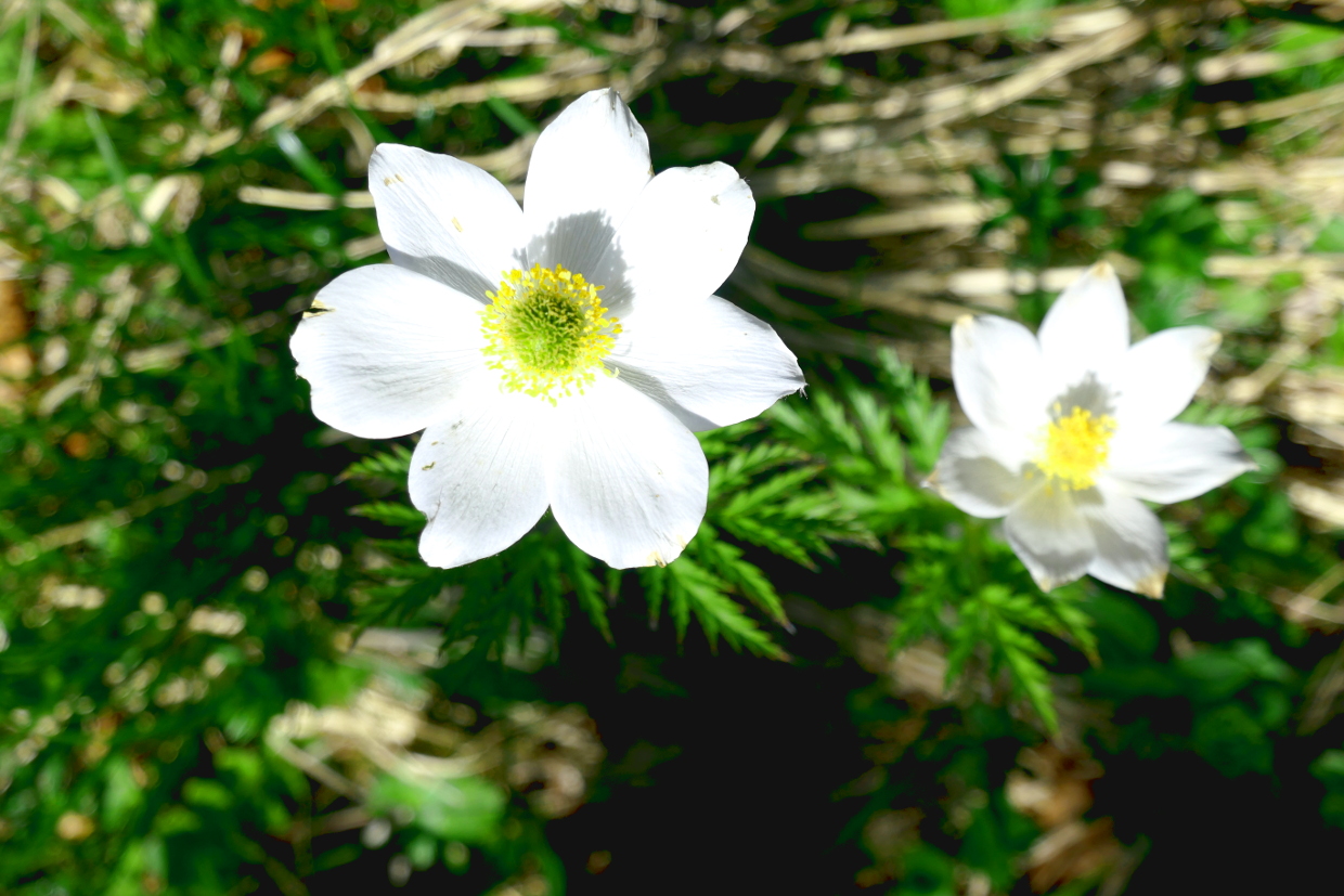
A few minutes later the view opens towards the „Lange Au“ and a sumit called Schinder behind it. This is one of the peaks I still have on my list to climb. The forest is getting less dense and so I find a few nice flowers along my way. I am a bit surprised to see the first alpine roses in bloom. Its mid-June and usually they bloom in July. But there nice to look at anyway.
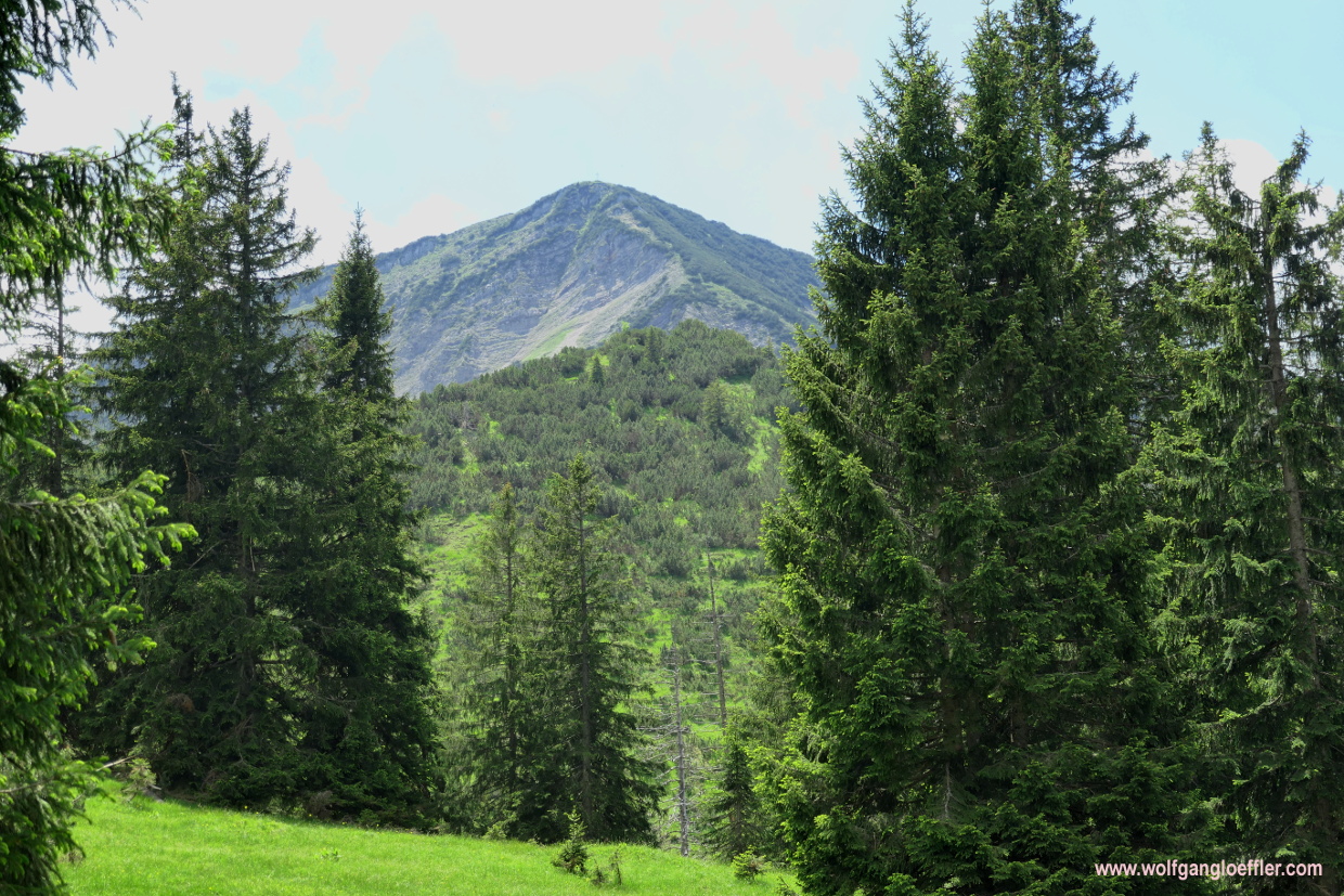


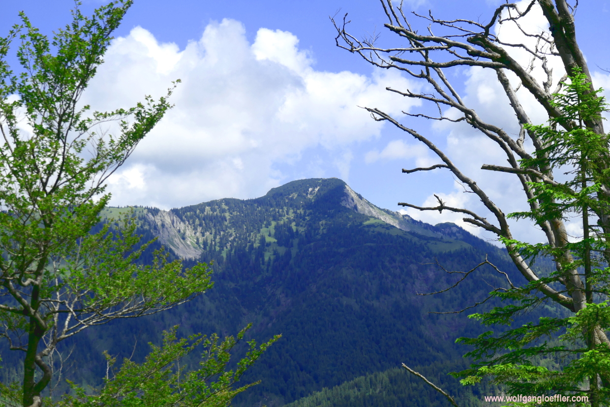
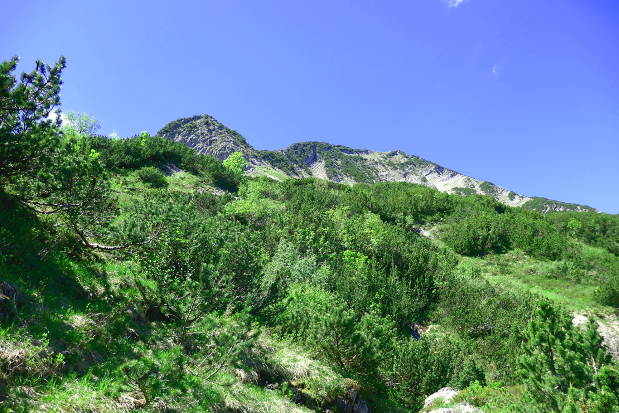
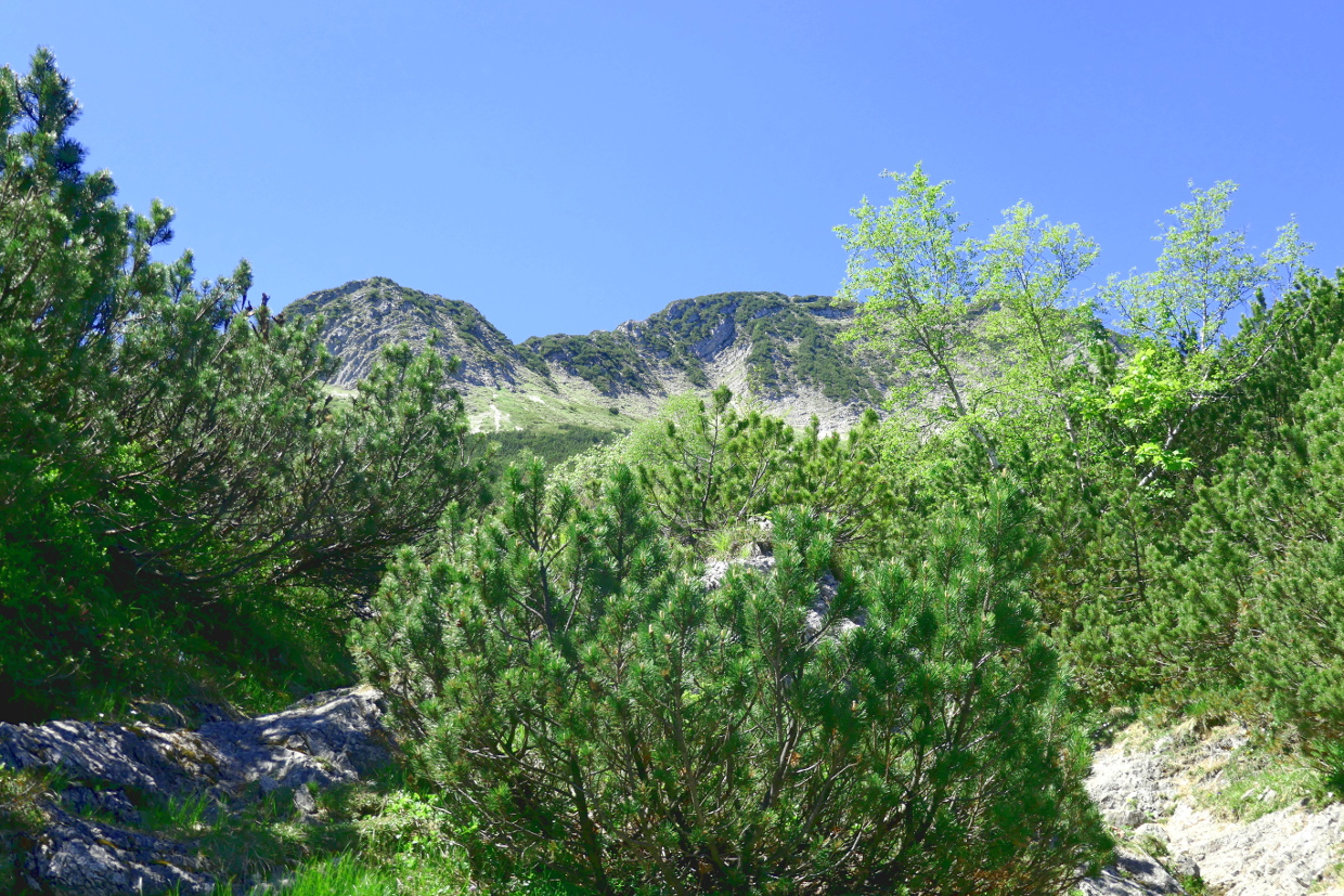
The path is going up and down and so I have a few small ascents to conquer. But on this soft forest floor they are easy to take. Slowly the summit is getting closer and presents itself in a more and more impressive way. And it’s becoming pretty clear that the last strtech will not be the easiest. From here it looks like it has ridges on all sides. This will be todays challenge.


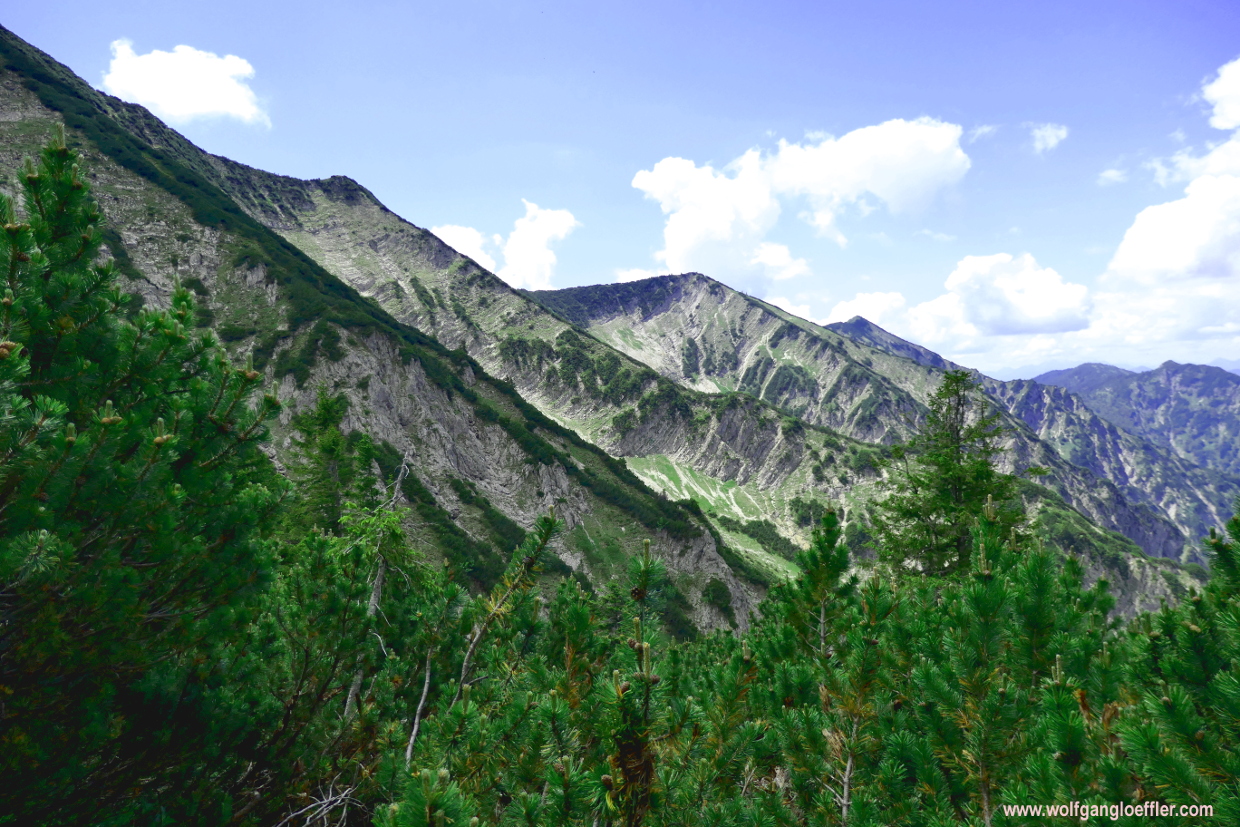
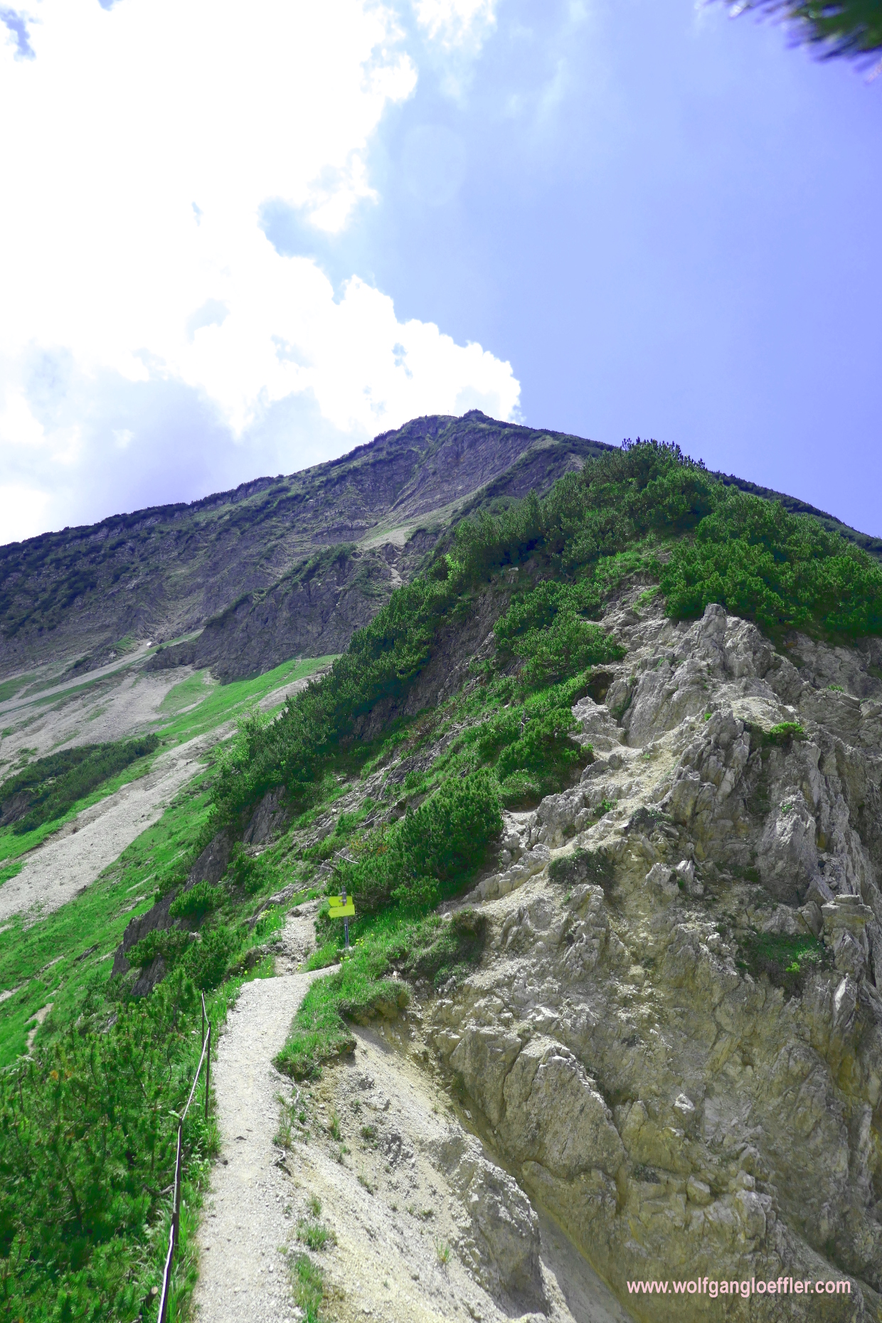

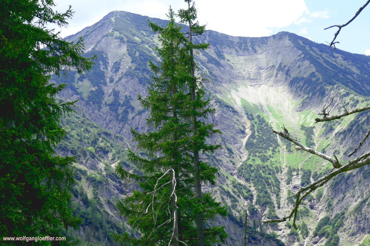
Shortly afterwards I do reach the track leading to the summit. It does look a bit challenging. Here I reach the path that I haven’t found during my first visit. And I do realise that the signs on the rocks aren’t of the usual red and white but blue and white. That was one of the reasons I have lost my way the last time. I just thought that those signs mark the border between Bavaria and Austria.
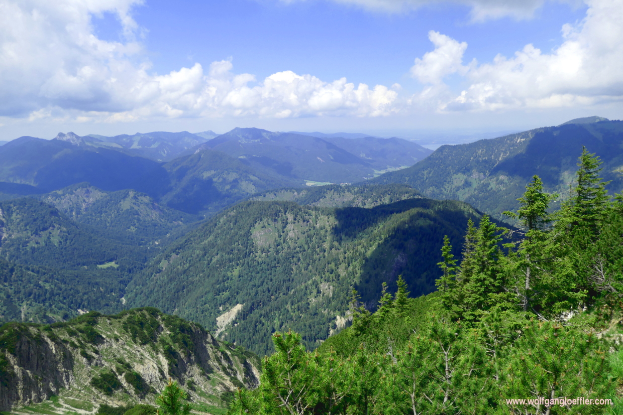


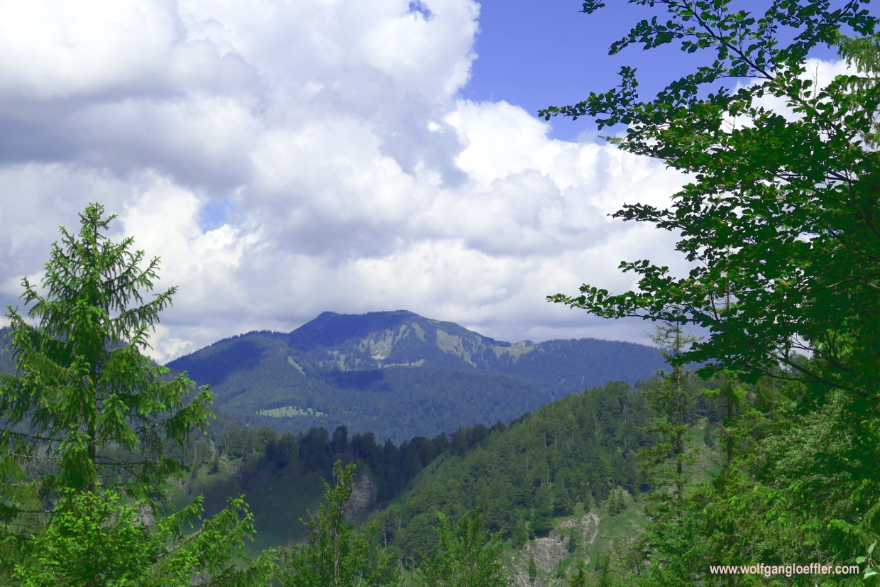
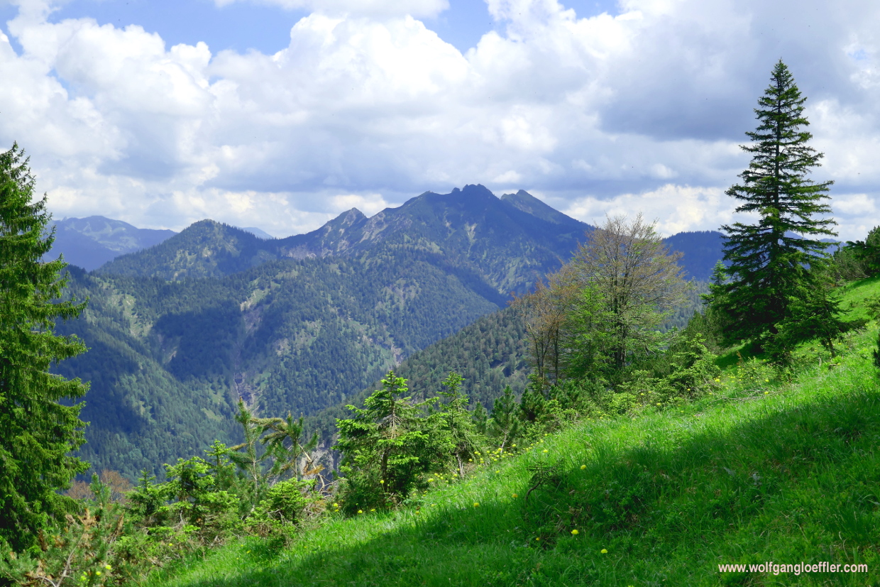
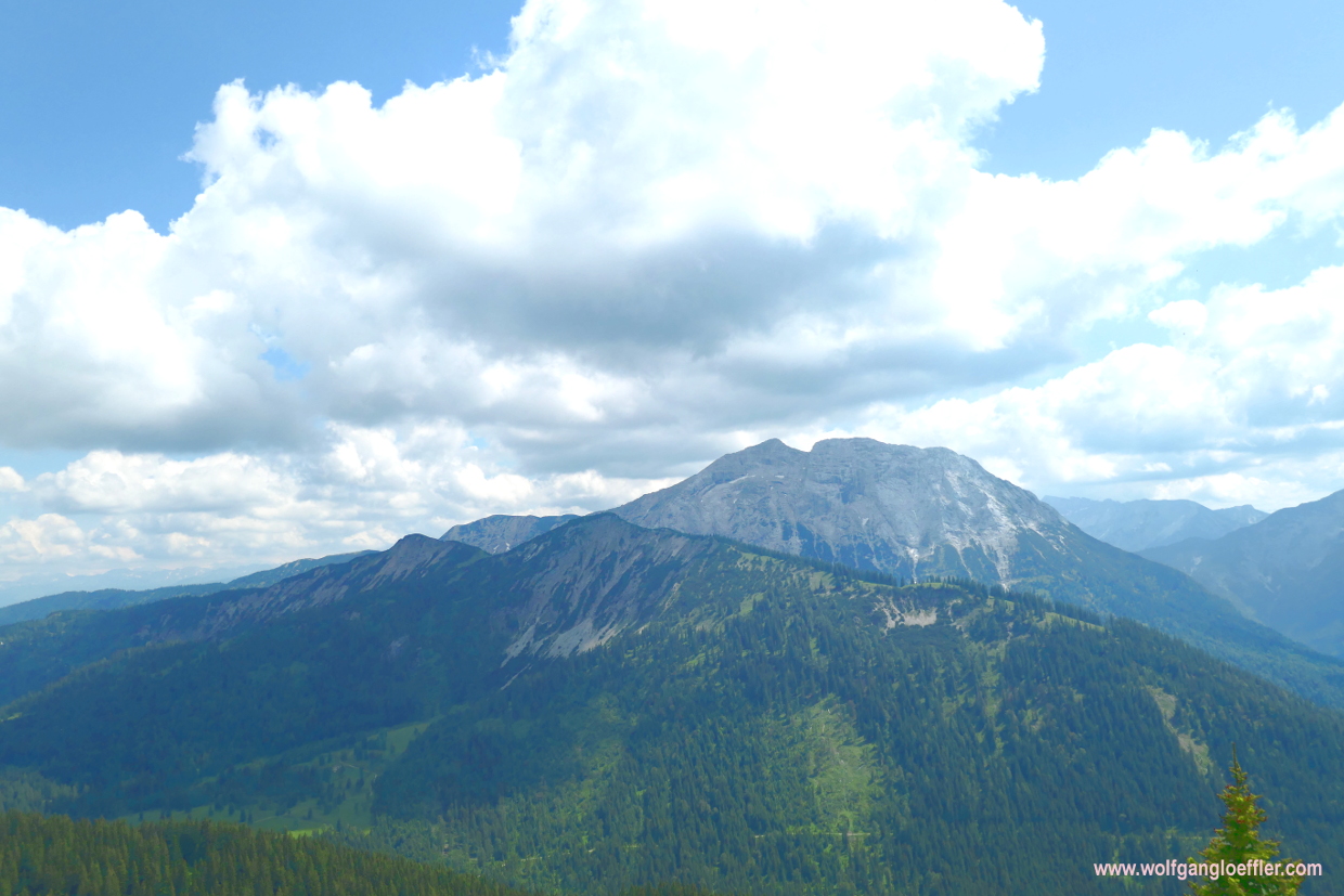
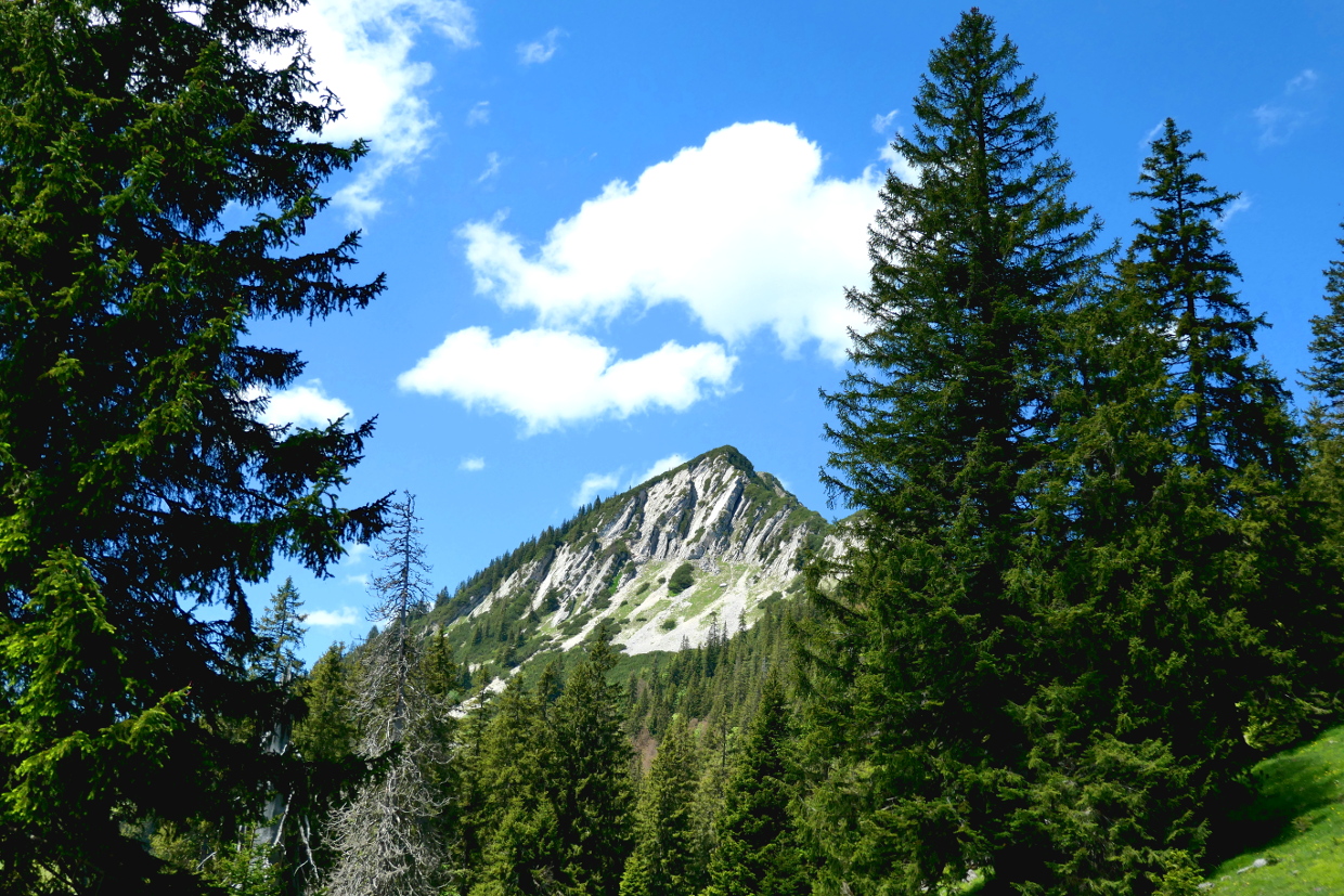
The heavy duty part of the track is done with the help of my hands and a bit of scrambling pretty fast and behind follows a path that meanders along the summit in serpentines. You will have to be sure footed and not afraid of heights on this stretch. Even the path is climbing slowly to the right the mountain falls steeply to the valley below. So it’s not as bad as expected. I had feared that I will have to make the rest to the summit scrambling over rocks using hands and feet at the same time. Faster than expected I reach the ridge leading towards the summit and now have a great view of the Guffertspitze to the south.


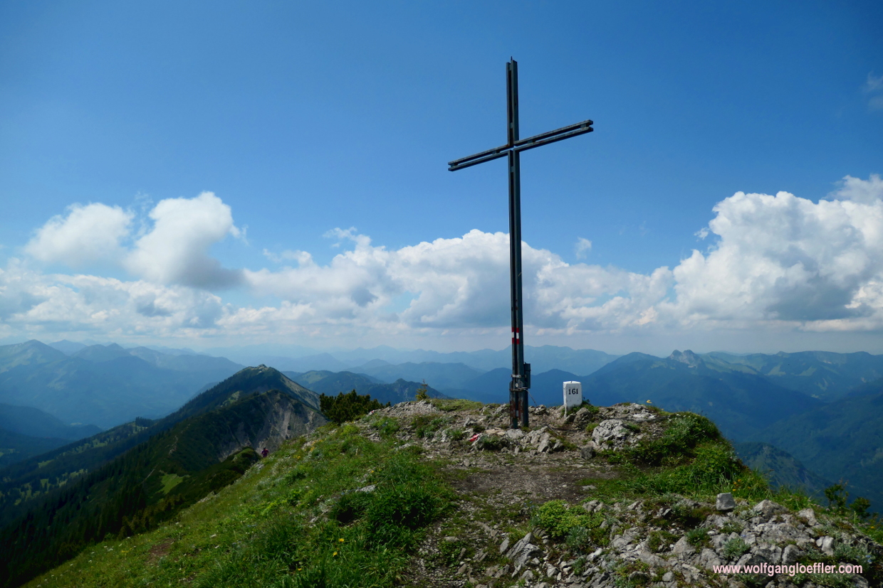
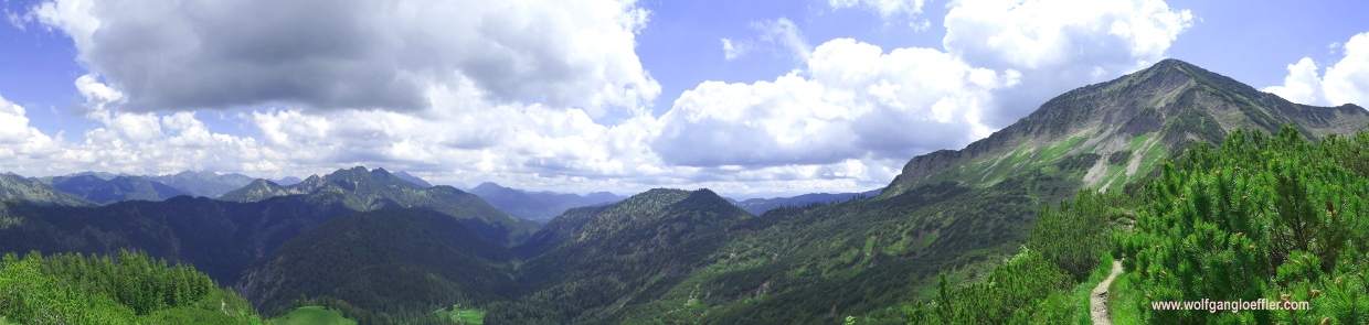
And then it’s done. I am standing on top of the peak and enjoy a fantastic panorama. Unfortunately the view is not very clear today but neverthless I find it breathtaking. During my ascent I have hardly met any people and here on the top there is only one other guy. That’s unusual . On my other tours the summit was the place where everybody met. But this gives me the possibility to enjoy the view in all tranquillity and stay a bit longer. That’s great for a change.

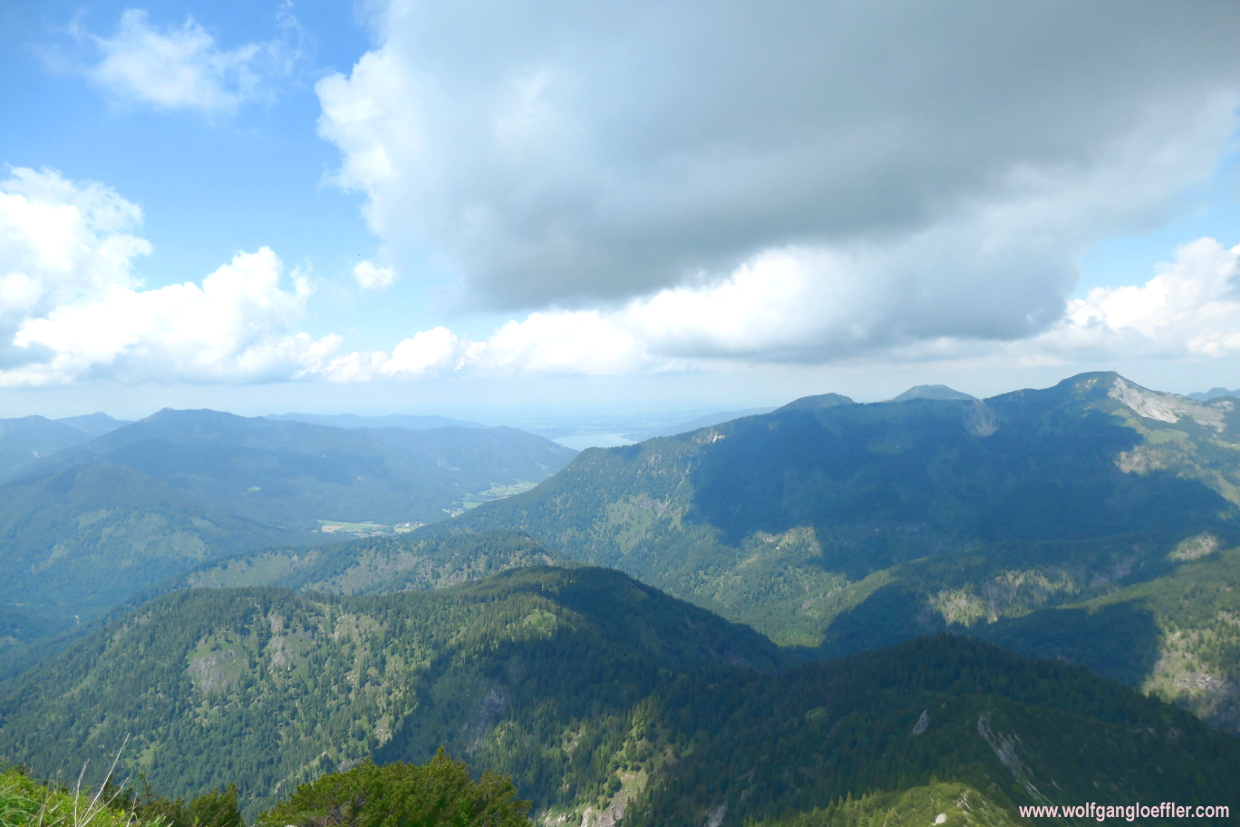


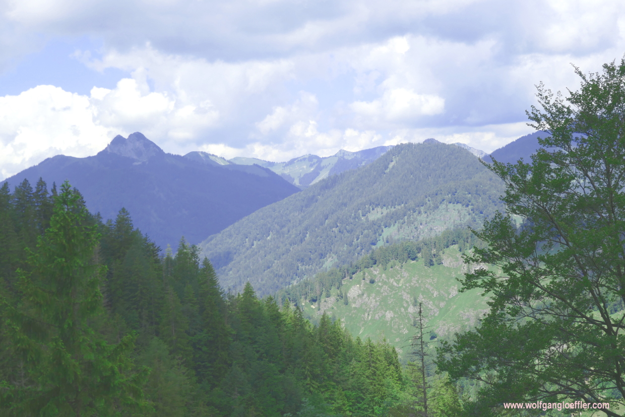
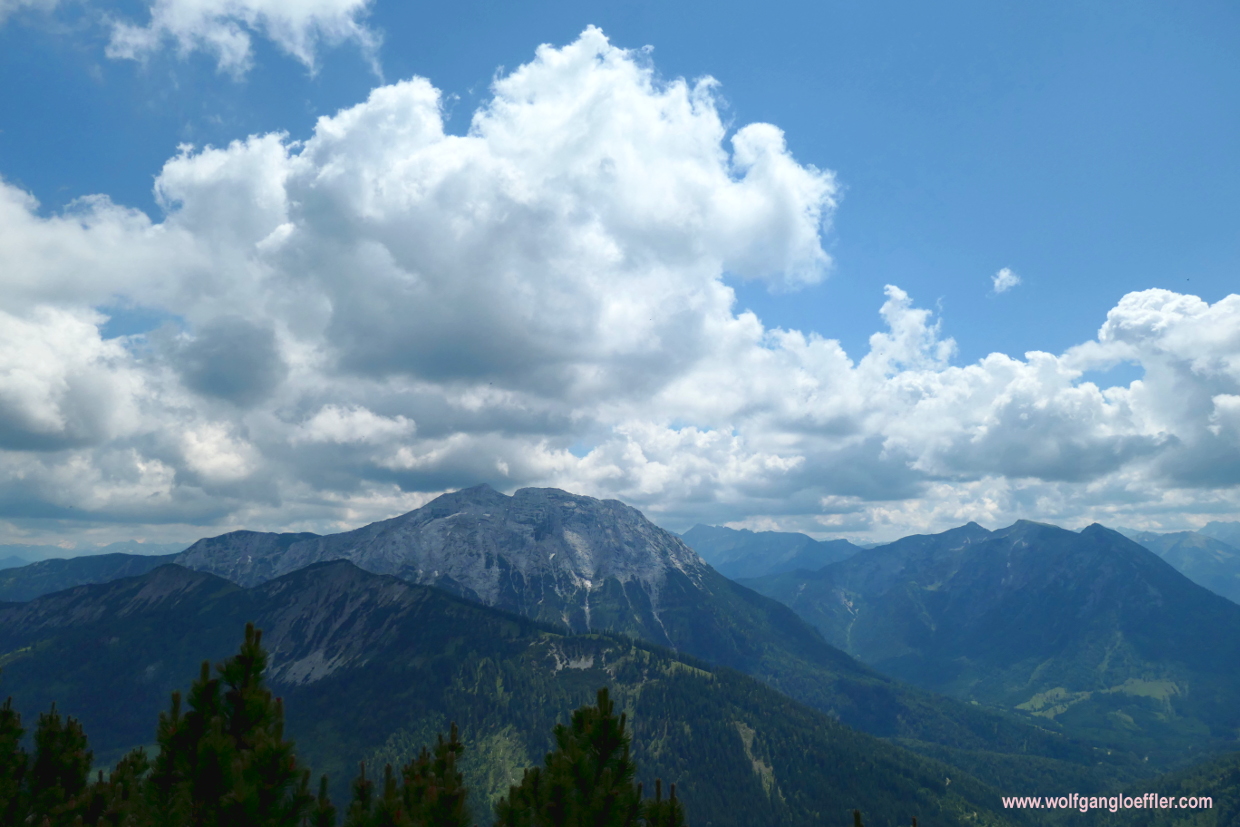
As always I have to start the descent at one point. I am choosing the easier route leading via the Bayische Wildalm. For this route it helps to be sure footed and not being afraid of heights too, but you don’t have to scramble over any rocks. Plus you have the majestic peak of the Guffertspitze always in front of you. Gorgeous. In the upper part you still walk along a precipice but it’s only a few minutes before you have passed it.


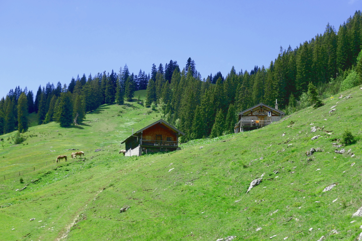
Soon I reach the Bayrische Wildalm which sits exactly on the German-Austrian border. I have read that members of DAV (German Alpine Club) can book this cabin with self-catering. But you’ll have to carry your provisions pretty far over the mountain. The next cabin that serves food is the Gufferthuette which is about a 45 minute walk away. On this pasture there are no cows just two lonesome horses are grazing on the meadow. And down here there are no other hikers to be seen either.

While crossing the alp I miss signs showing the direction. But since I have been here on my last visit I know which direction I have to go. So I am crossing the meadow and climb over a fence that has been erected around the cabin. And there I do find the next signs. The route now leads a bit uphill and allthough it’s not steep, I realise that my resources are melting away slowly. I wouldn’t be able to make a longer climb anymore. But I do know that the rest of the tour is an easy hike.

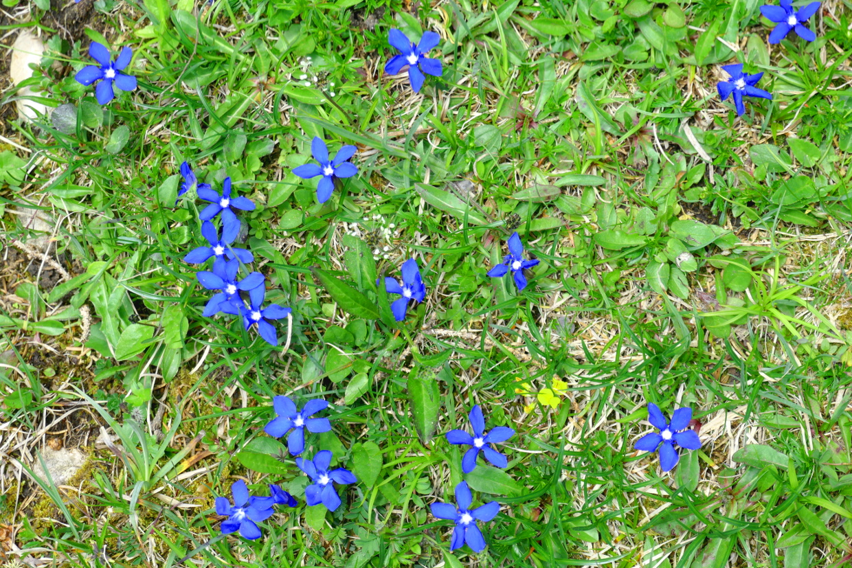


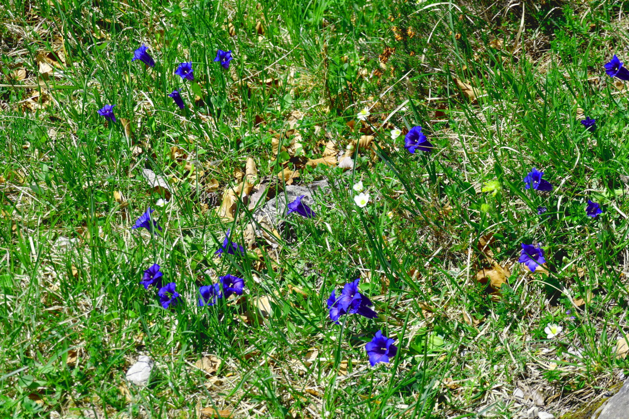
I enjoy a last view of the Guffertspitze and admire the many flowers alongside the path. I am a bit surprised to see this daphne bush still in bloom. They usually are amongst the first flowers to bloom in March. And then all those wonderful gentian. If you have read some of my other posts you will have realised that this is one of my favourite flowers. This deep blue facinates me again and again. I’d love to come across a cabin and sit down for a while and have a fresh drink.


A short time later I am standing in front of the sign that shows the path to the summit. The last time I follwed this sign just to get lost in the middle of dense underbrush. On this side of the mountain many beeches are growing which don‘ have any leaves left. When I have a closer look it seems as if there are bugs eating or sucking them out. The few leaves that still cling to those trees are full of brown stains. I sure hope that the beeches will recover from this.


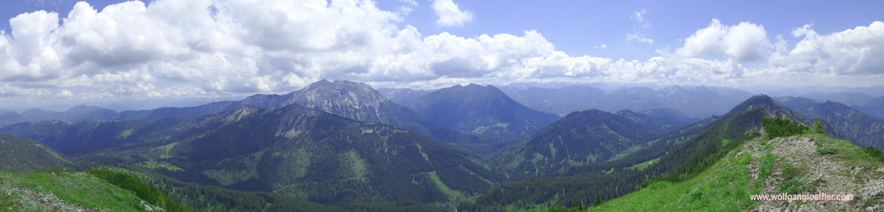
The track now leads on a longer stretch over some sort of plateau and descends only slowly. That means that I do have the summit of the Halserspitz in view for a few more moments. It’s beautiful up here. And the view towards the East offers some great panoramas as well. Finally there is a somewhat steeper descend into a trough. Here grows a lot of yellow gentian which is not bloomig yet. Somehow I never find the right time to see this flower bloom. Either I am too early or too late in fall.


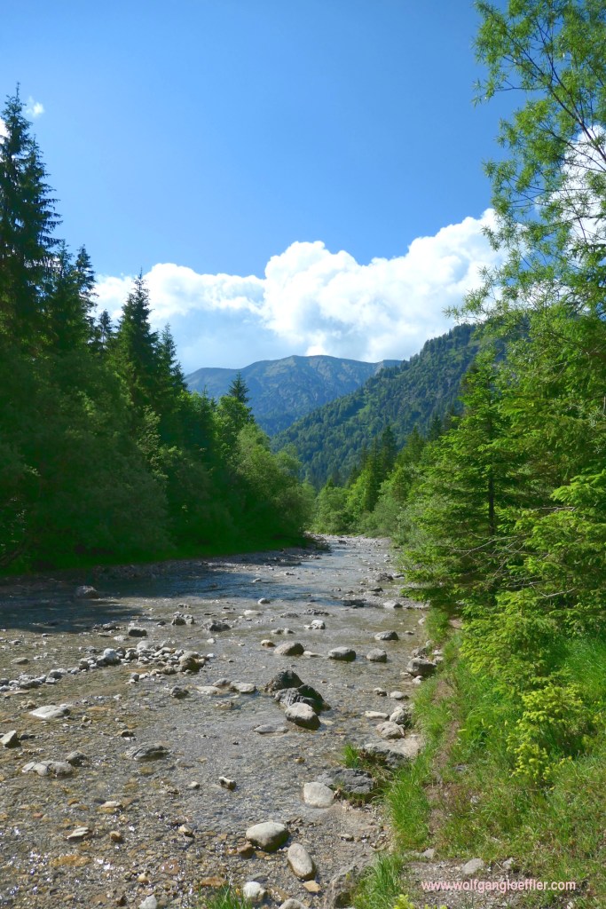
I savour the fresh mounatin air and the silence. There are hardly any other hikers around. When I reach this gurgling creek I feel up my drinking bottle. The cool water tastes delicious. I have read somewhere that you should take water only on points where it is actually in flow. In a standing pond there could be germs. But since I am really thirsty at the moment, I couldn’t care less.
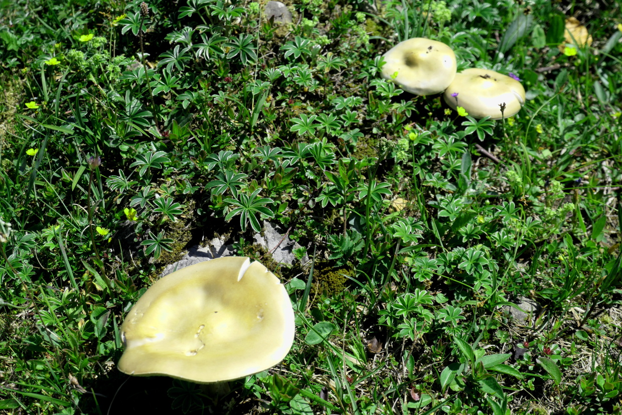


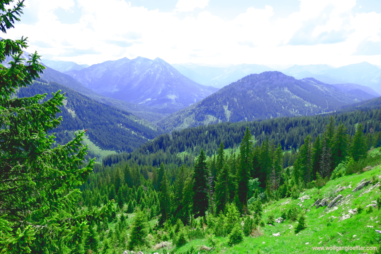
In the grass I see these mushrooms that glow like pure gold in the sun. Back in my childhood days I would have probably known what kind of mushroom these are. Those were the days when the whole family was out collecting pounds of mushrooms every year. Today I rather let them sit where they are. After I have crossed this trough I get a last glimpse of the summit before I am entering the forest. This is where the steep track that’ll bring me into the valley starts. This track through the Baerensteiggraben gets pretty steep at times but those are just short stretches in between long serpentines.


Finally I hit the valley floor next to a small stony cross. This is a good sign when you take this ascent. But it’s not very impressive. Ont he opposite side there is a bench and a table. Since the sign tells me that I still have to walk 1.5 hours before reaching the Schwaigeralm I sit down a bit. Und jump up right away since my leg became a highway for ticks. I have to get rid of them very fast. And hurry away form their nest.


The route continues on a gravel road and the rest of my hike becomes an easy stroll. Most of the time I am walking through the cool shade of a forest and only every once in a while I come to openings that allow a glimpse of the mountains to the left and right of the valley. Somehow I move forward much faster as noted on the sign and just a few minutes later I am standing in front of the Black Cross. From there it’s not far anymore to the Schwaigeralm, where I hope to get a cool refreshment.
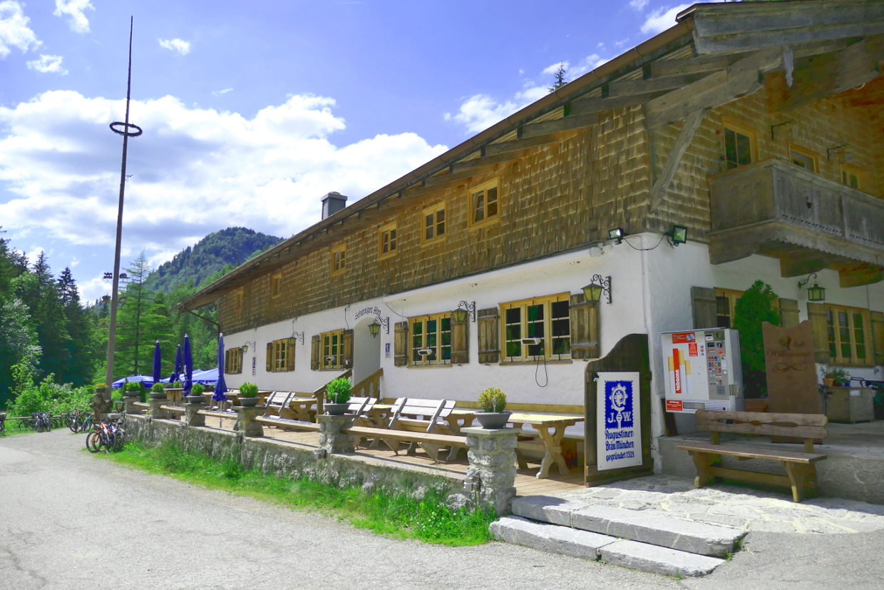


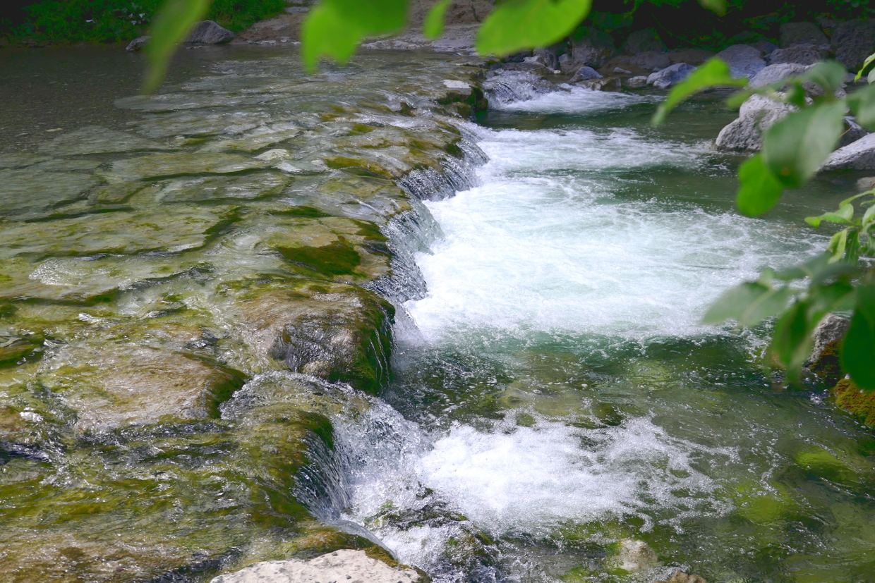
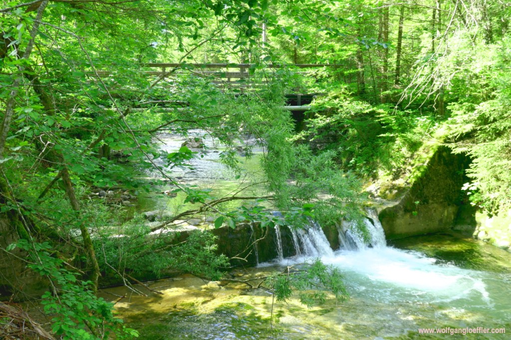
So when I reach the guesthouse I put on my mask, clean my hands with disinfectant and get a table shown. The waitress is very friendly and makes fun with her guests. A short time later I have my non-alcoholic beer in front of me. That frizzles and refreshes. That’s the way I like it. So I order a second beer and enjoy the moment a bit longer. In the end I do have to return to my car. On the way back to the parking lot I pass a small gurgling waterfall. During this tour I have realised that you can go hiking in times of COVID-19 when you comply with some rules and am looking forward to my next tour.


Kommentare