 wolfgangloeffler – weitgereist
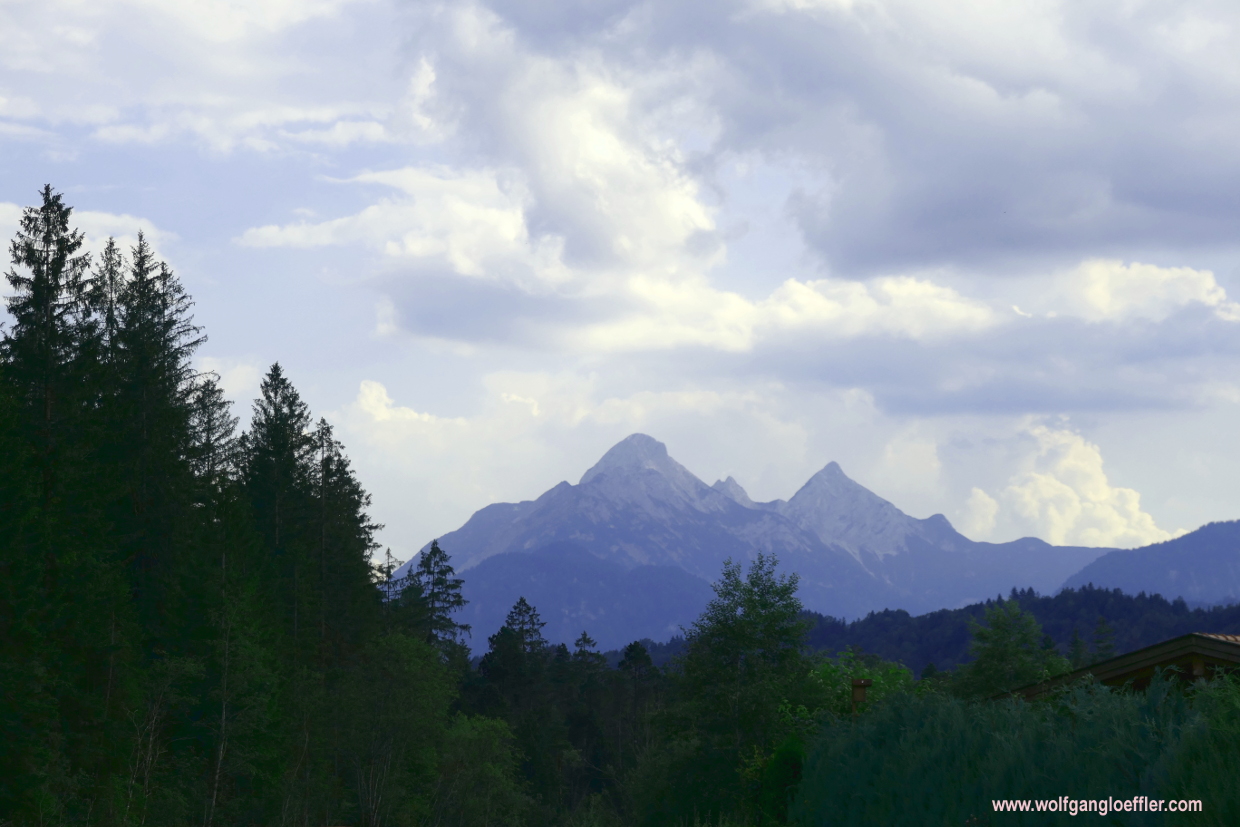
Schöttelkarspitze – magnificent views in the Karwendel

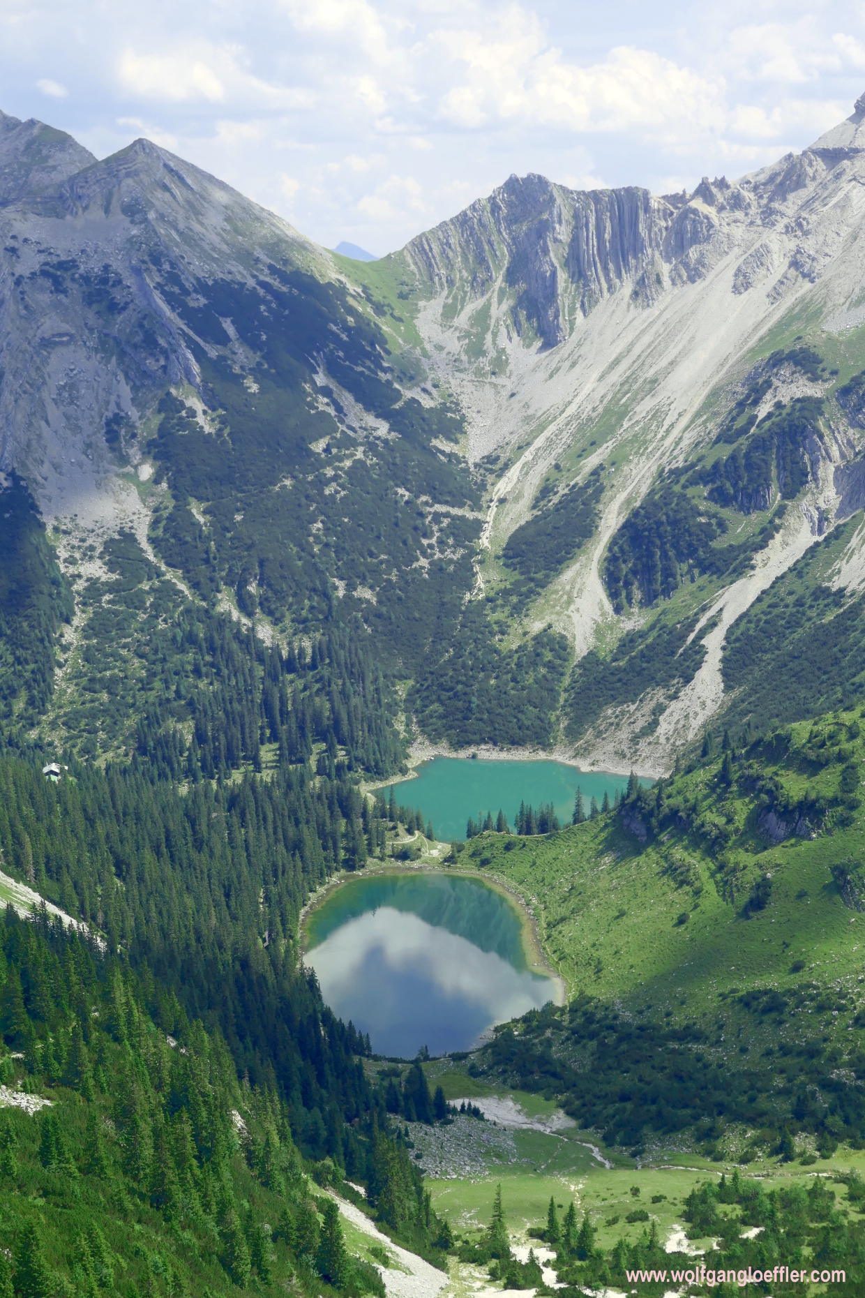
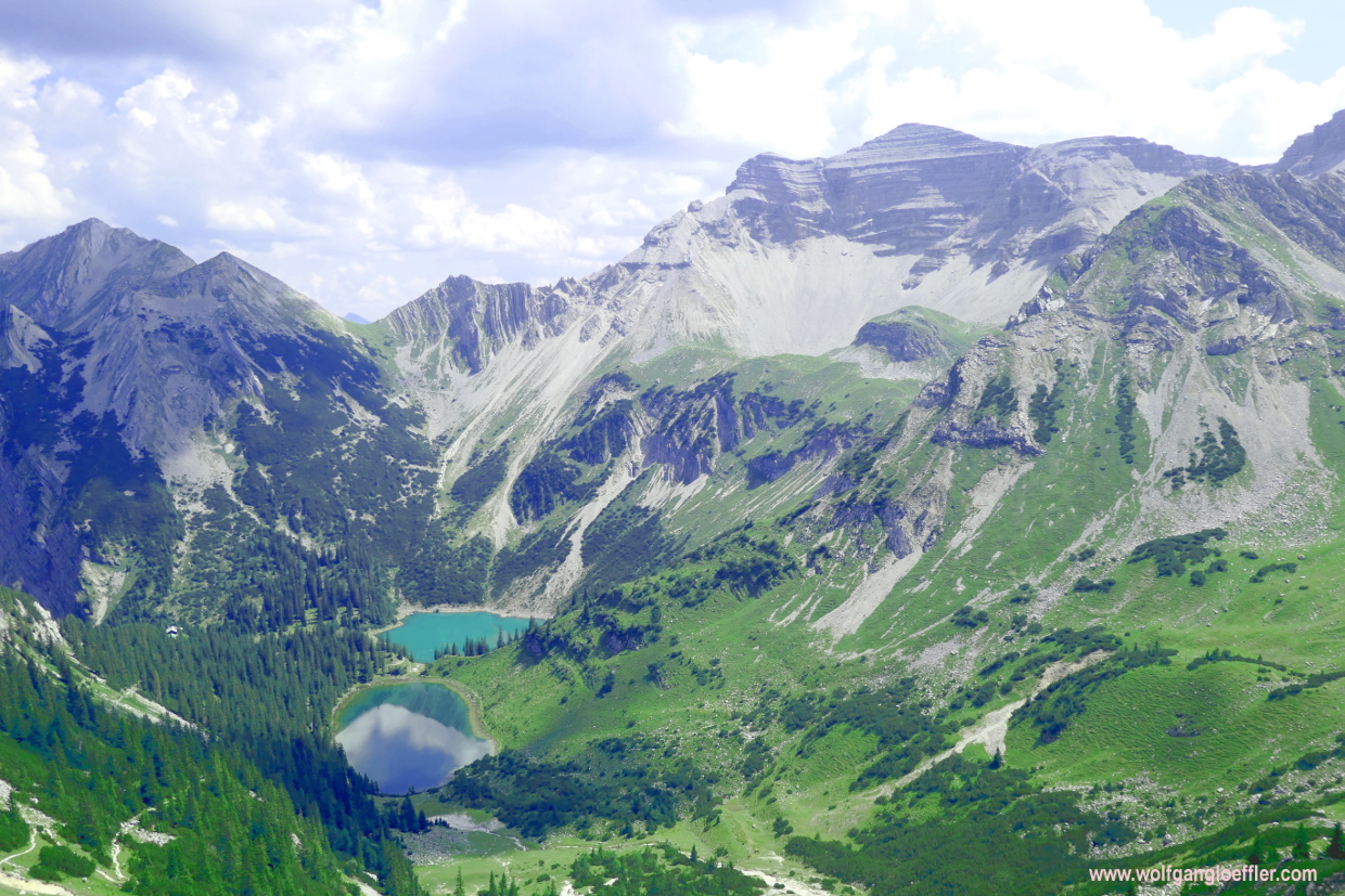
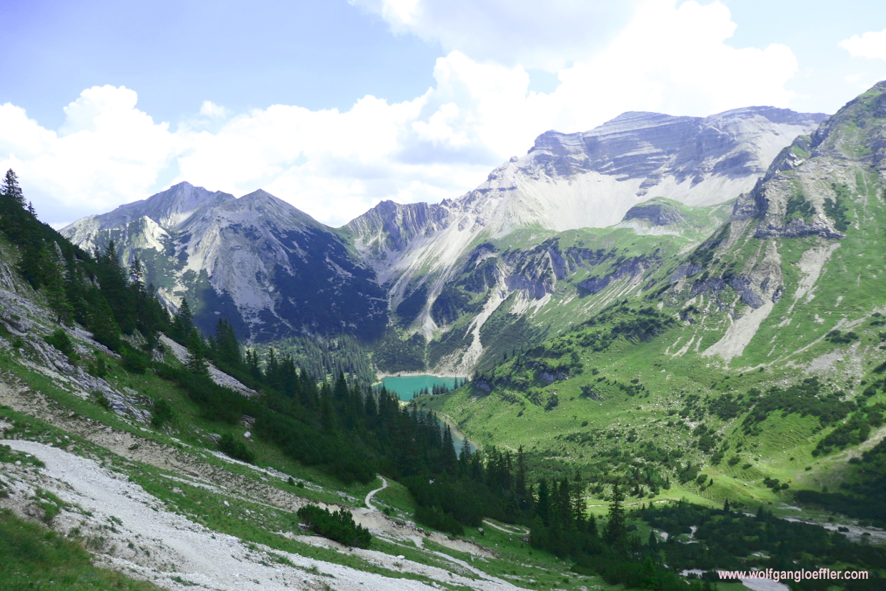
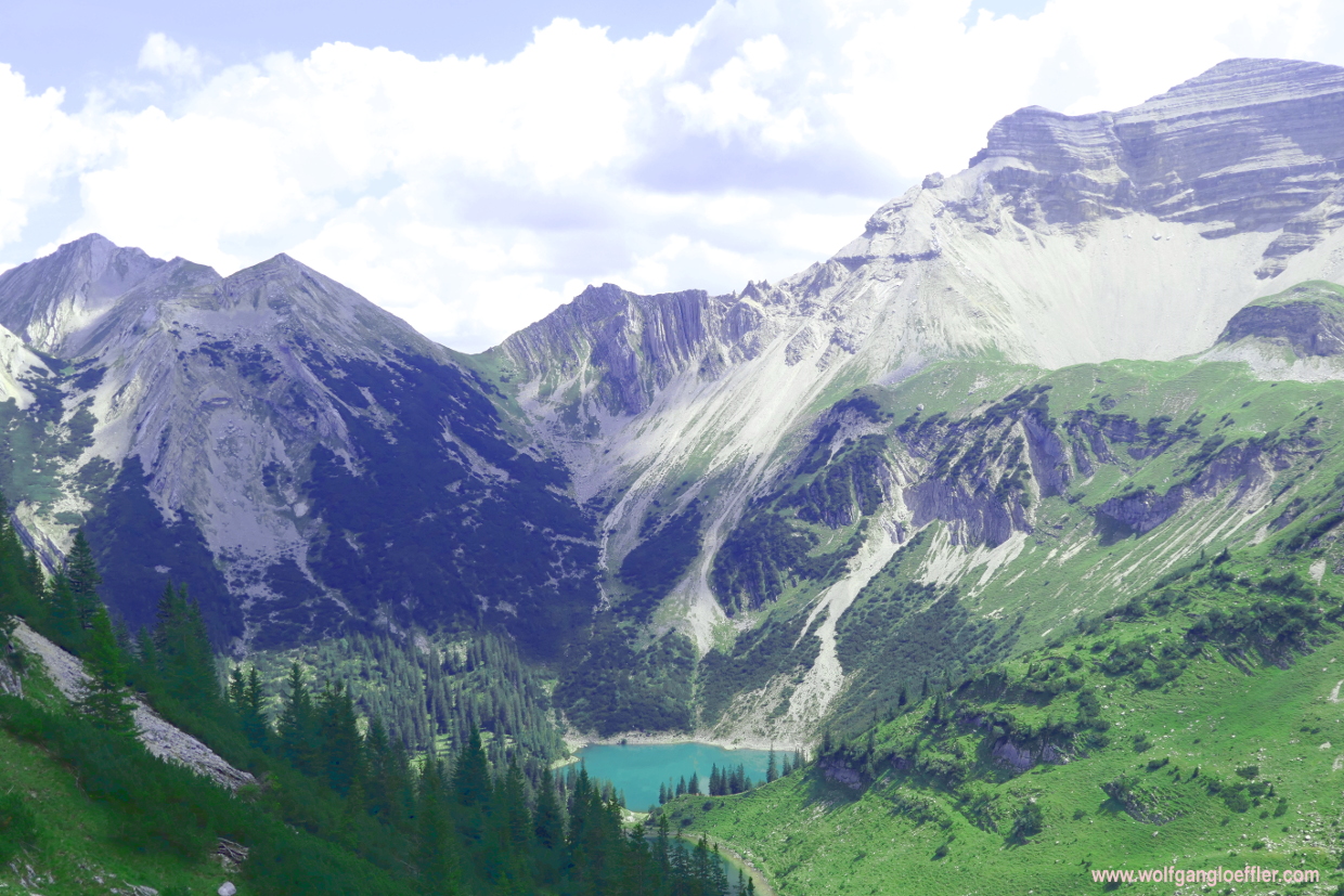
The Schöttelkarspitze sits in the middle of the Karwendel mountains. To get to the summit you need to be in shape in bring some time. The ascent is sometimes a bit steep but still easy to manage. When you have reached the ridge at the Seinskopf you will realise that you still have to walk for a while. There are two tracks leading from Seinskopf to the Schöttelkarspitze. One of them follows the ridge and you need to be sure footed and not afraid of heights. The second one is easier to walk and runs a bit below the ridge. The Lakaiensteig in the descent is another stretch where you should be sure footed and not afraid of heights. Allthough the tour is rather long it’s worth to walk it. Especially the view of the Soiernspitze with its two lakes below is humongous.
- difference in altitude: 4150 feet in ascent and descent
- length: approx. 10 miles
- walking time: approx. 9 hours
The weather was great and so my beloved mountains were calling. I have read somewhere that the tour to the Schöttelkarspitze is a dream tour. But takes some time. So I got up early, if not to say in the middle of the night, and drove with my car to Krün. I arrived at the parking for hikers next to the Isar bridge without any traffic jams shortly after 8 a.m.
Krün, Isarbrücke 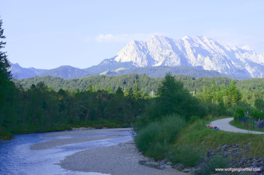
Krün, Isarbrücke
The parking lot offers quite some places, even in the shade but there are no restrooms. On the other hand it’s free of charge. I’d rather pay a small fee, like in Wildbad Kreuth, and would be able to use the restroom befor or after the tour. This early in the morning I have the choice of free slots and so I am looking for one that lies, especially in the afternoon, in the shade. After my tour I simply don’t want to sit in a sauna after my hike.
Now that the car is safely parked I can start the tour. Meanwhile I have organised walking sticks and later on will be very happy to have them brought along. From the parking I have first to cross the Isar. On the other side of the river I see the first sign. This tells me that the ascent will take a bit more than five hours. That’s long. I am curious if I am fit enough to go all the way.
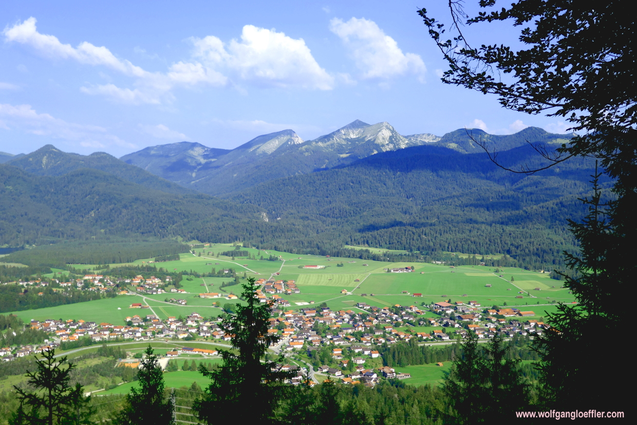

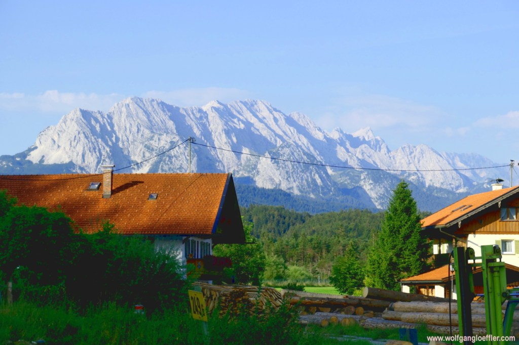
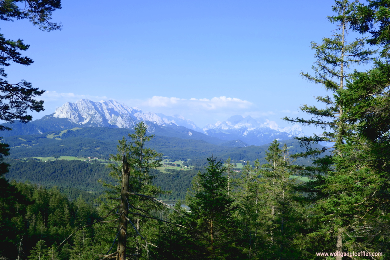
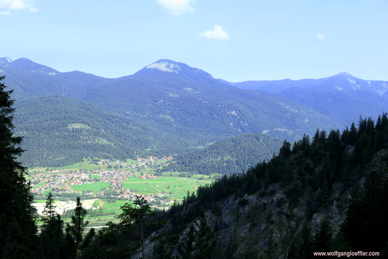
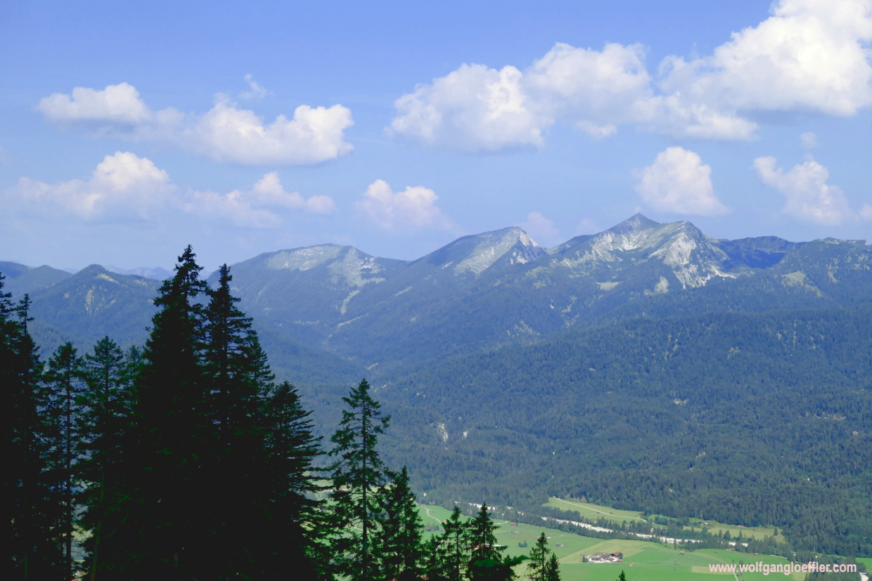
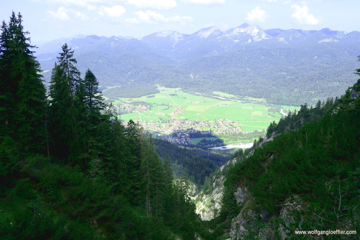
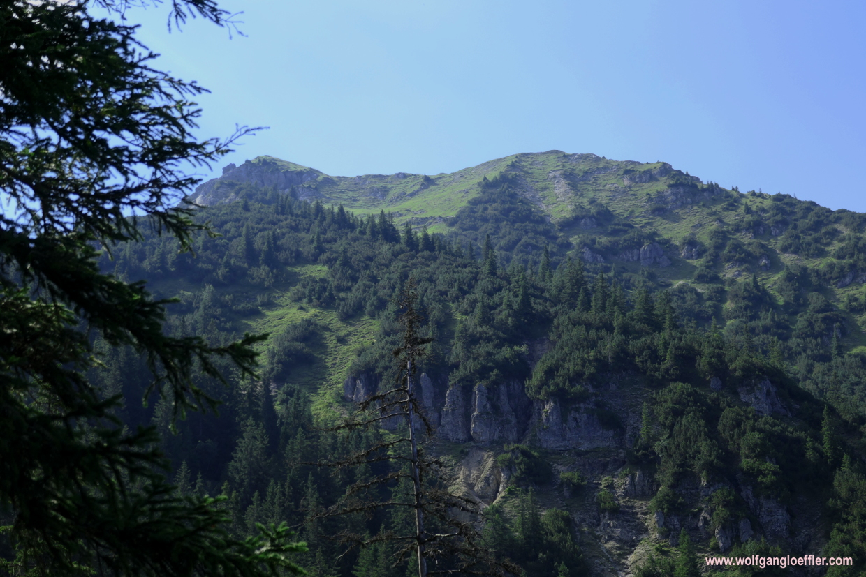
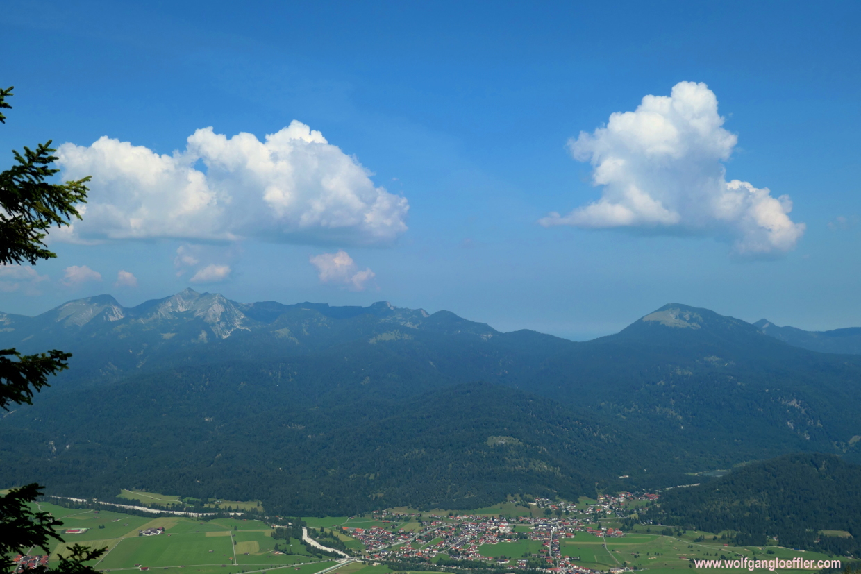
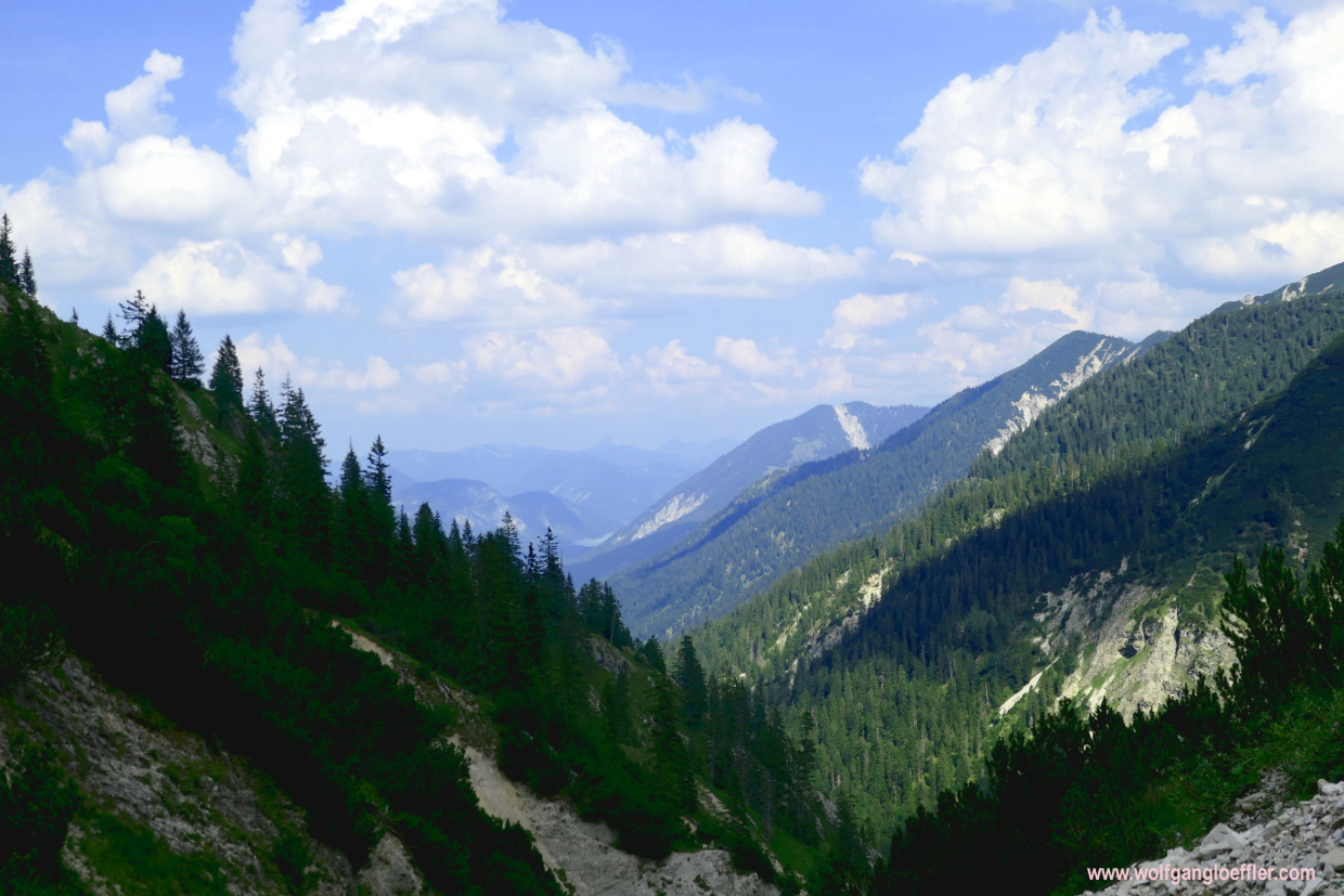
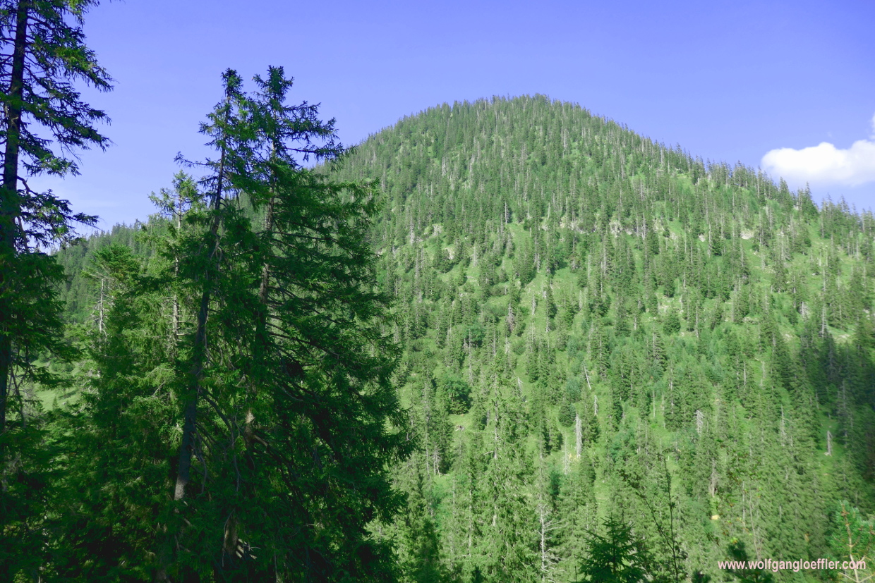
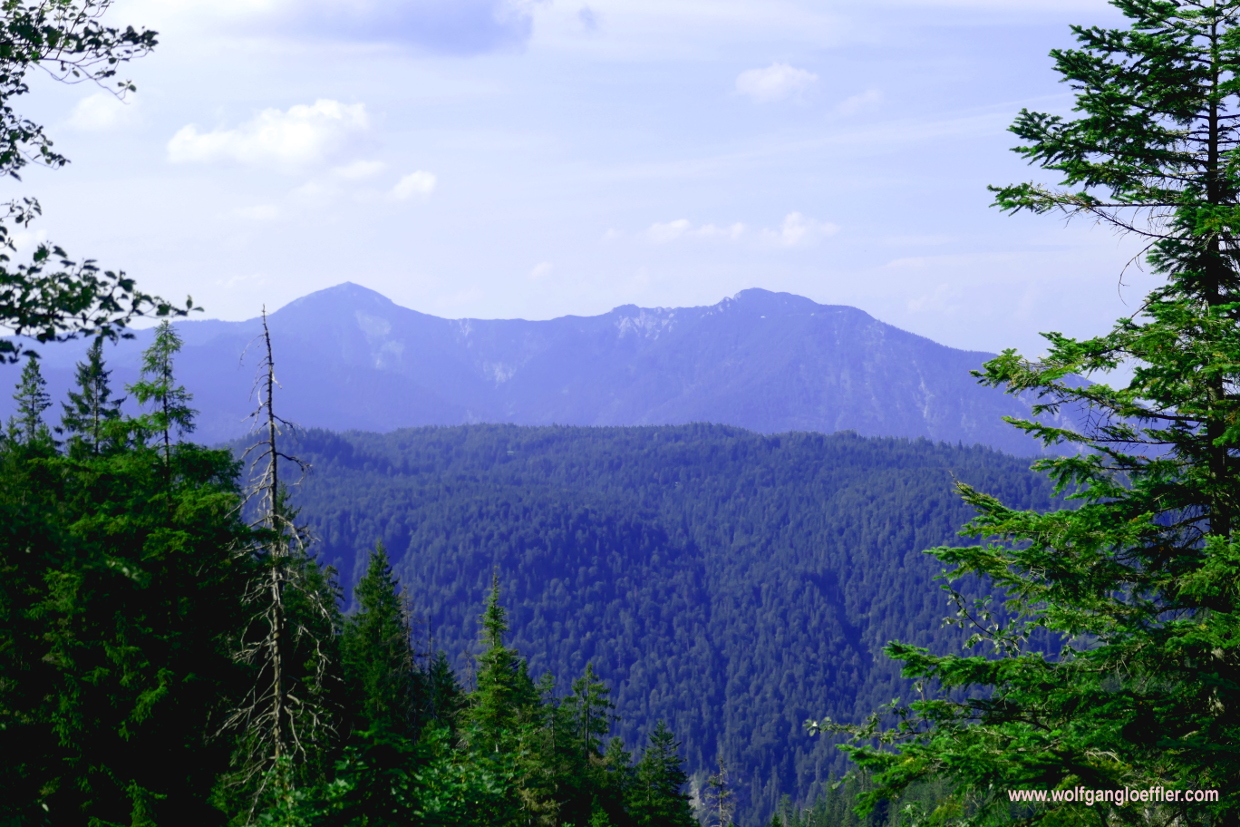
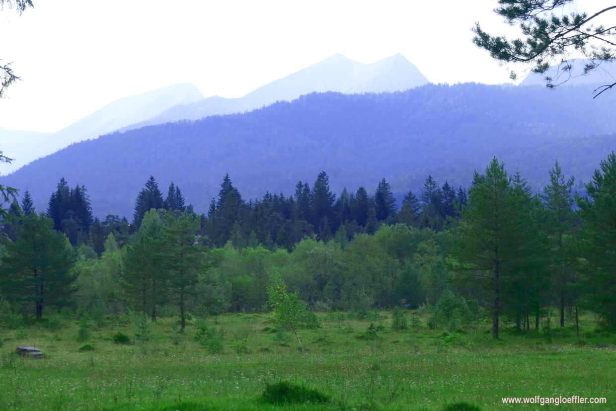
At the beginning I walk along a forest road which turns soon into a simple hiking path. This winds uphill in serpentines through dense forest and is at times a bit steep. The perfect stretch to warm up. After abut 45 minutes I reach the Schwarzkopf and there a viewing point that offers great views of the Isar valley. Down there I can see Wallgau and behind the village the summits of Herzogstand and Heimgarten. To the southwest I can see the impressive summits of the Wetterstein. When I continue I am walking through dense forest again
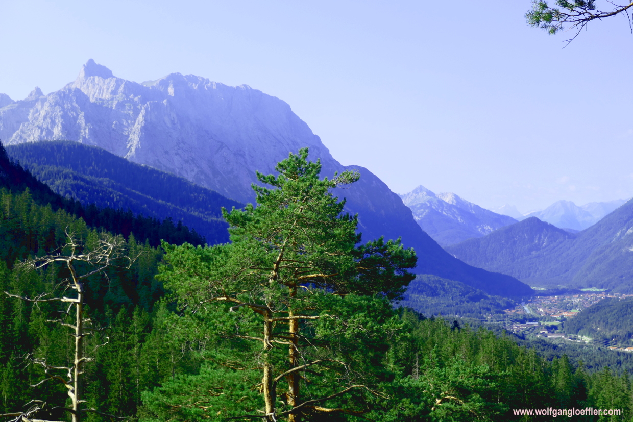
The small detour from the Schwarzkopf to this viewing point was well worth it. Some time later I reach an opening where I have a good view of the Karwendelspitze in MIttenwald. Quite impressive, too. The cragged summits of this region enthuse me again and again. Most of all when you get closer to those giants during a hike and realise that there is an abundance of flora and fauna to be found.
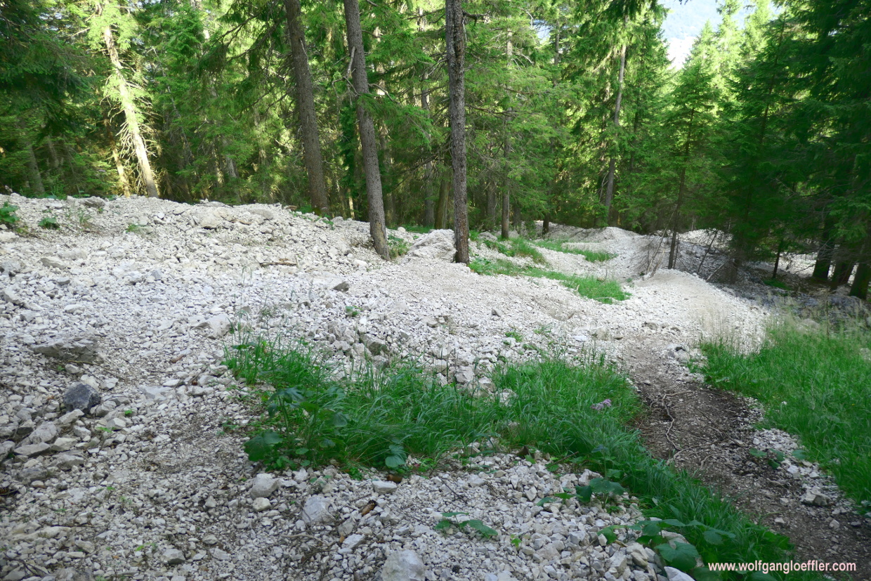
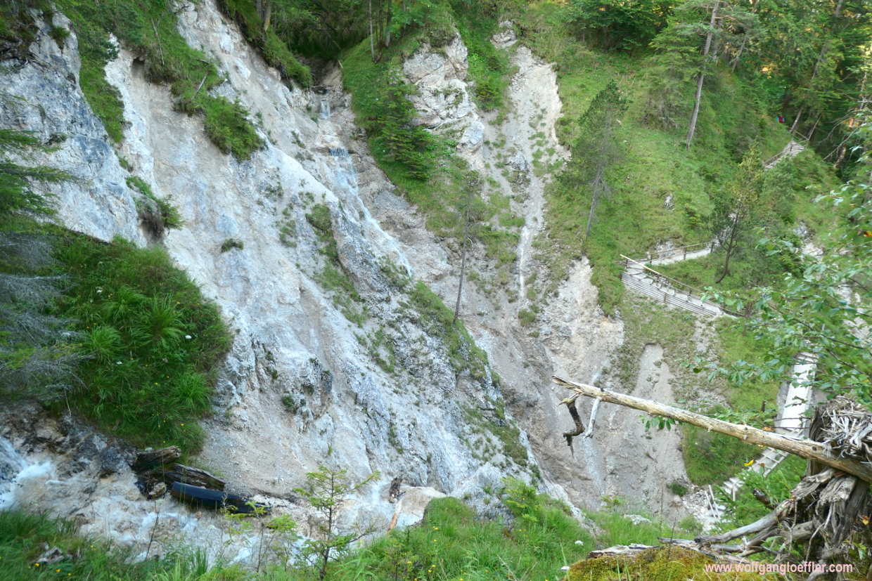
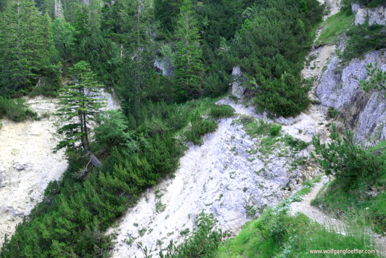
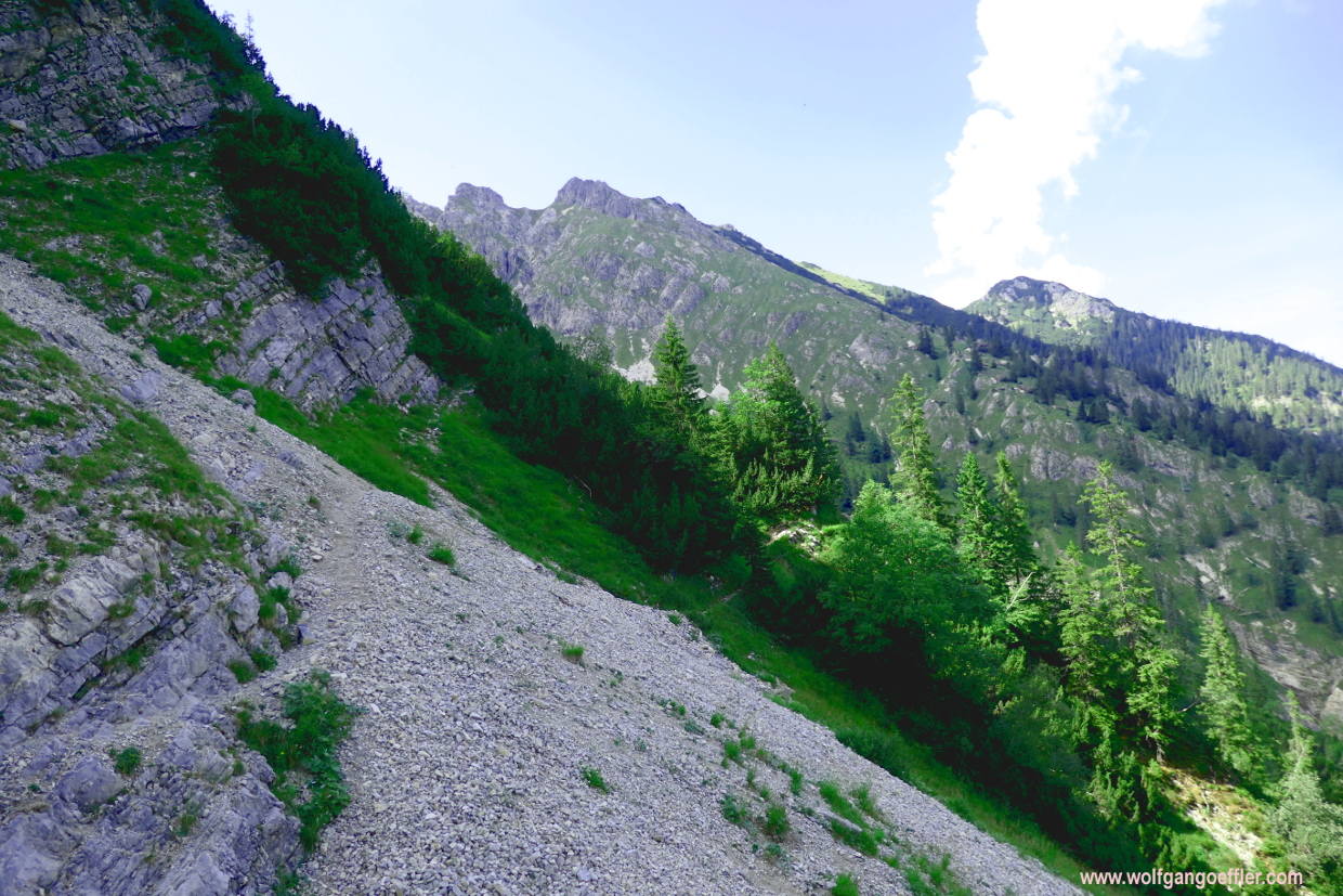
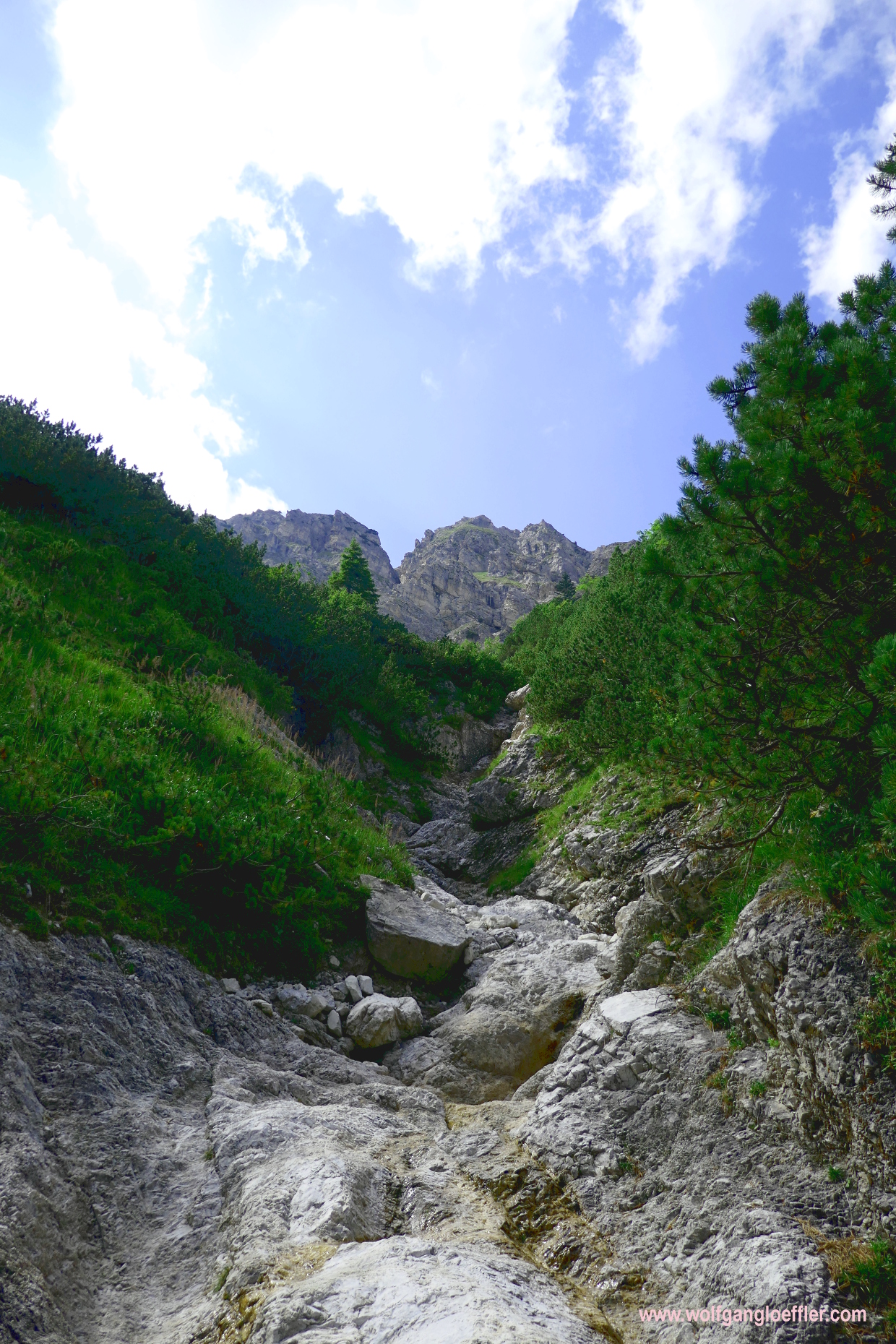
At some point I have lost the feeling of time and besides the fresh temperatures in the woods in the early morning I am getting hot. But that’s quite normal and the reason for me to carry an extra shirt in my backpack to refresh a bit after the hike. Out of nowhere erupts this scree in front of me. There must have been a moraine coming down not too long ago. Unfortunately the path leads in narrow turns exactly over this field of gravel. That’s a bit strenuous to cross it. And it takes a rather long time t get over it.
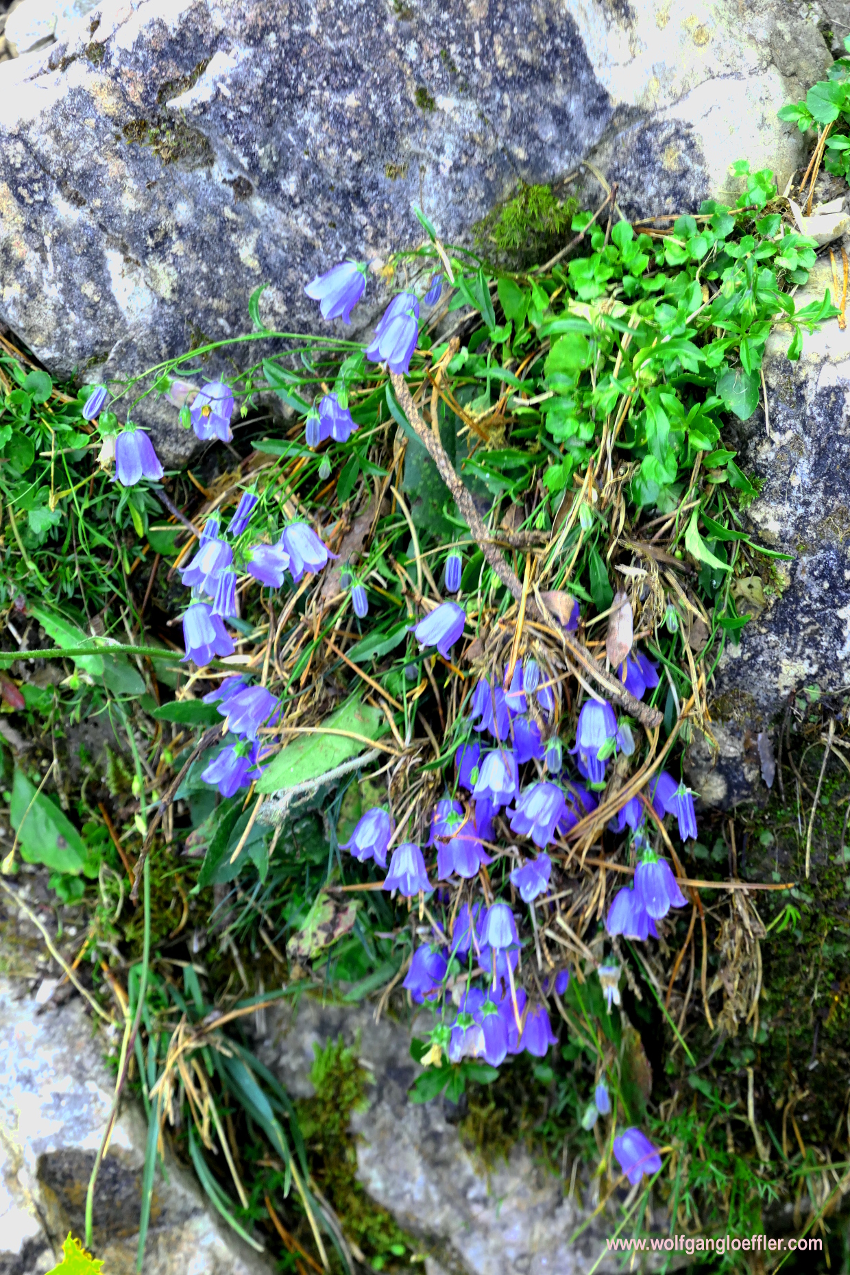
But after a while I have made this part and walk now on a soft path through the forest whch is becoming less dense and changes from fir to mountain pine. That allows me to get a few more great views. The drudgery of crossing the gravel is soon forgotten and I enjoy the fresh, crisp mountain air. And I finally see flowers growing alongside the path again.
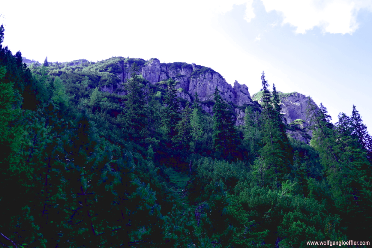
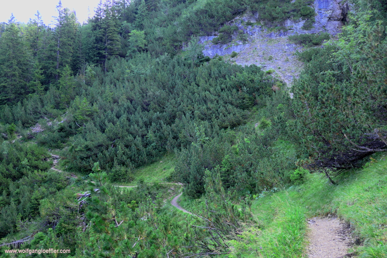
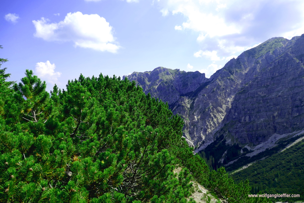
The track now leads along a overgrown rock wall. It’s very sunny, but the visibilty is not that good today. The surrounding summits disappear more and more into the mist. Later today they have announced thunderstorms. But the view over the Isar valley is still fantastic. Since I am walking through mountain pine now, I can enjoy it more often. Untill now I do like this tour. It’s just the perfect amount of challenge and variety. Although I haven’t even made half of the ascent.

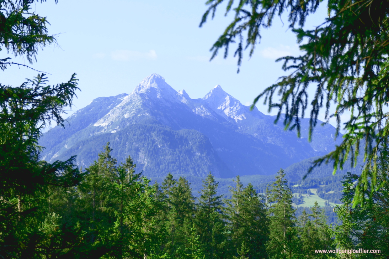
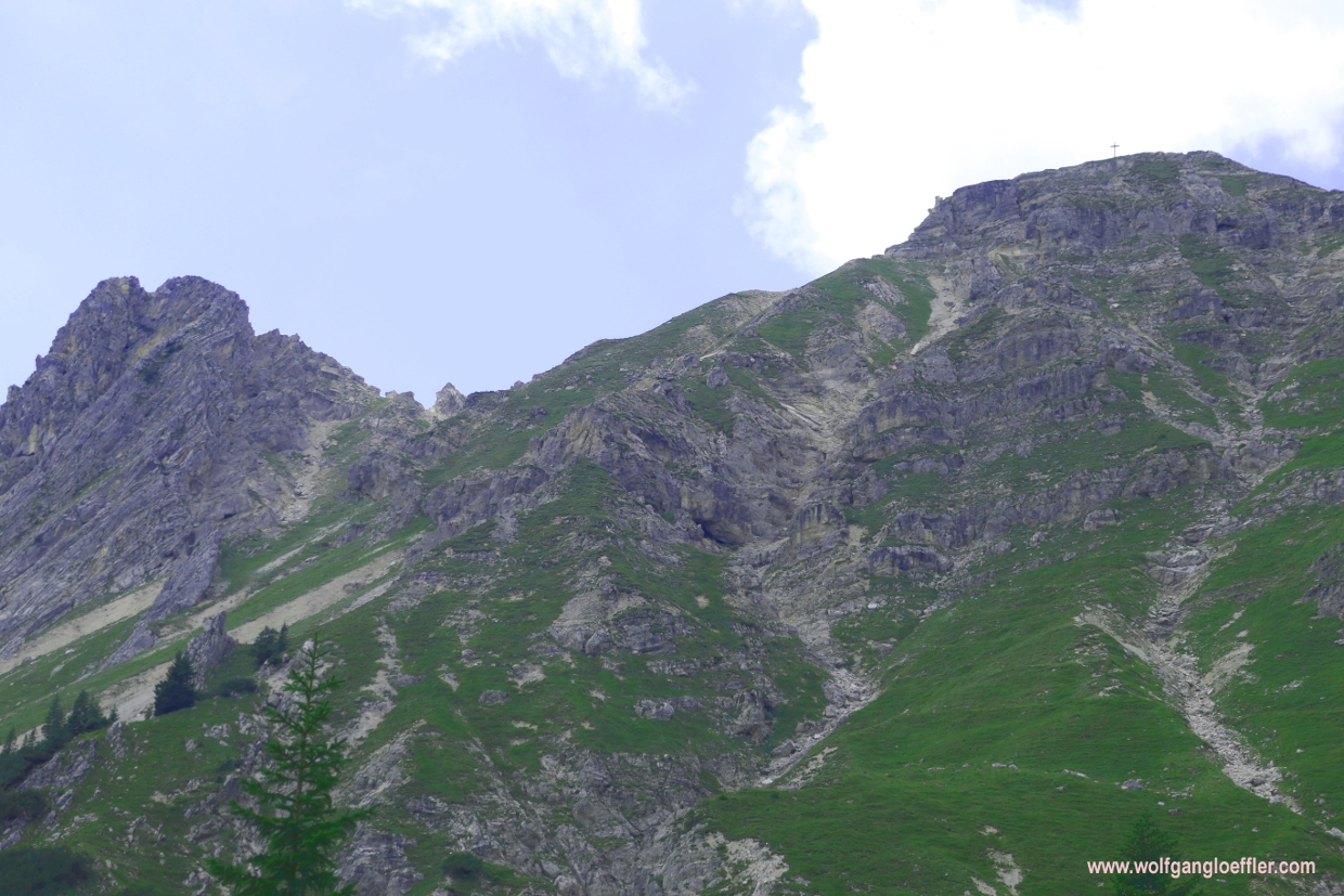
Suddenly the summit of the Signalkopf rises above my head. I won’t get to that summit today. It would be only a short detour but I am sure that I have to keep some strength for the ascent ot the Schöttelkarspitze. And I guess that from that summit I will have an even more spectacular view. But it’ll take another while before I can admire this.

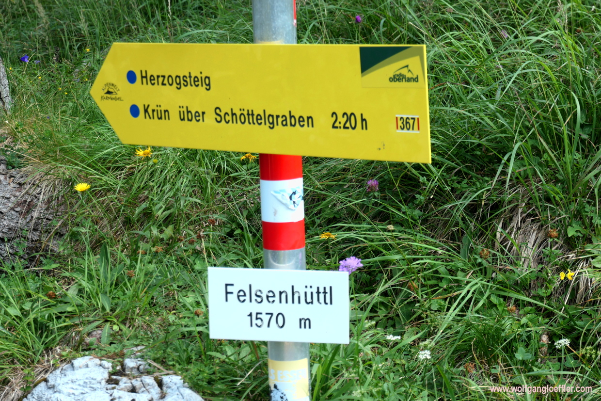
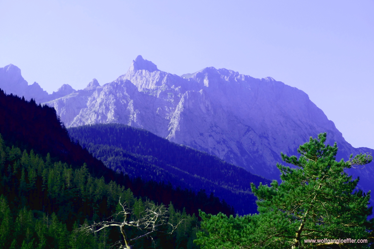
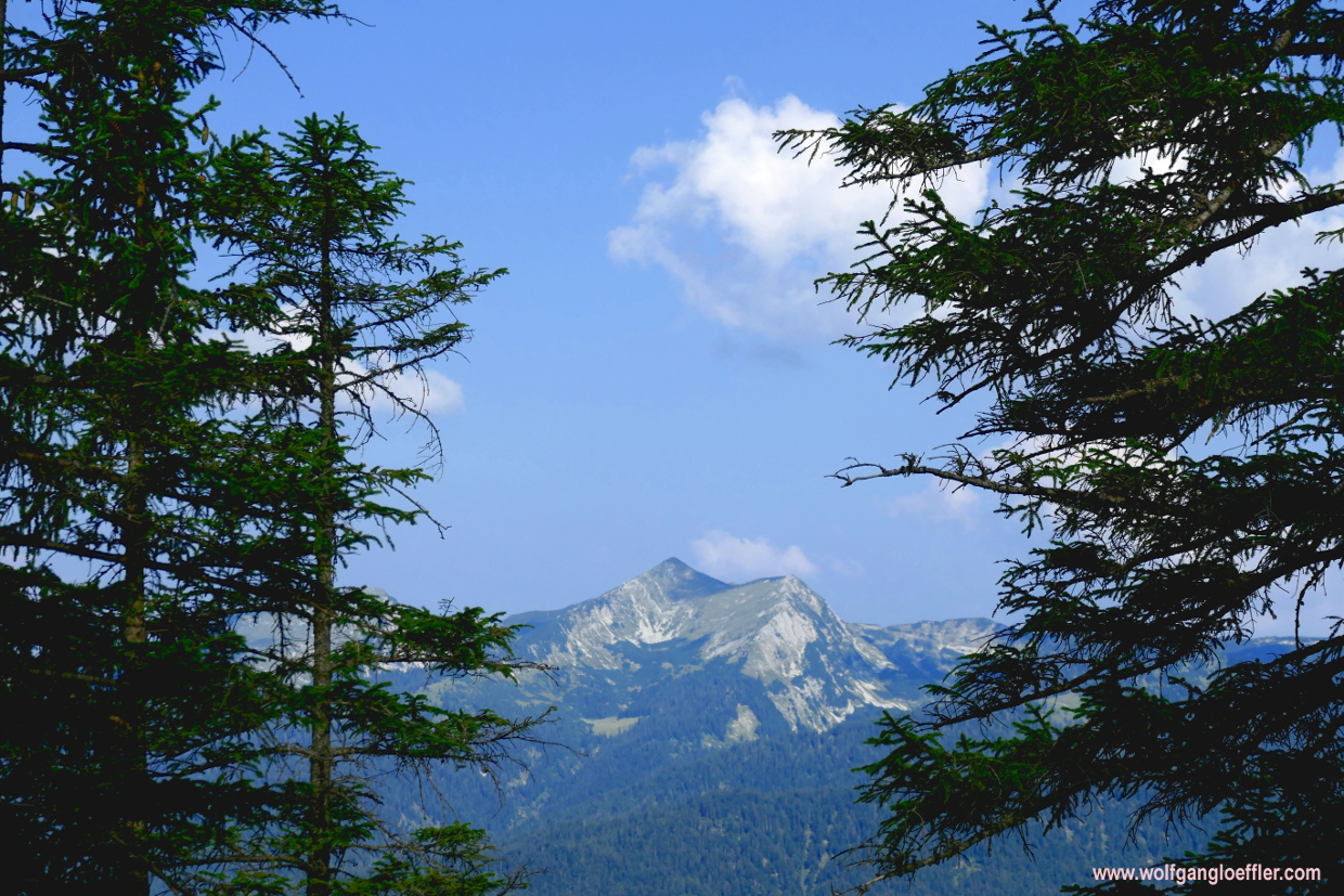
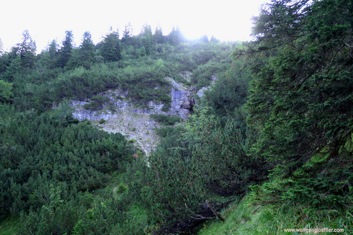
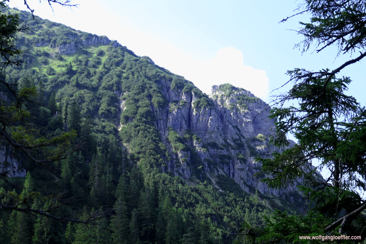
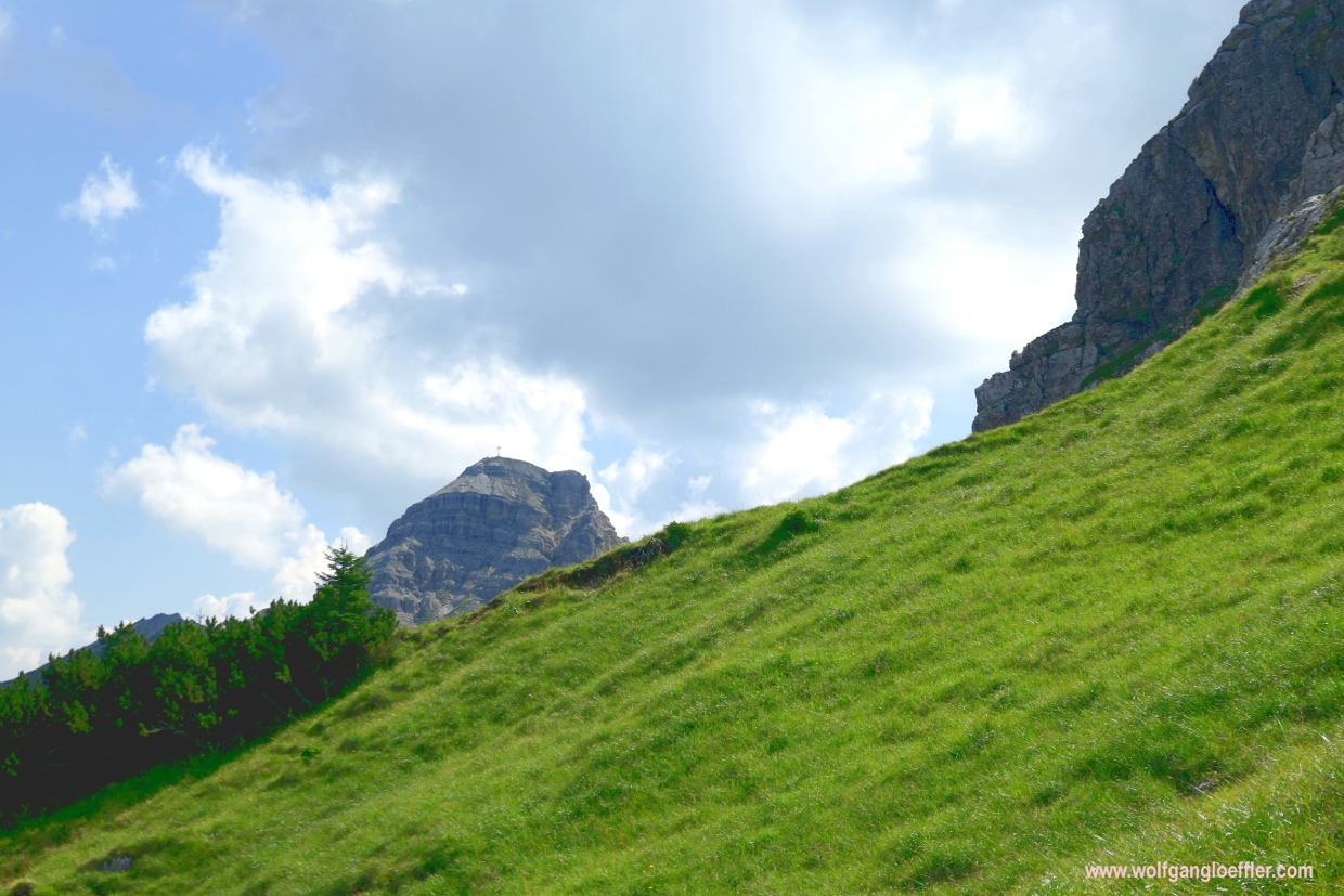
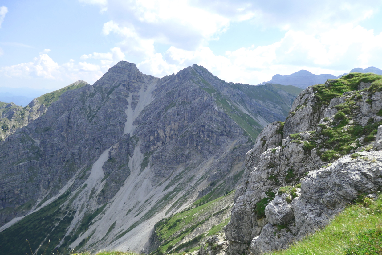
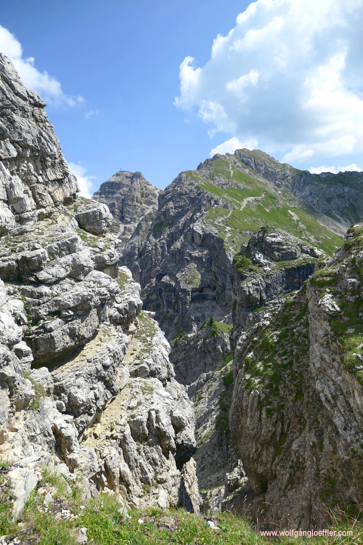
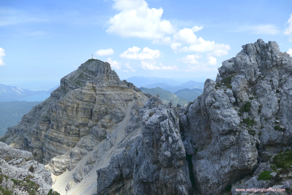
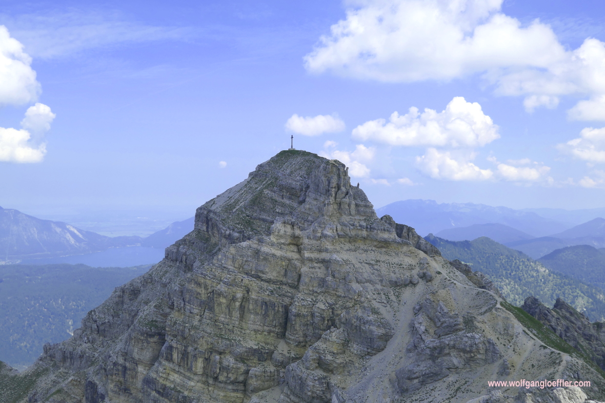
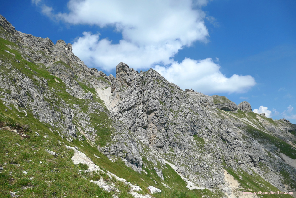
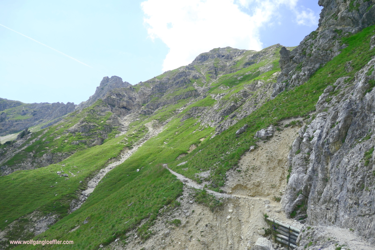
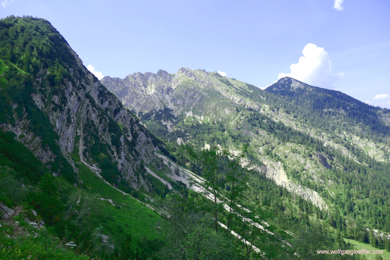
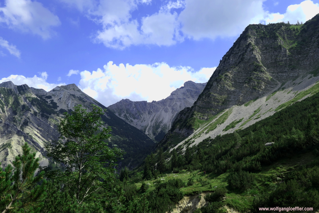
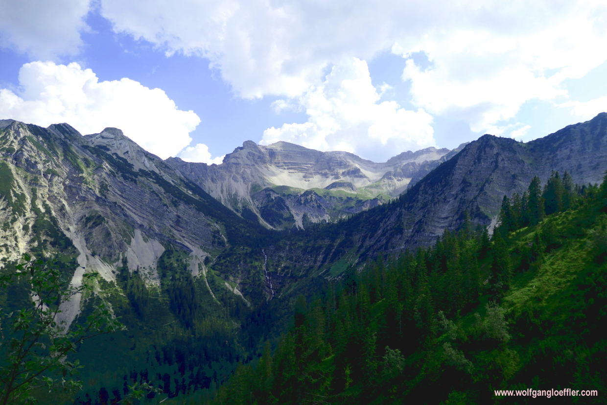
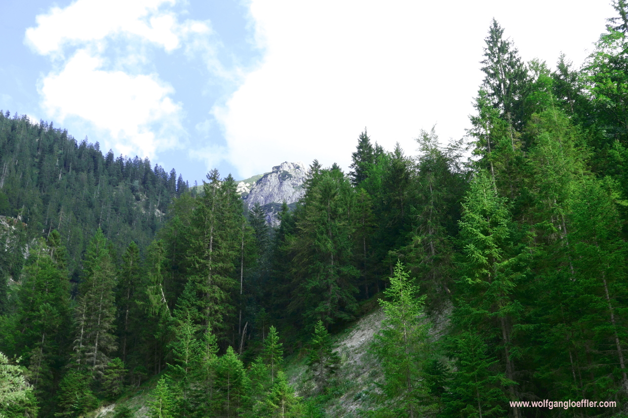
A few minutes later I do see the first summit I will have to cross today. But as I realise when reading the sign at the Felsenhüttl, there are still around 1300 feet to climb before accomplishing this stretch. A few feet further up it looks as if I would reach some sort of plateau and am looking forward to a while of even terrain. But when I reach the alleged plateau I have to hold my breath. First of all because a steep chasm is opening up in front of me and secondly I have the first view of the Schöttelkarspitze.

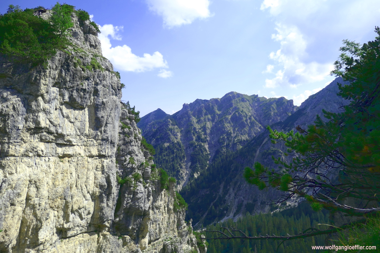
That much about strolling on even terrain for a bit. The summit is the highest peak of a cirque whose walls are falling steeply into the deepness. Now I know why it takes so long to get there. I have to walk along its ridge. Just crossing it is no option. I have to admire this great view for a while. Breathtaking! A hiker that is standing next to me and who apparently has made this tour before, tells me that this is the best view of the peak..
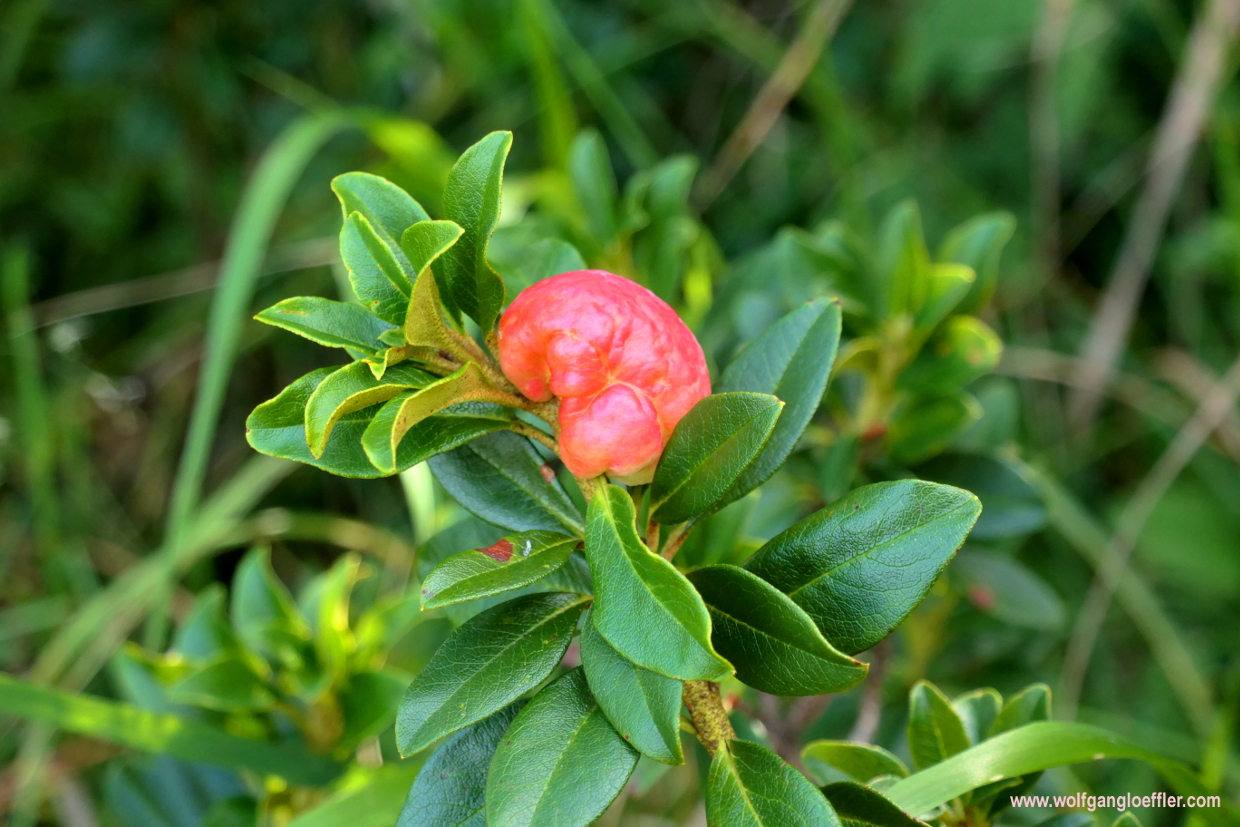
The path now winds a bit steeper uphill. Since I am walking just below the ridge I loose the sight of the Schöttelkarspitze again. On the other hand I have wunderful views of the Isar valley and can even see the Walchensee from time to time. A few of the alpine roses have those funny bulbs in their branches. Some of them are white and some red. Looks quite interesting. When I have a closer look I am convinced that these are nests of gall wasps. I just hope that the bushes will survive this assault.
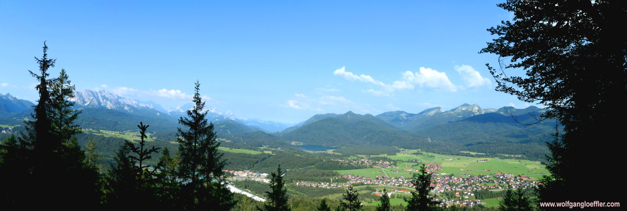
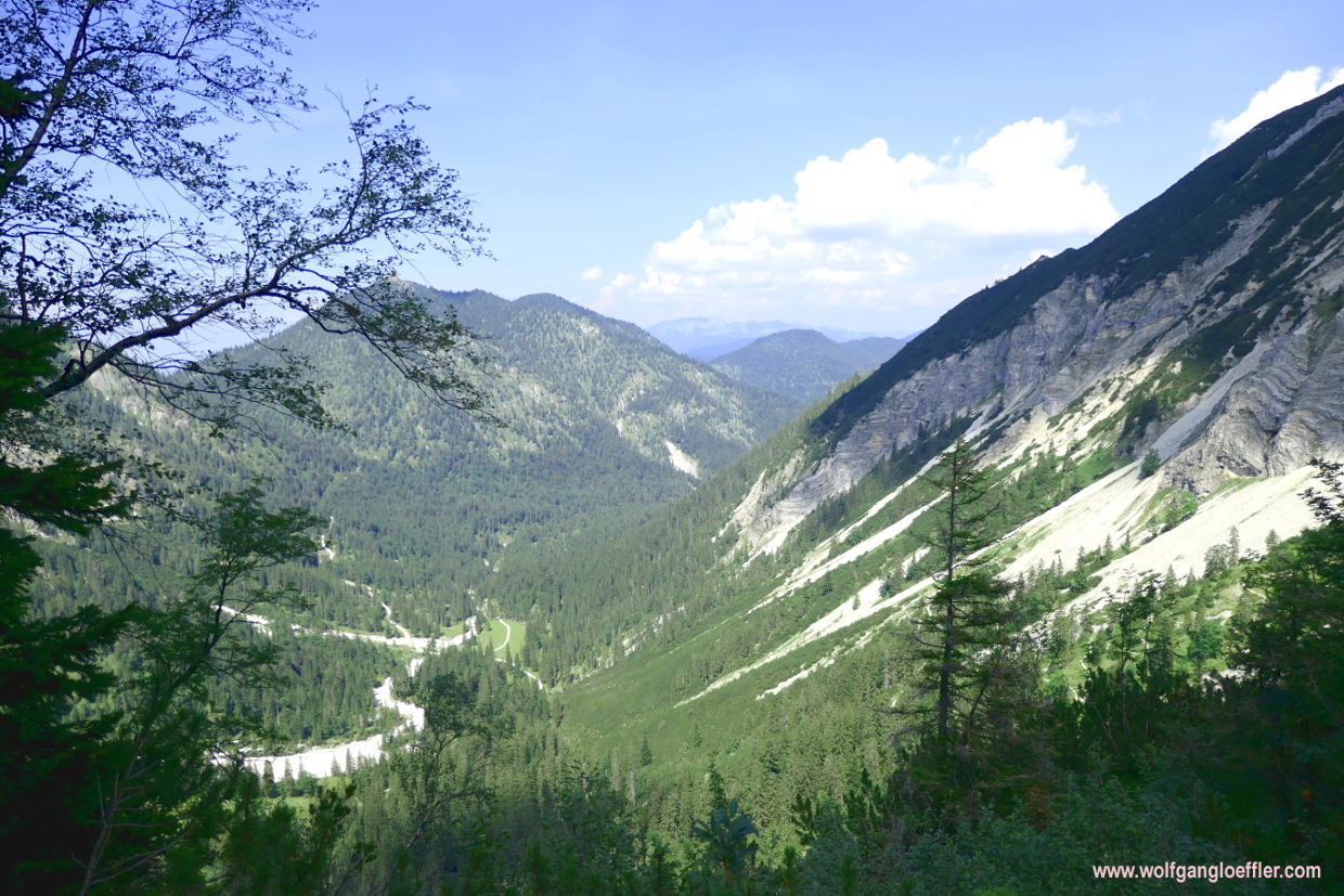
Shortly afterwards I reach the timberline and in front of me sits the grassy summit of the Seinskopf. Here I get fantastic views of the area again. When I turn around I can see the Walchensee shimmer in the far between the mountains. Behind this lake you should see on a clear day the alpine upland which is hidden in the mist today. To the left the peak of the Schöttelkarspitze is dominating the scenery. And I have to agree with this hiker I met earlier The first view was better.
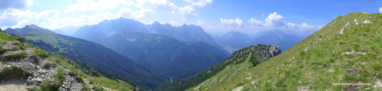
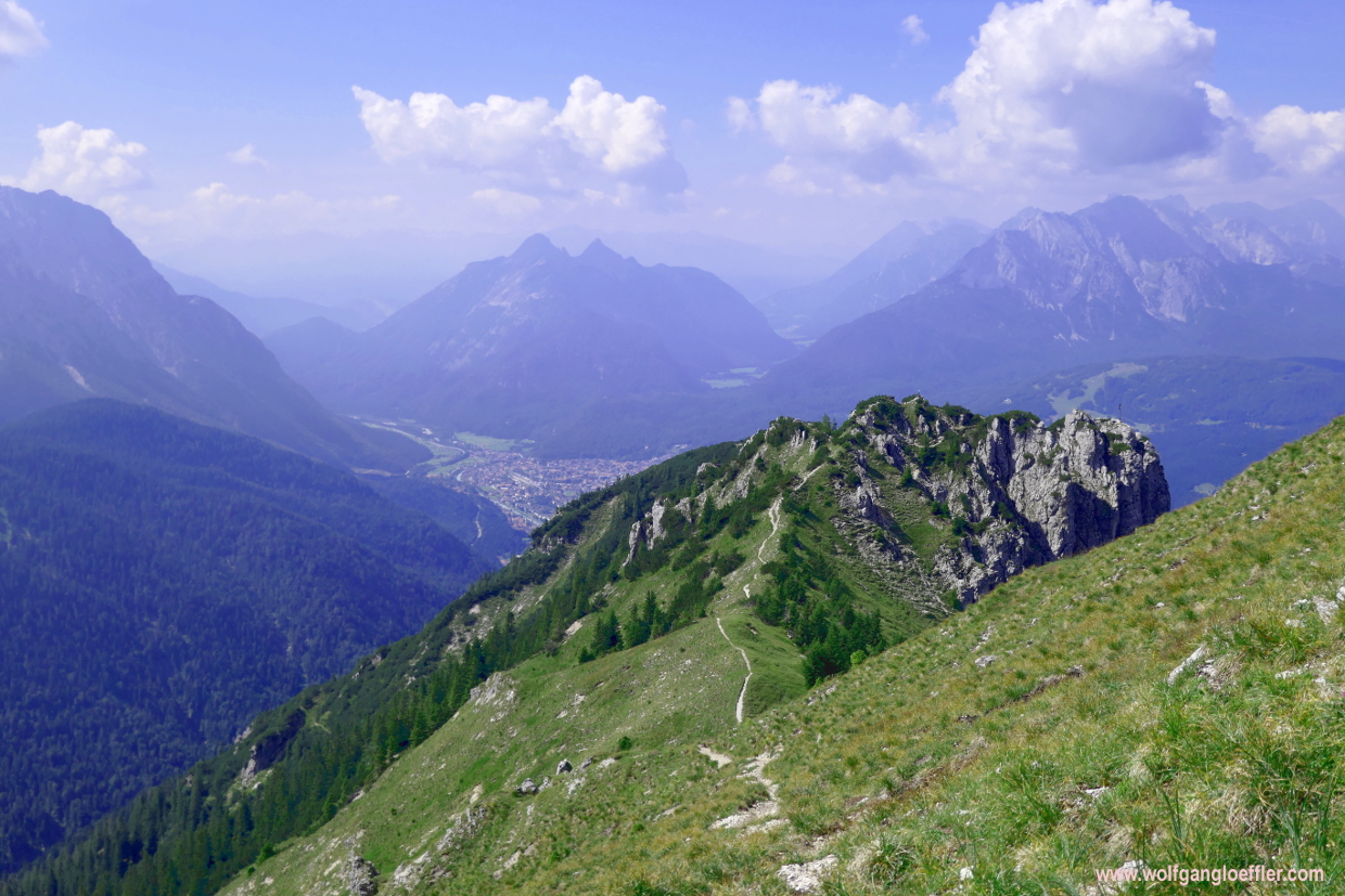
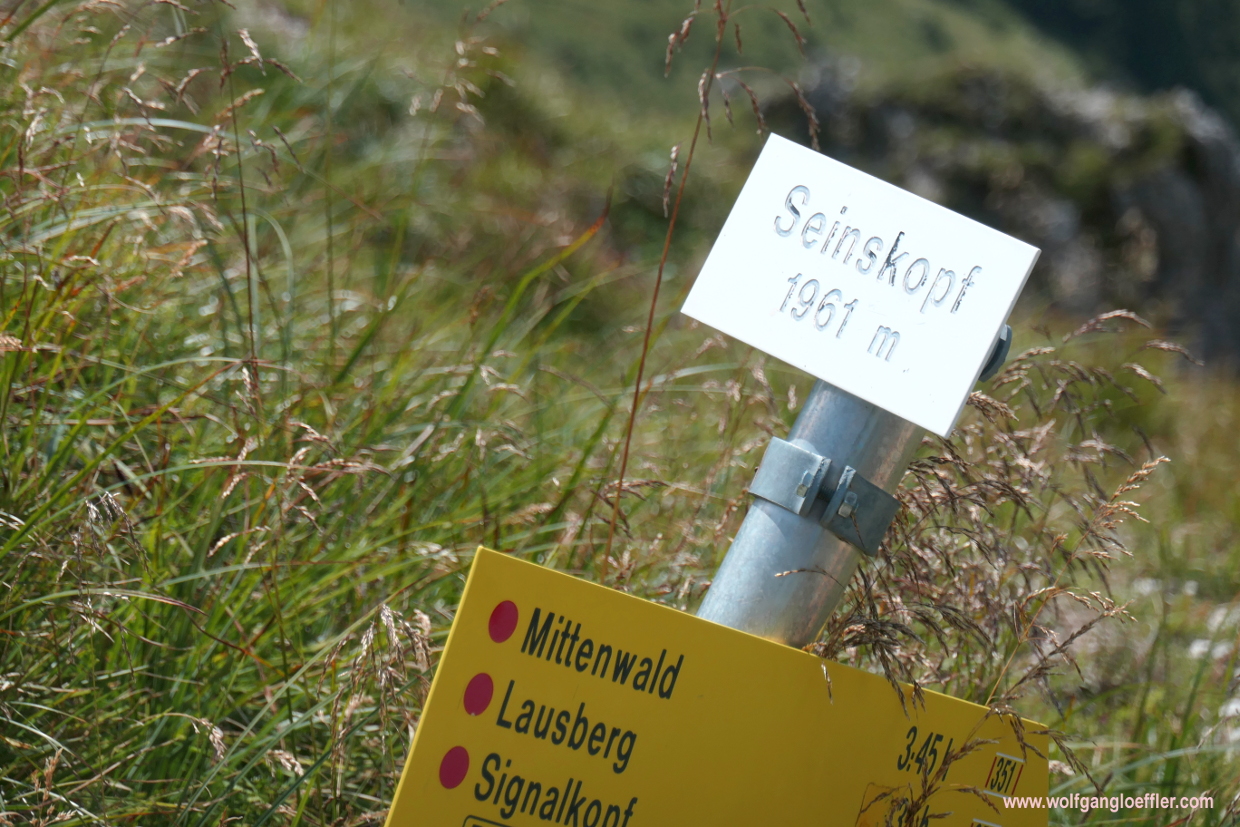
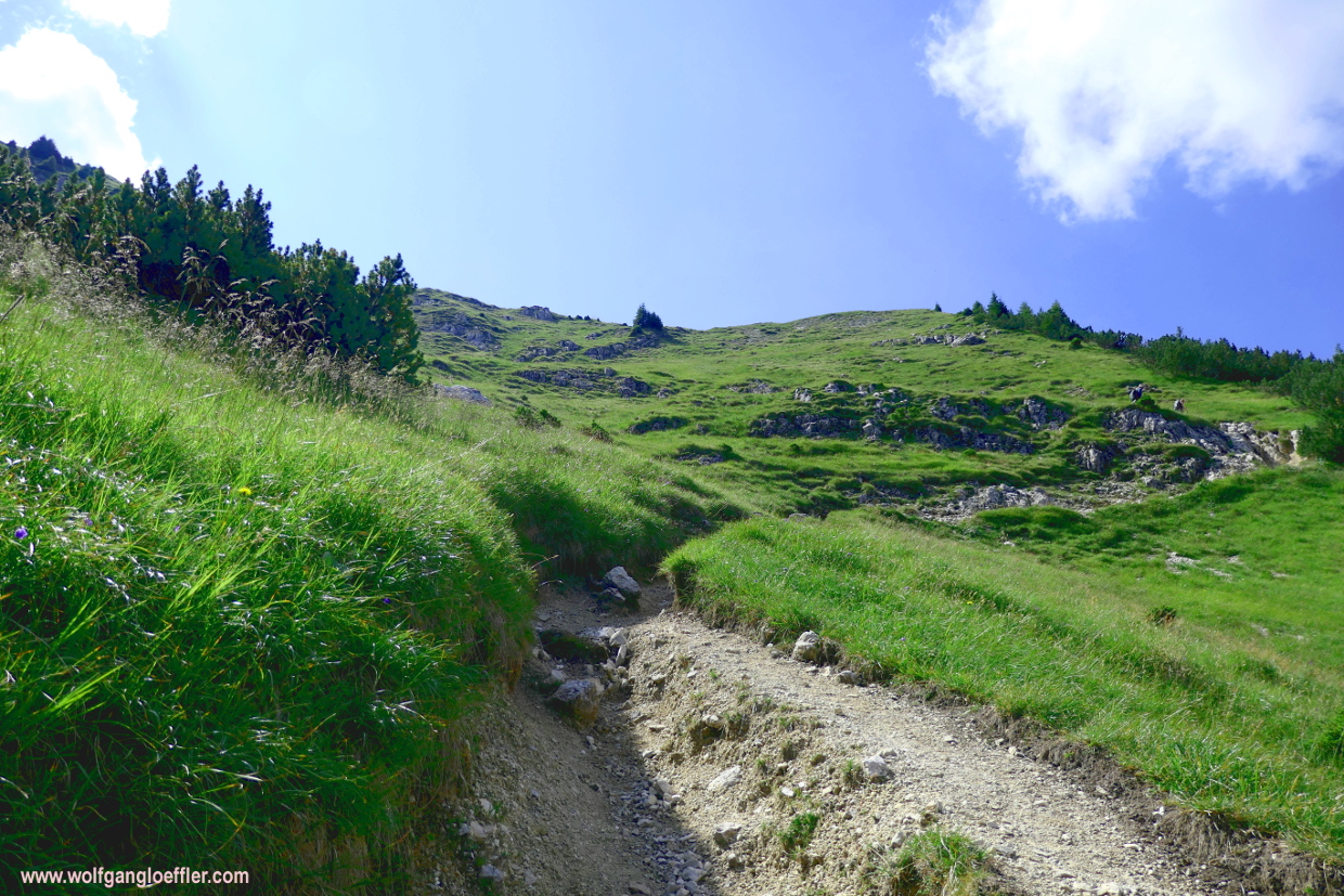
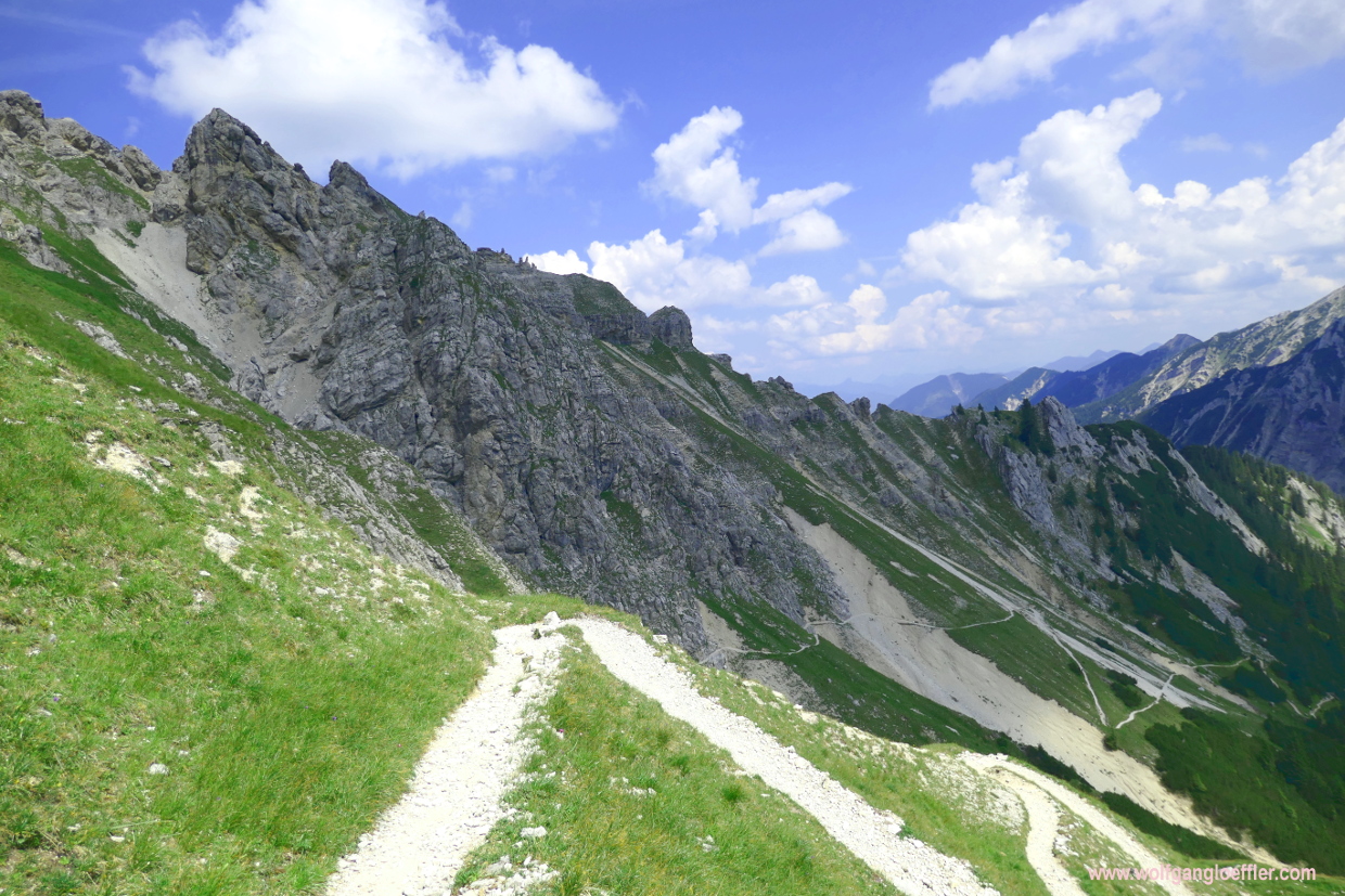
Along wide turns leading through grass I finally come to the summit of the Seinskopf which offers great views of the surroundings. To the south I see Mittenwald and the Karwendel Summit. To the north I look from the Schöttelkopf to the Walchensee, Herzogstand and Heimgarten. Too bad the visibility is not so clear today. The sign tells me that I have to turn left here. There are apparently two paths leading to the Schöttelkarspitze. One runs precipitous below the ridge while the other follows the top of the ridge. I take the latter one but would recommend that you’ll tke the lower one, because it’s easier to walk.

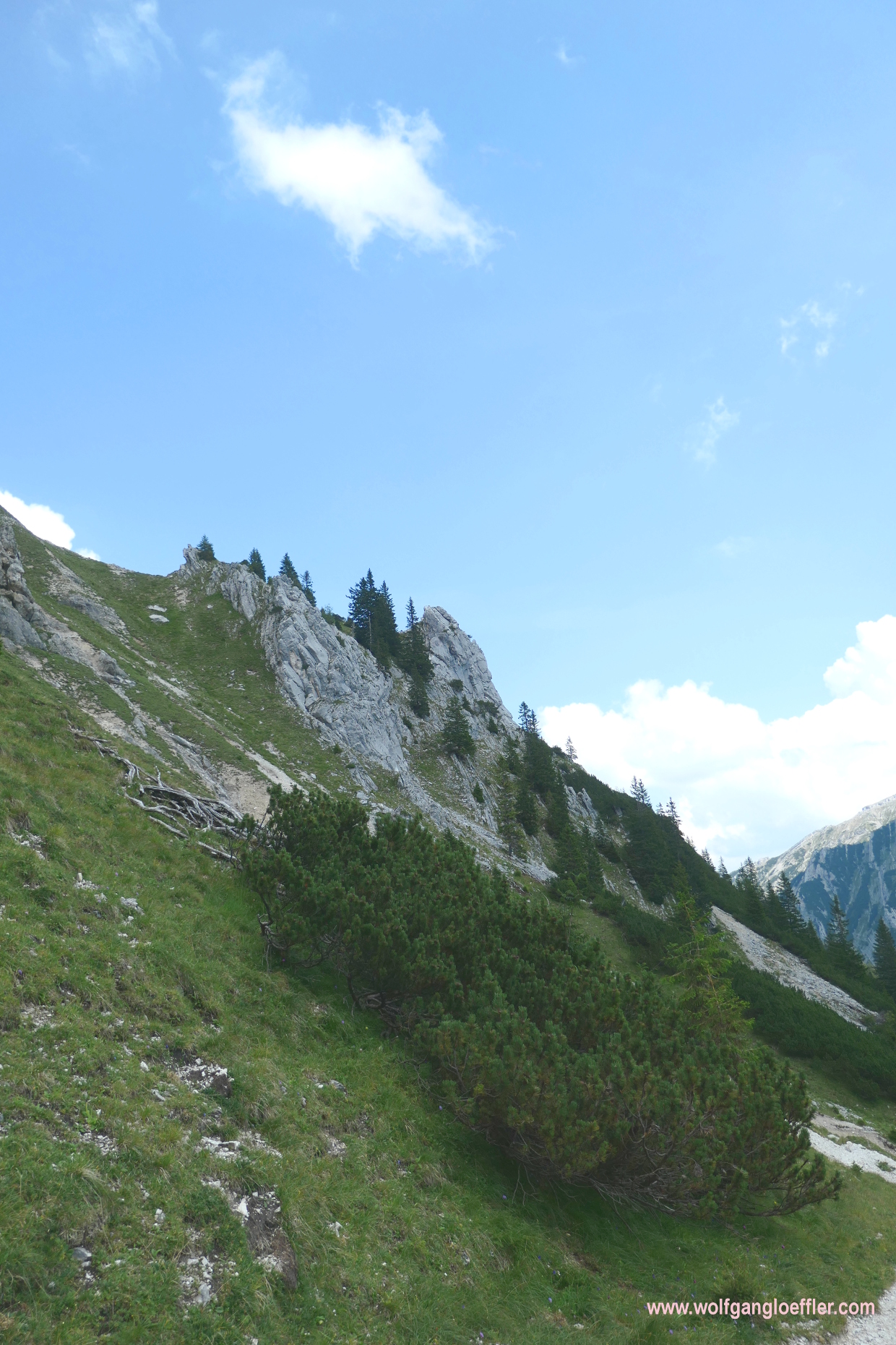
The trail over the ridge starts pretty unspectactular. A part that it falls steeply to the bottom on both sides. But only a few minutes later I find myself in front of this rock tower that I have to cross. It’s not secured with wire rope and actually not that hard to surmount. I am sure footed and not afraid of heights but even I fell somewhat uncomfortable while crossing this stretch. Usually I love to scramble over a rocky stretch but here I have to concentrate not only on the way across the rocks but also on the steep chasm to both sides. This is the point where I am happy to have brought my walking sticks. They offer more stability. So for a while I am not admiring th great views, but place carefully one foot before the other and focus completely on the path.
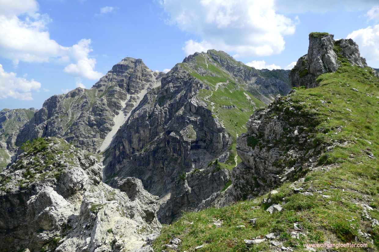
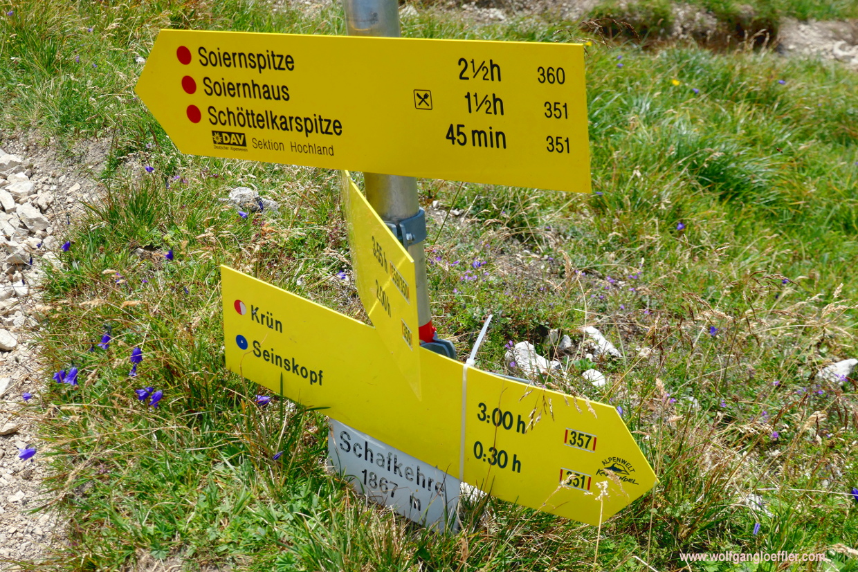

At the end of the crossing of the ridge both paths meet again at the Schafkehre. When I look back to te ridge I just crossed I am asking myself why I have taken this strenuous way. But actually it looks worse than it was. According to the new sign I still have a 45 minute walk to the top, despite it being so close in front of me. Meanwhile I am starting to get tired and have the feeling that I won’t be able to make another ascent. I have to cross a rocky passage which brings me down a few feet.
Again I have a bit of scrambling to do and my sticks are a great benefit during this stretch. And then I can finally see the last bit of trail leading to the summit. It runs along another narrow ridge to the top. But since I have my goal in view permanently th energy is coming back and the urge to stand below the cross. So let’s go for the final spurt. I have almost made it.
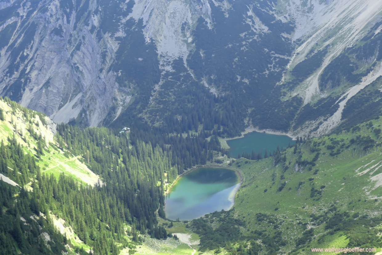
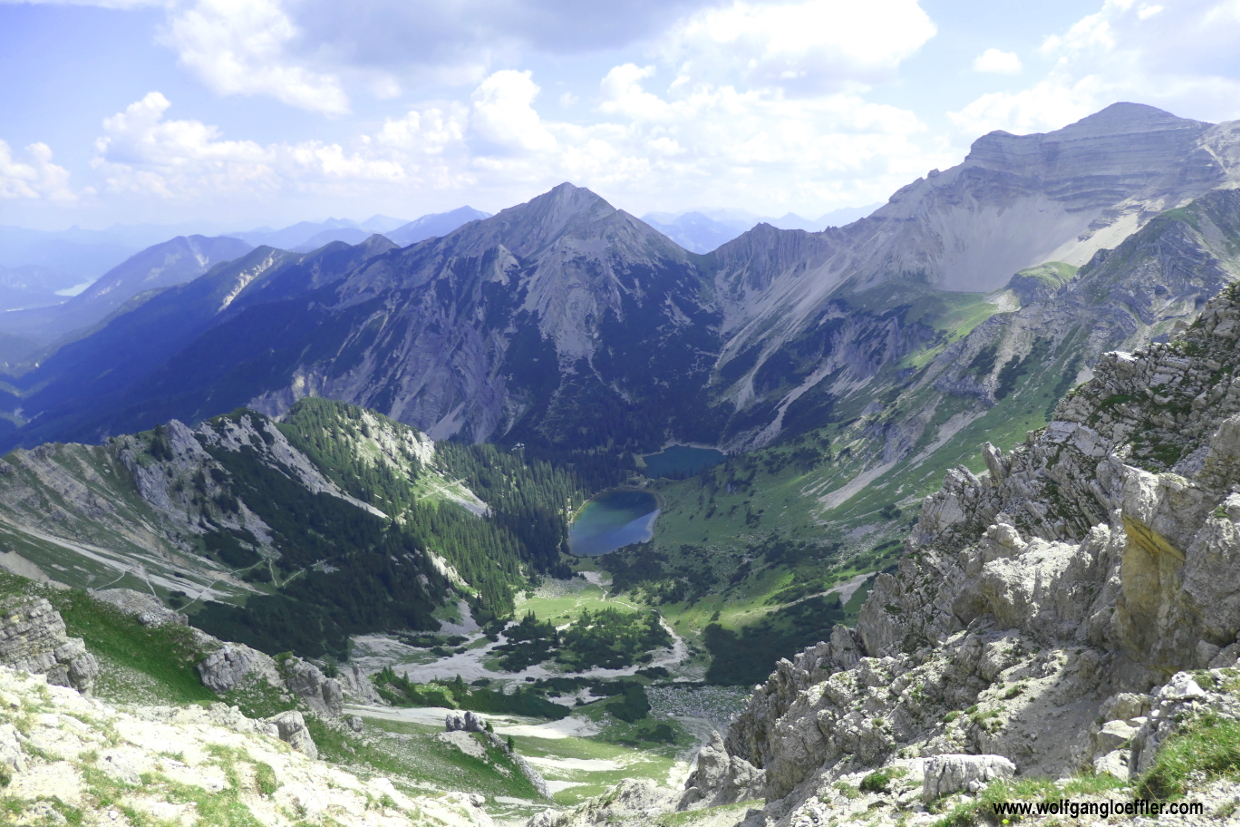
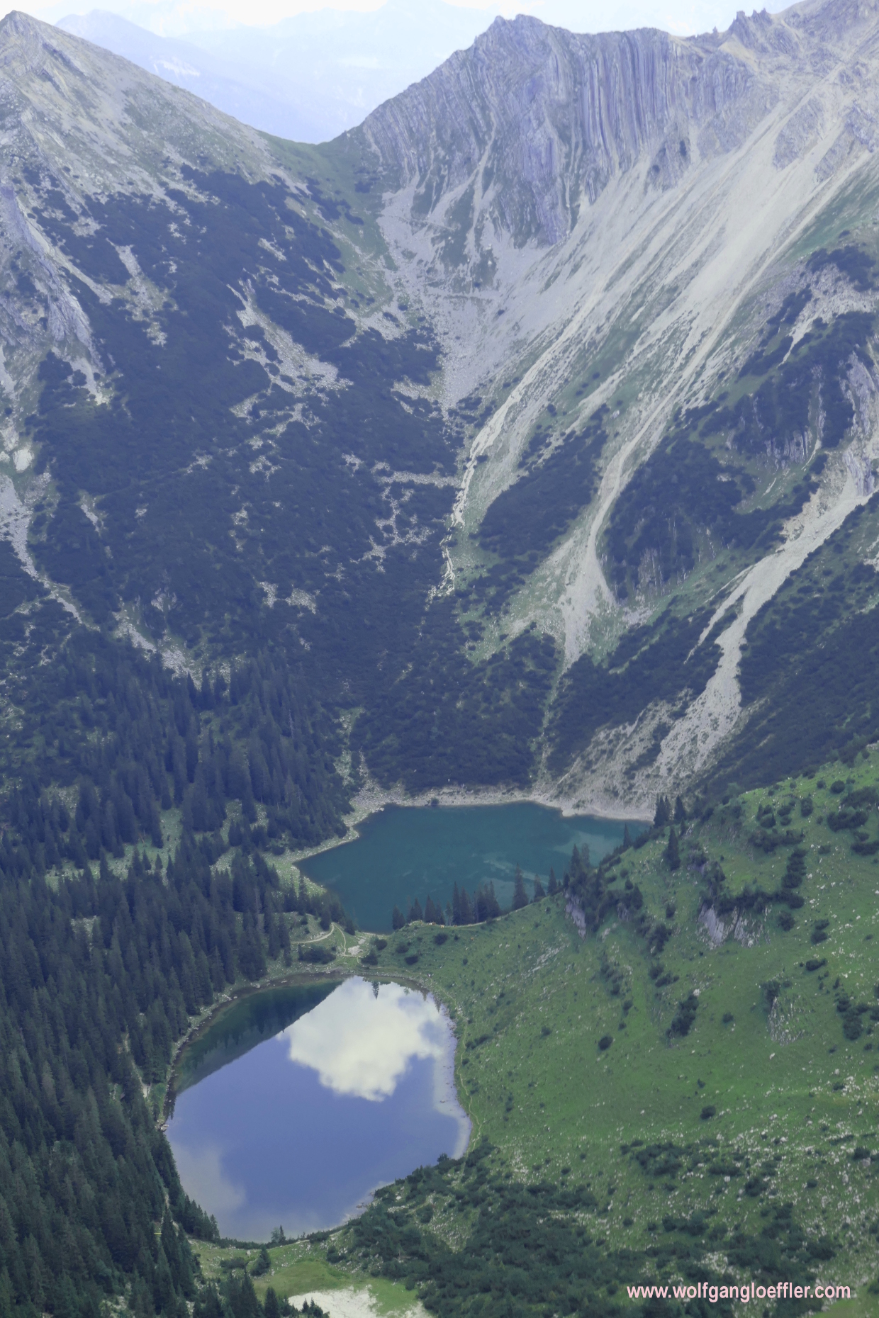

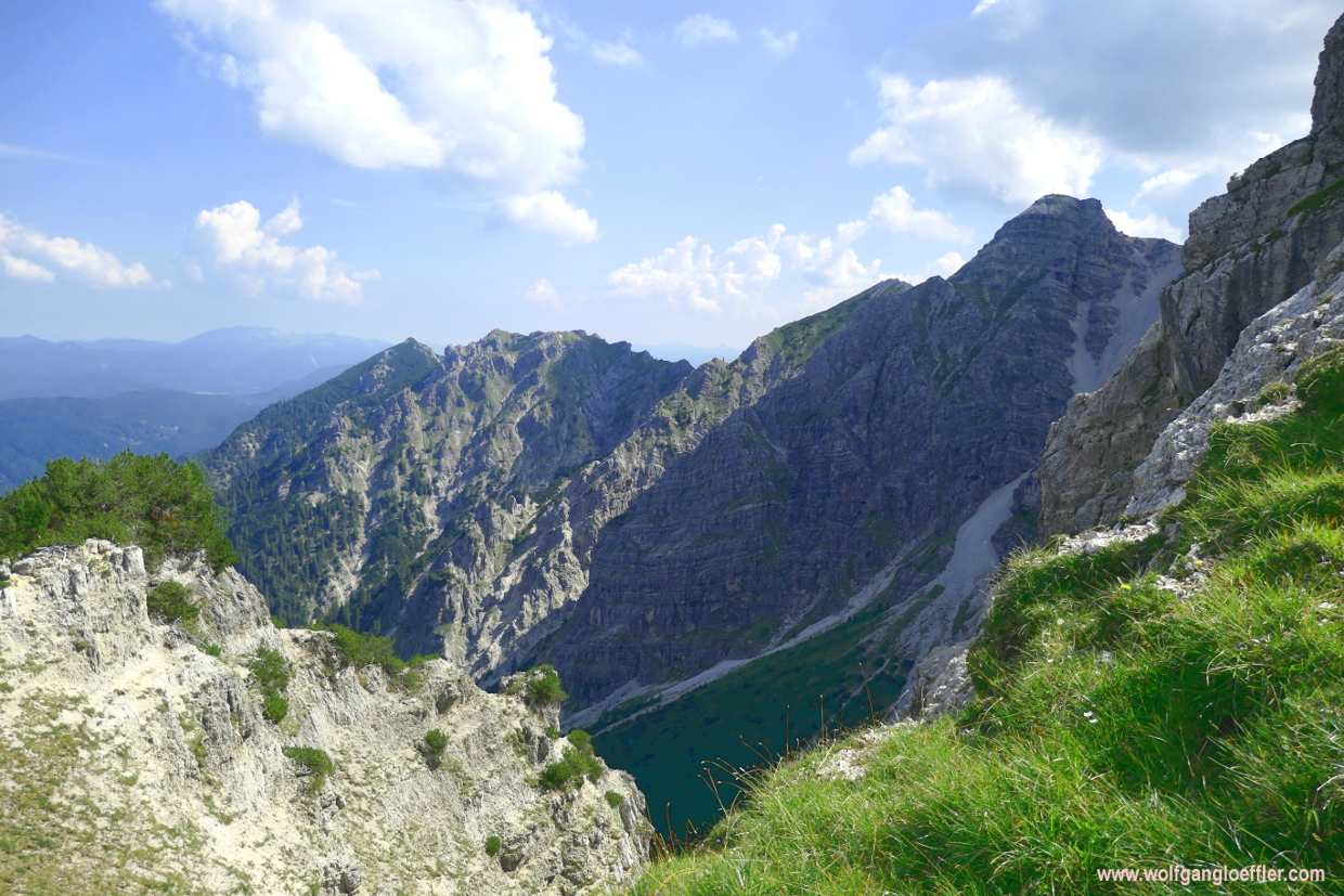
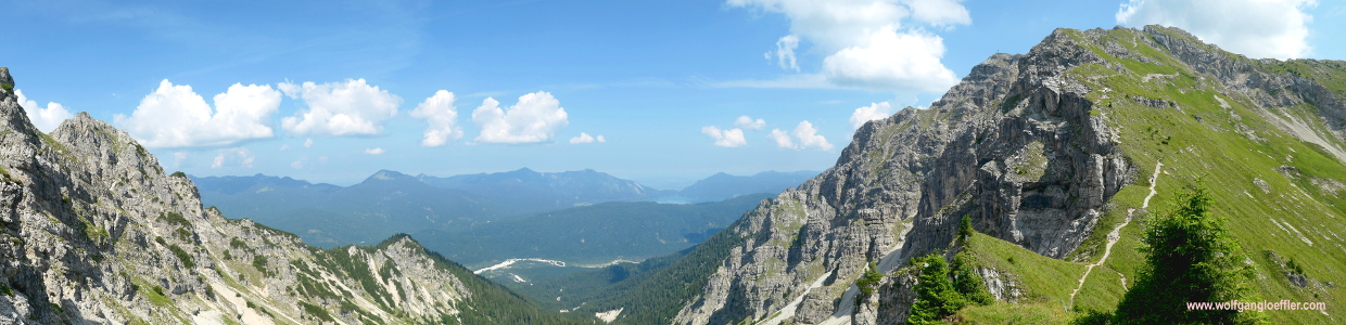
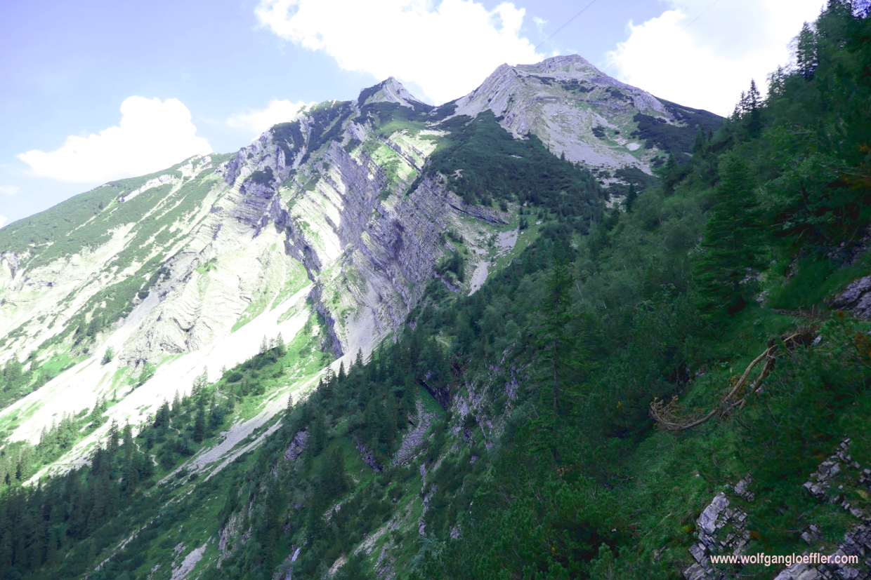
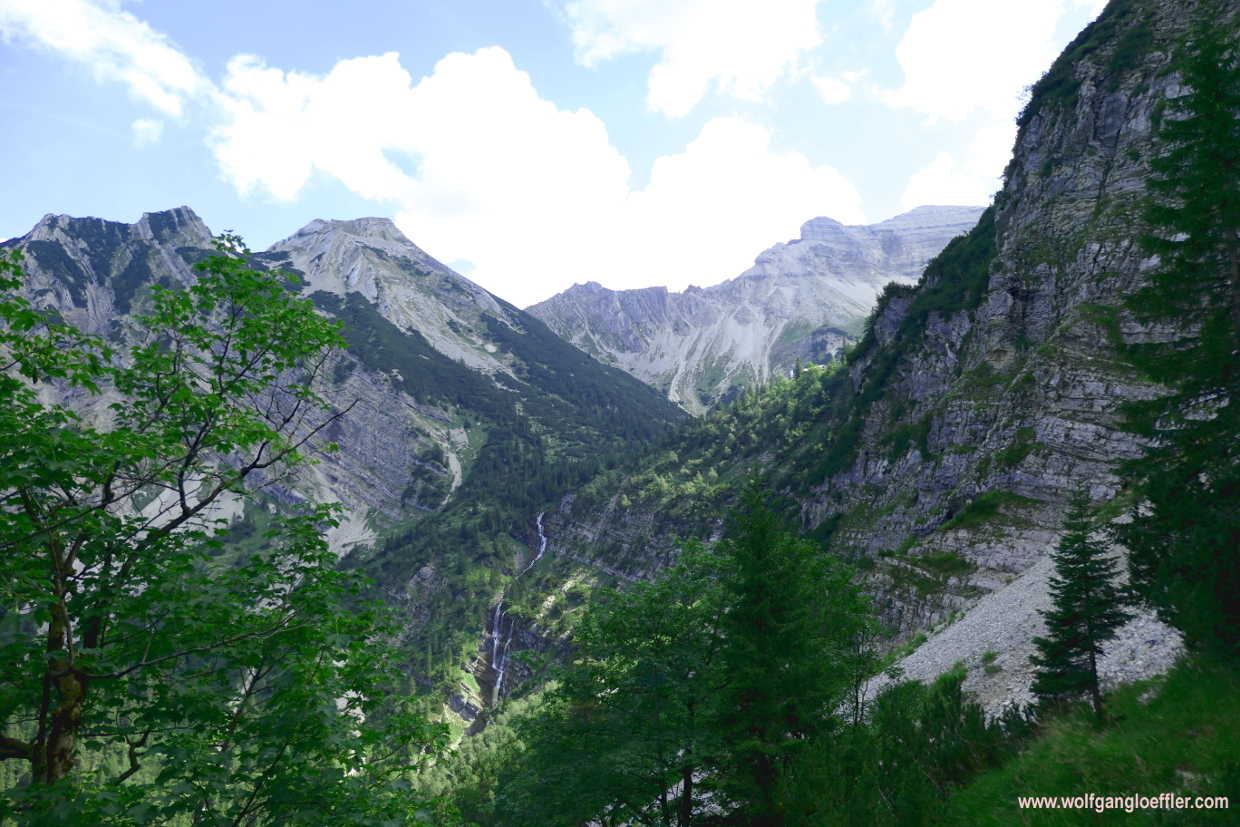
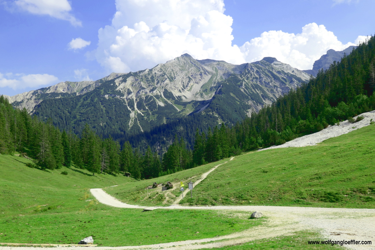
After crossing the passage there is a rocky wall next and in front of me and the path winds along this wall. But after I have passed this stretch I have the next WOW effect during this tour. In front of the cirque of the Soiern is opening up with a majestic peak and two lakes on the valley floor. What a view! For such sights it’s always worth the hazzle of climbing up the mountain. Since there is currently no one on the small path I can admire this view for a while.
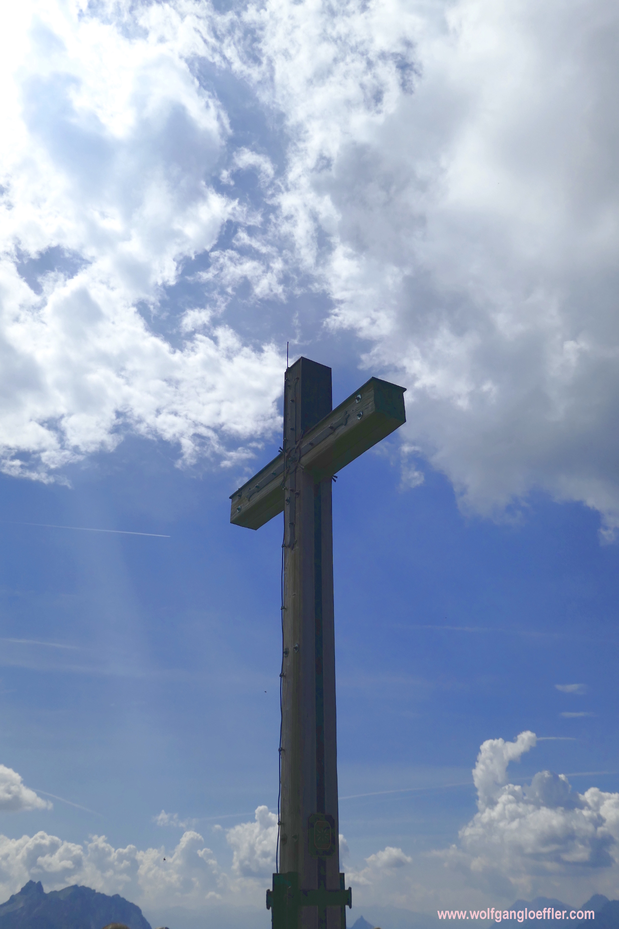
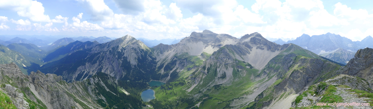
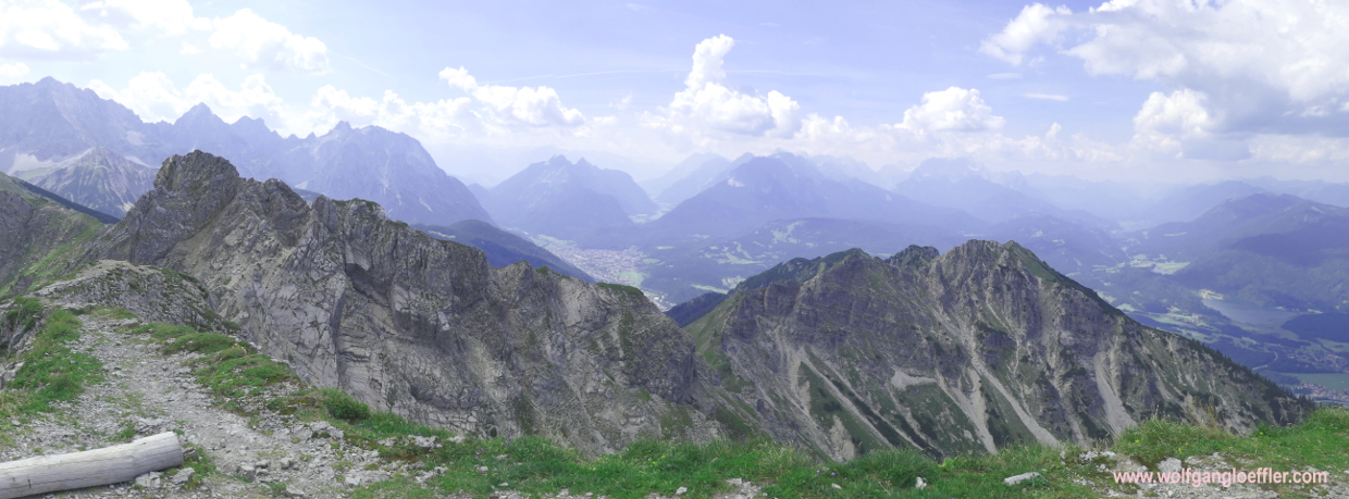
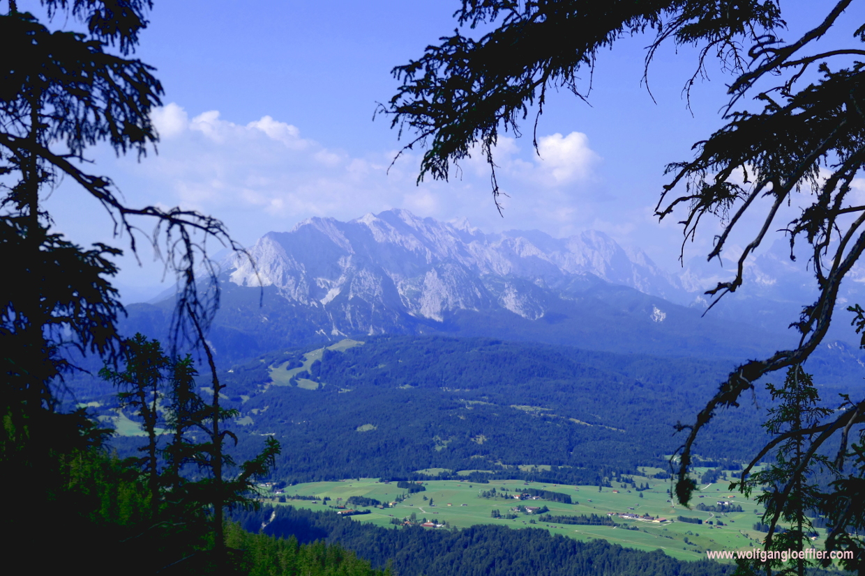
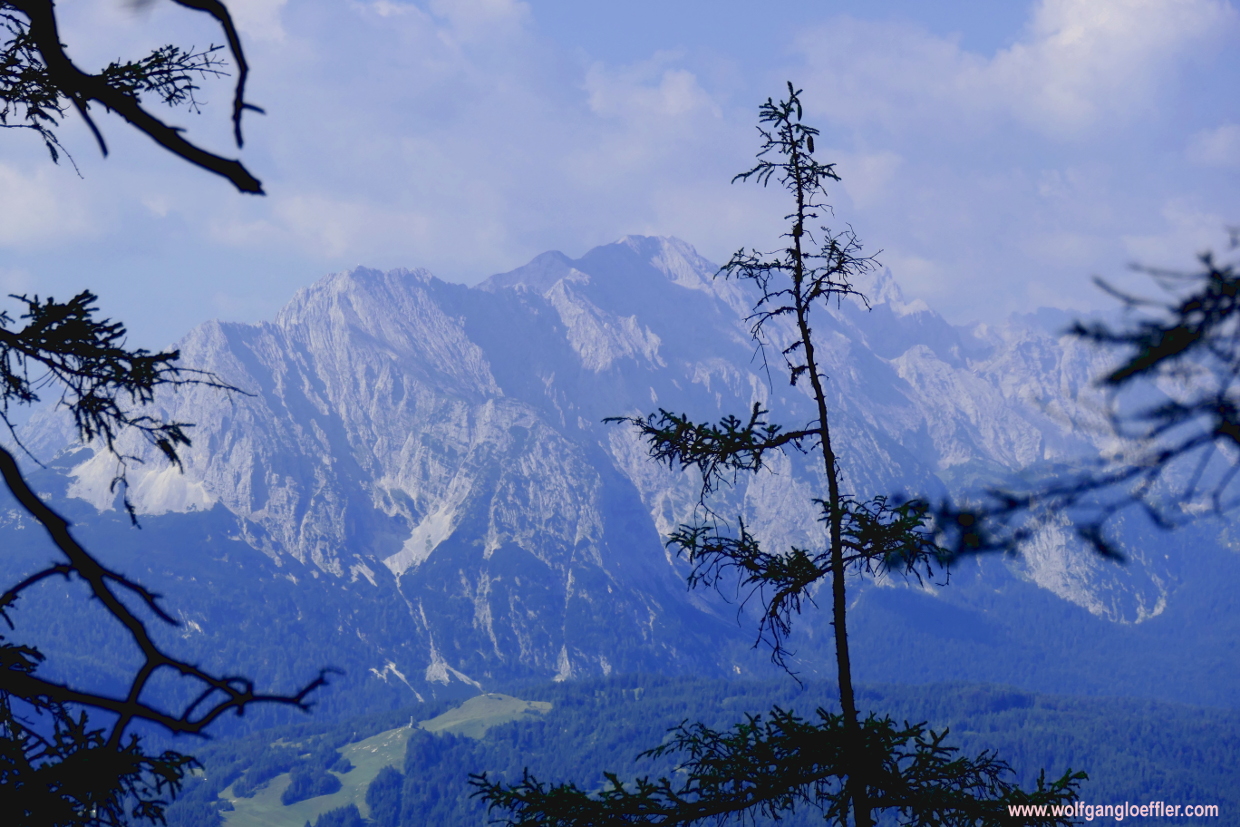
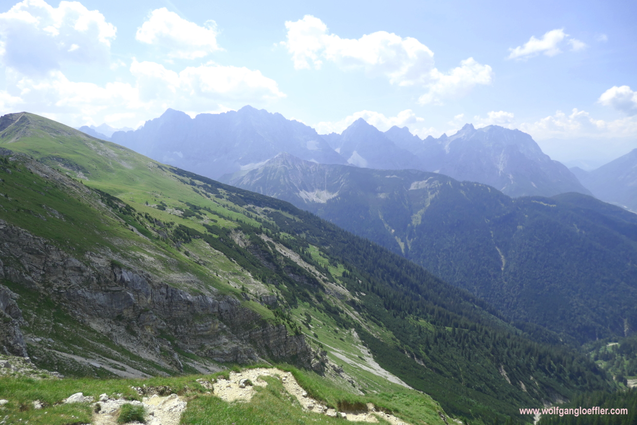
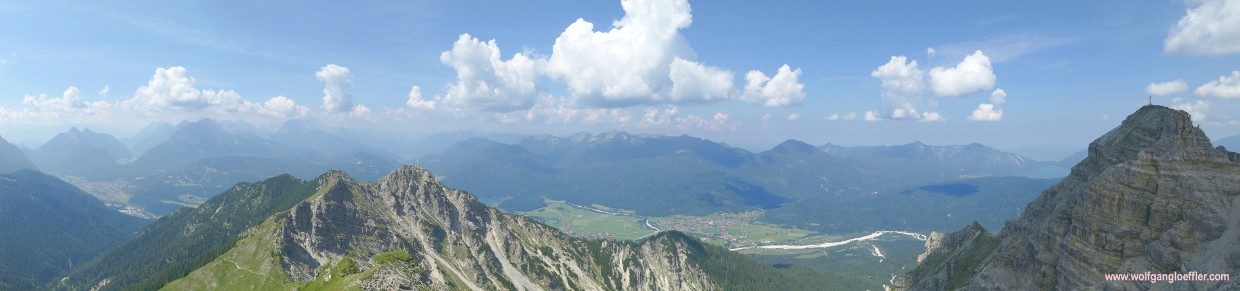
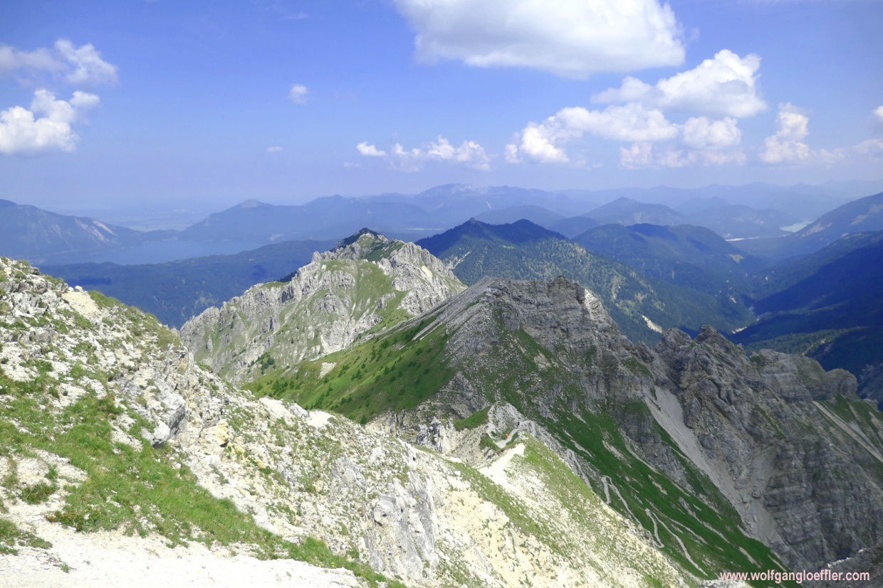
Shorlty afterwards I have made it. Instead of the 5.10 hours I only needed 4.45 hours for the ascent. But I have to admit that it has gotten pretty much of my energy. Here on the summit I get the reward for doing it. Especially the view of the Soiern cirque is fabulous. Again I think, how bad that it s so misty today. The view of the Karwendel peaks and the Wetterstein must be as impressive on a clear day. But when looking towards the Karwendel I can at least see the ridge I just crossed.
There are only a few people up here. So I can stay a bit longer. A couple is asking me which way I came up. They were a bit dissapointed about their ascent via the Soiernhaus since they had to walk on a gravel road for a long time in the beginning of their tour. That’s the route I had planned for the descent. Actually I don’t like to walk on those hard beaten gravel roads but on the other hand it would mean that I wouldn’t come to a cabin for a rest. Since I am very thirsty I decide to take this route anyway. Can’t get that bad.
First the trail falls in long turns along the mountain slopes. But soon it runs along another rocky wall and descends slowly to the valley. At some points the path is somewhat exposed and to my right the terrain falls almost vertically to the bottom. To be sure footed and not afraid of heights is helpful on this part. In return I can admire the great view for quite a while. From time to time clouds are covering the valley and so the temperatures are not getting to hot. That’s pleasing during a hike.
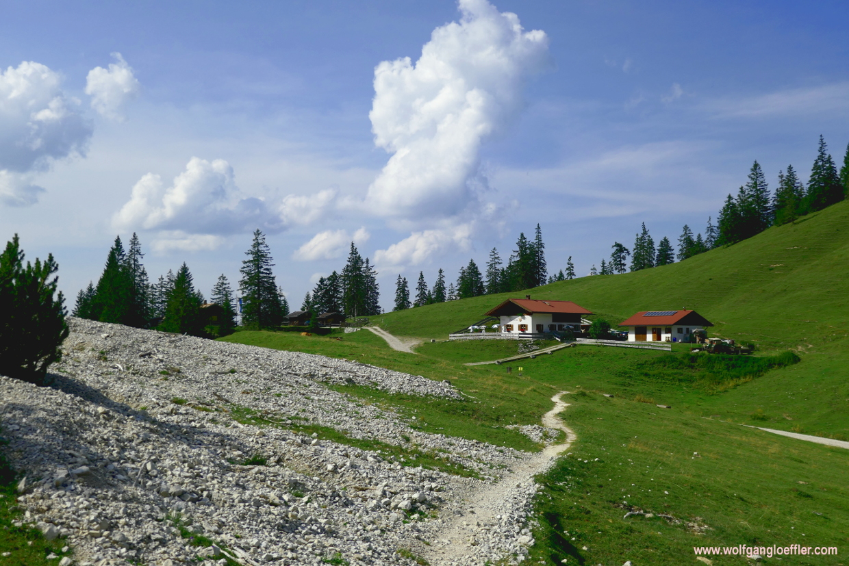
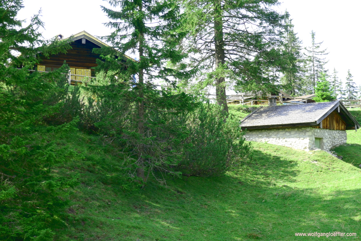
Before I enter the woods again a few minutes before reaching the Soiernhaus I stop for a while and admire this view for a last time.The summit of the Schöttelkarspitze seems to be far away allthough I just walked for about half an hour. At the Soiernhaus there are quite a few people taking a rest. But I can find a table for me with enough distance from the others. It takes me a while before I understand the concept of distance and how to walk around the cabin but am surprised how much effort is put into security here. I really have earrned my dumplings and the first non-alcoholic beer is empty before the food arrives. So I have a second one right afterwards.
After my break I continue with the descent. Shortly behind the cabin there is a bifurcation. I can see that the path leading straight forward will continue steeply into the valley and end soon after on that famous gravel road. To the left is the Lakaiensteig that apparently follows the mountain ridge and will allow me to admire the panorama or another while. That’s the trail I’m following. Looks more interesting.
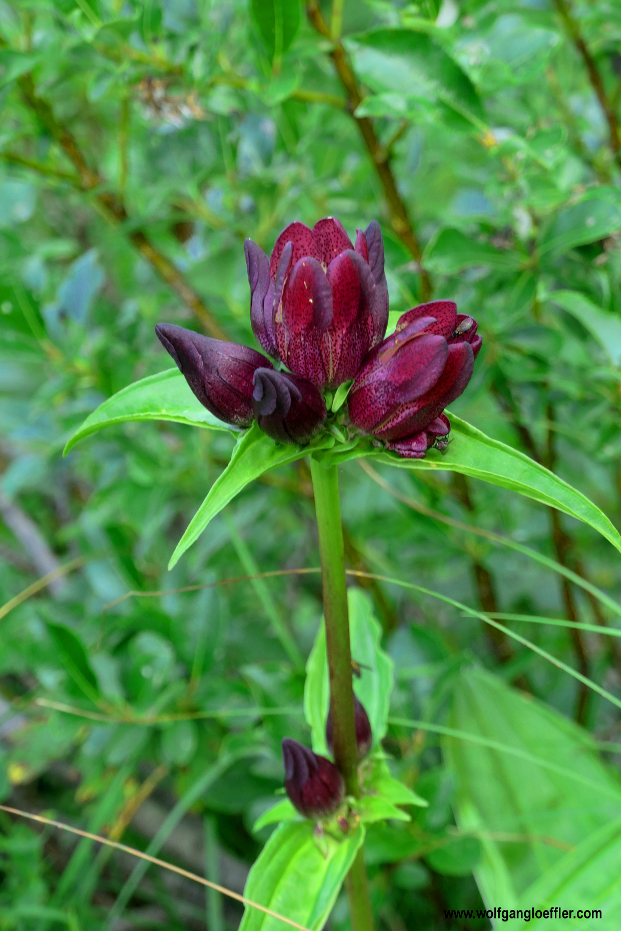
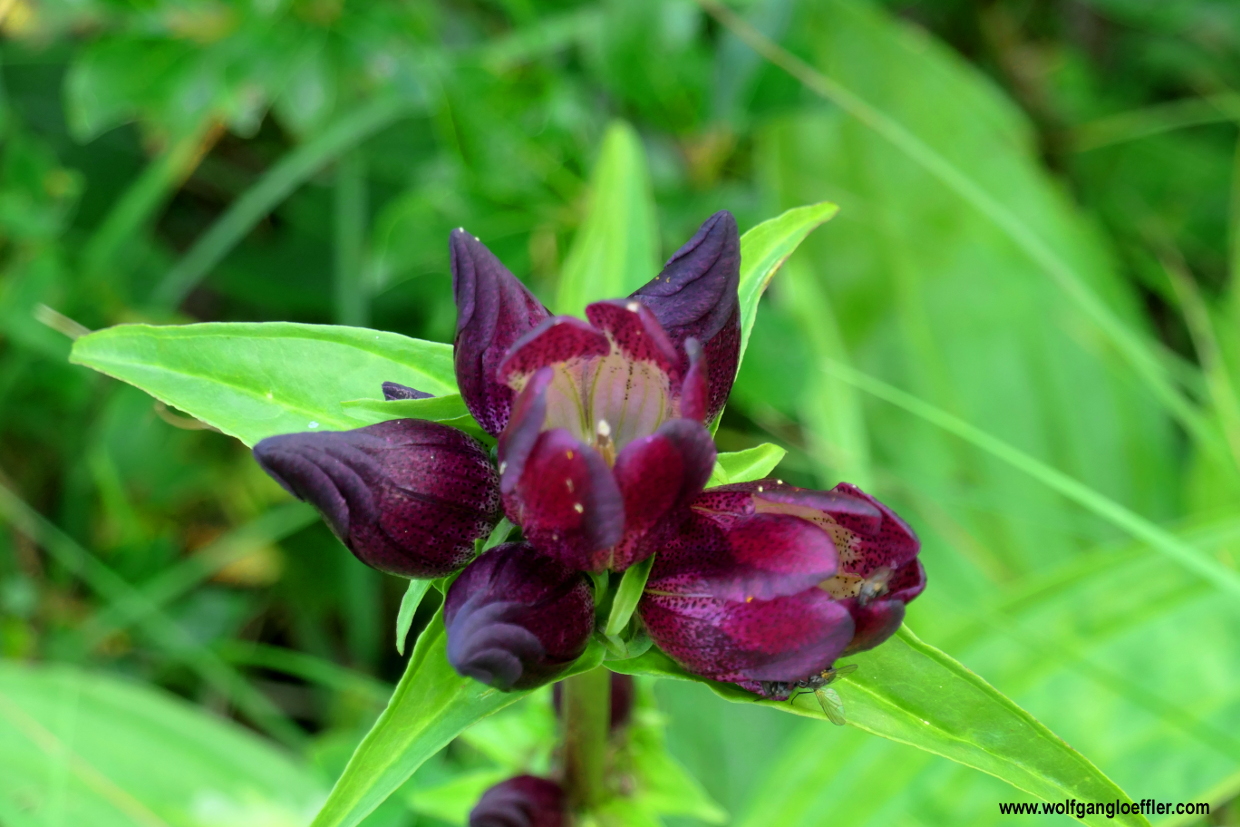
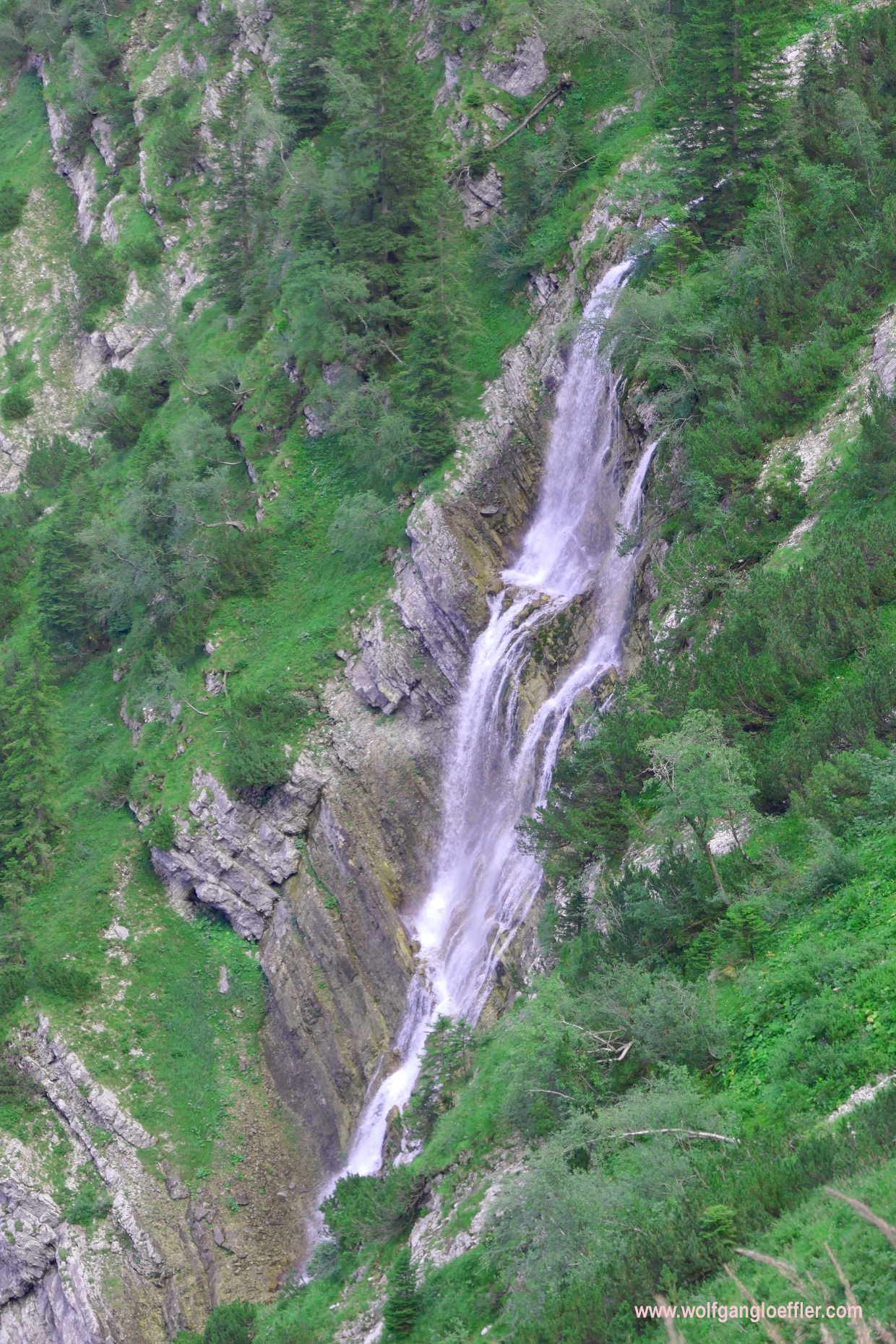
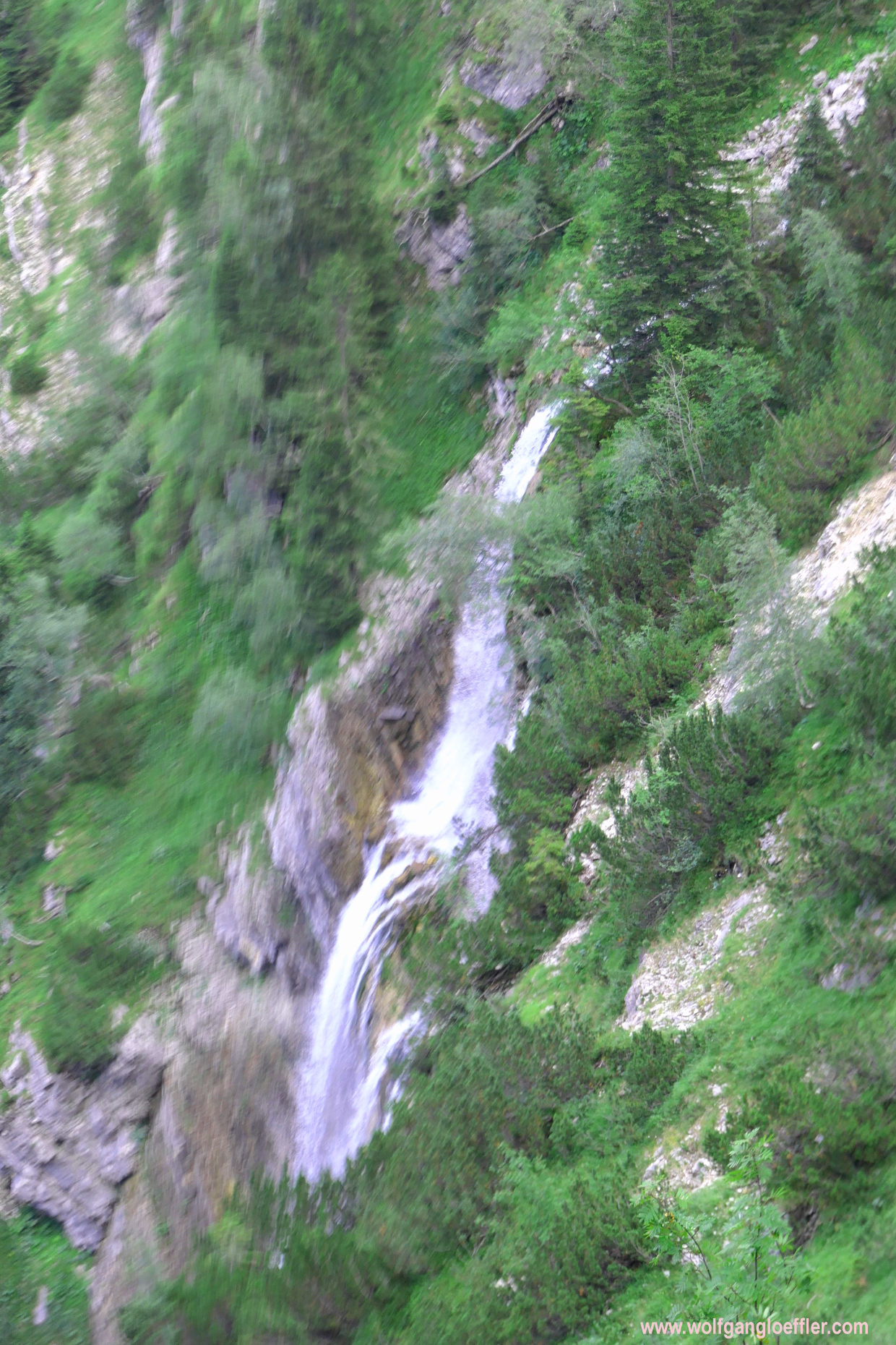
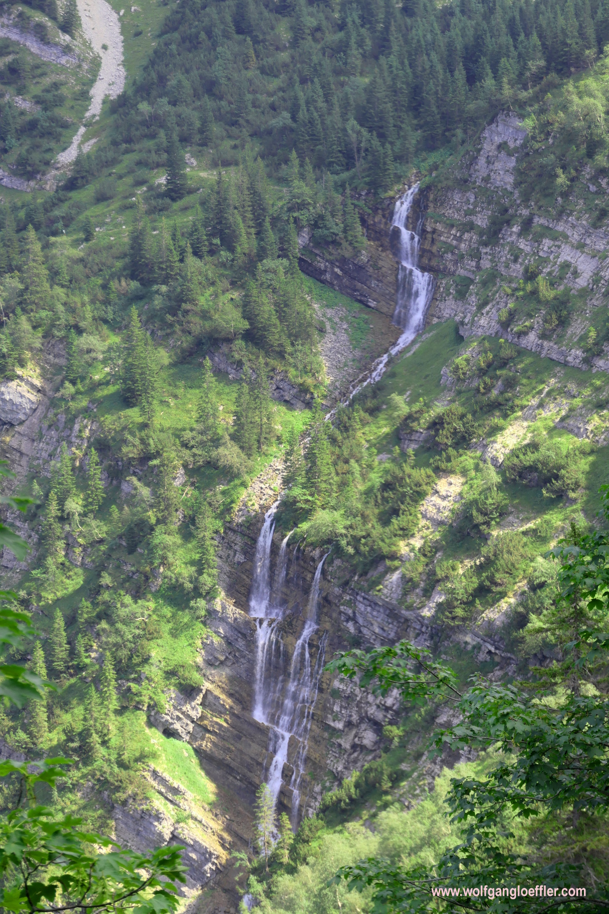
A few steps later I know that I have taken the right path. Already on the cabin terrace I heard the gurgling of water but couldn’t see where it comes from. Shortly after starting to walk on the Lakaiensteig I see the reason for that sound. A huge waterfall rushes just a few feet below the cabin into the valley which is completely filled with the noise of the water falling over the rocks. Just seconds later I tumble over this deeply purple gentian. It’s called the eastern alps gentian or botanical Pannonica-gentian. This is the first time I see this species. If you have read some of my blogposts you now that I love gentian in all its forms.
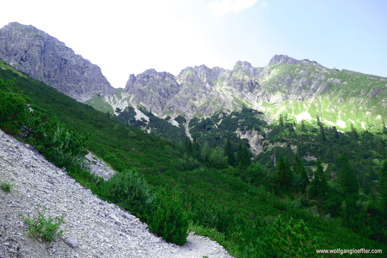
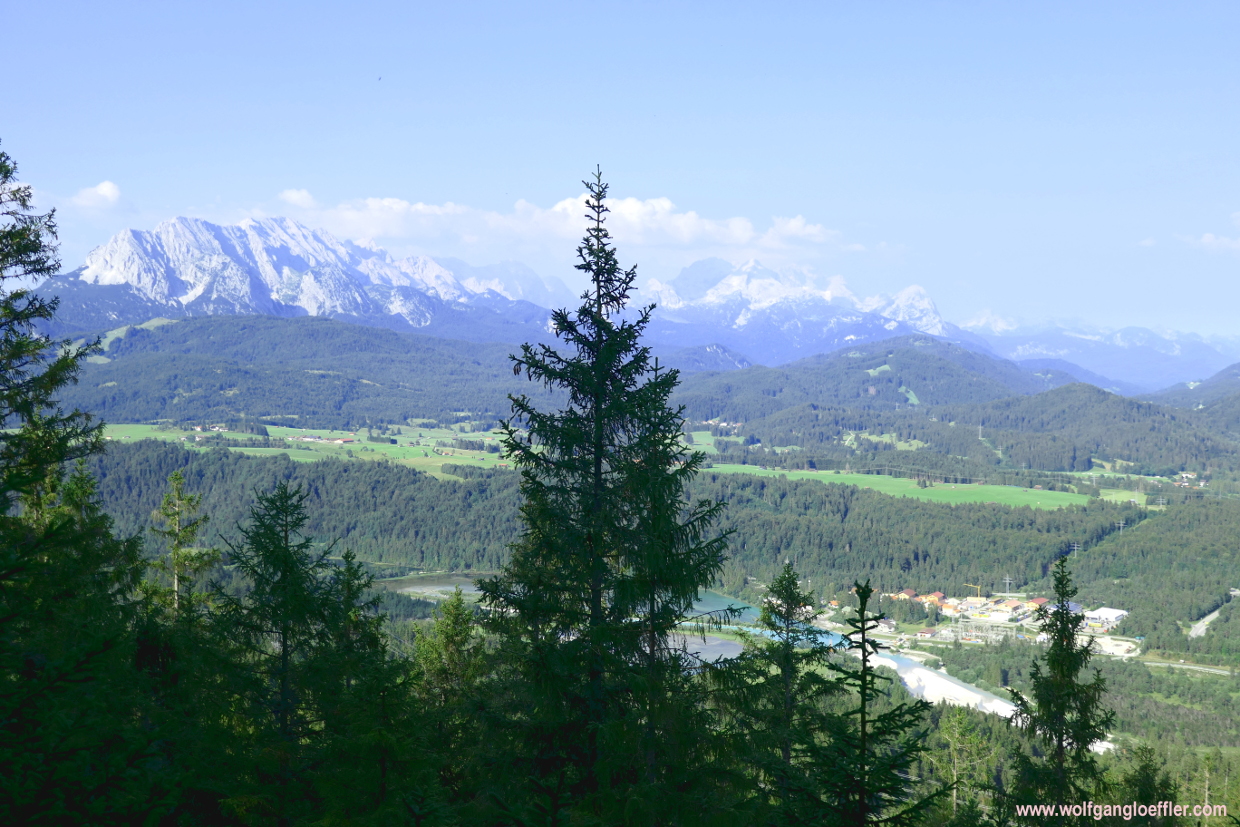
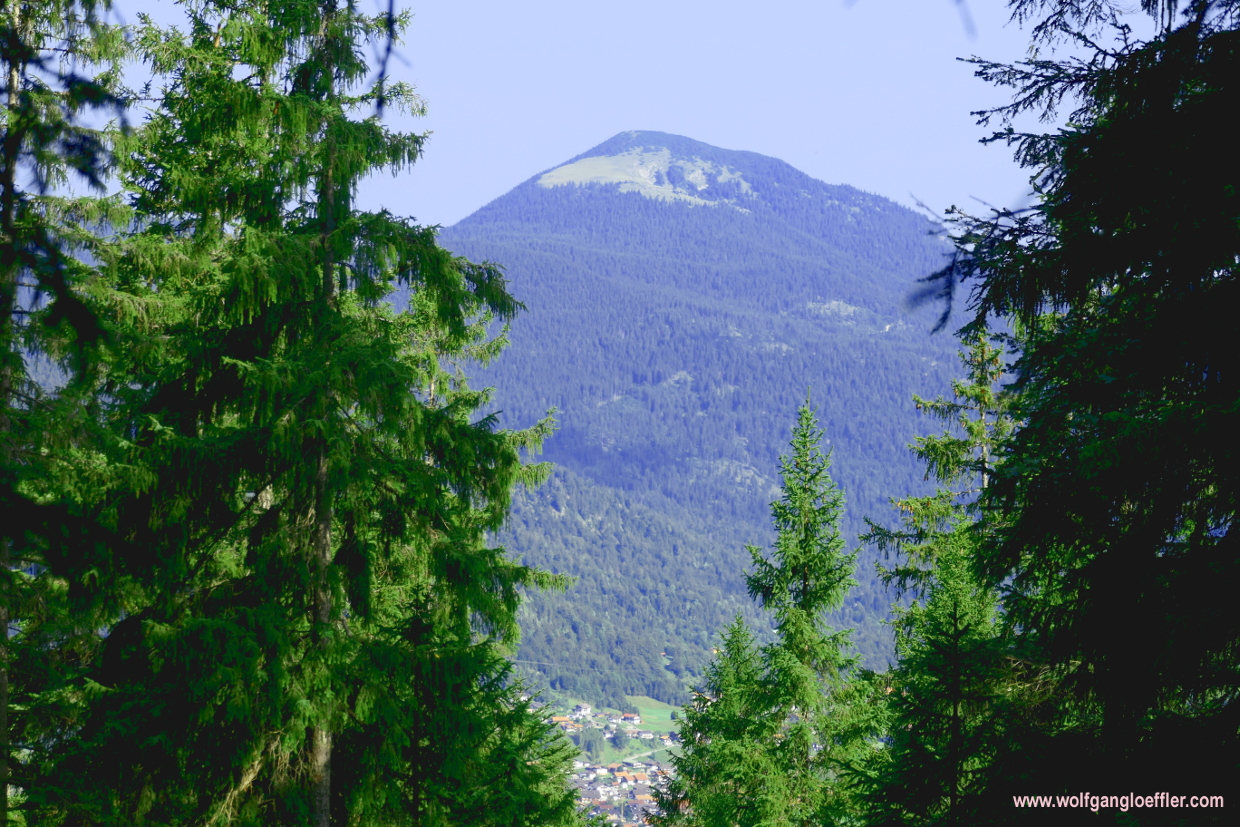
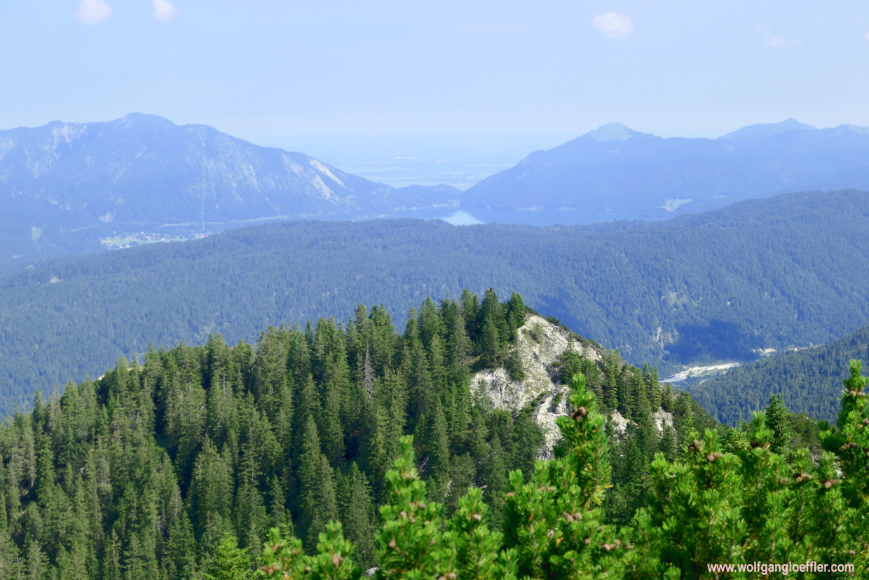
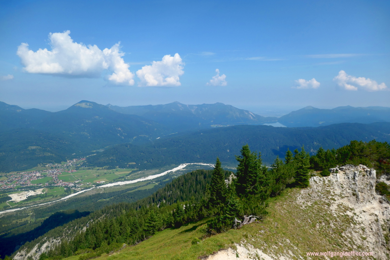
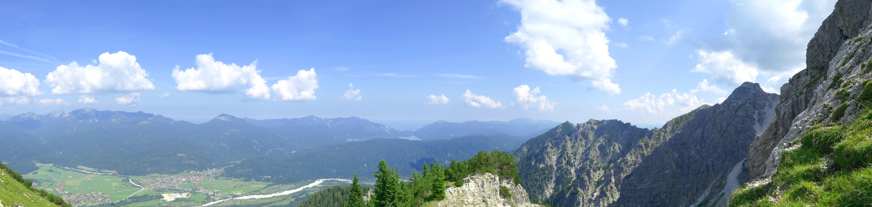
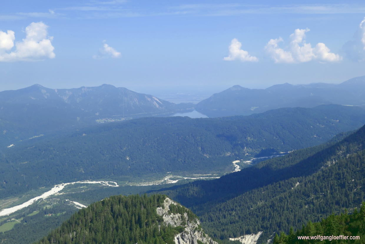
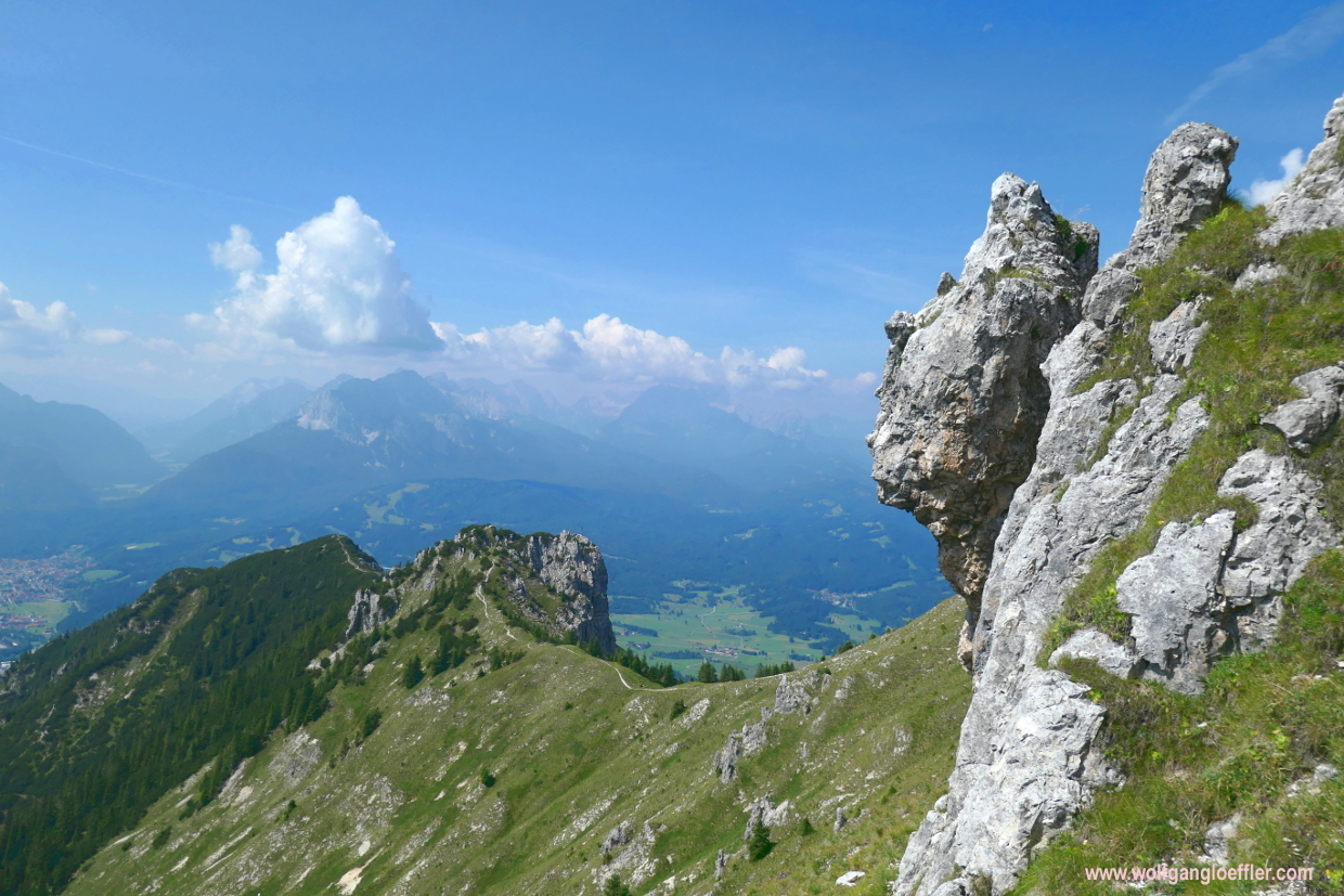
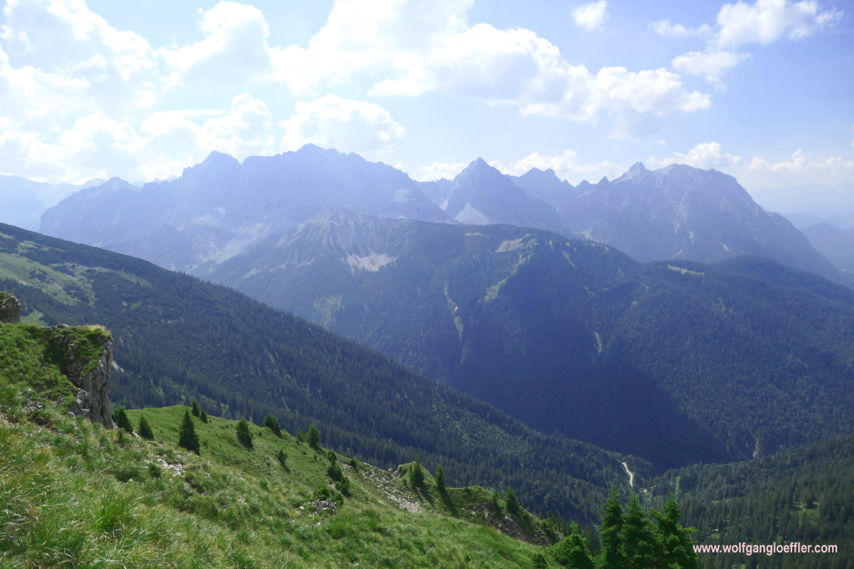
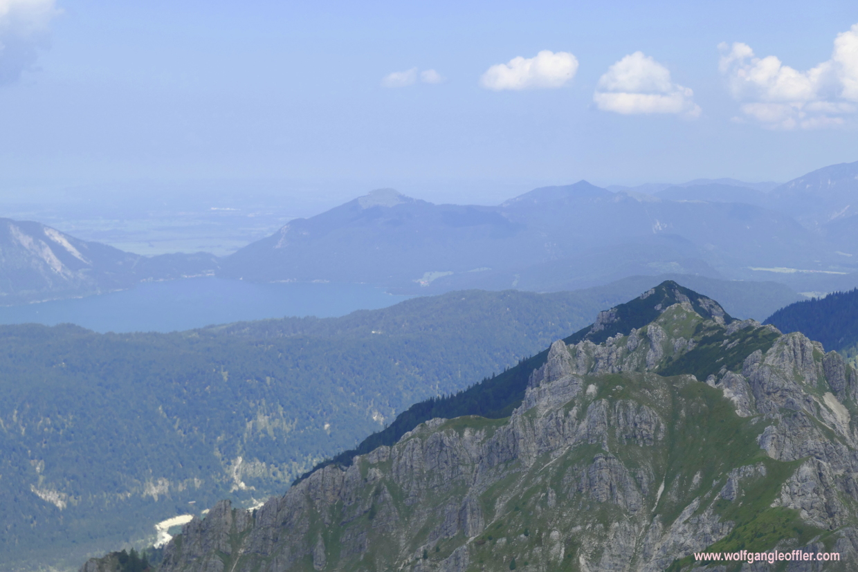
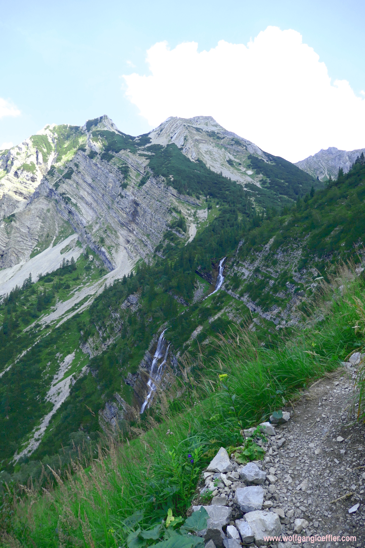
For quite some time the gurgling of the cascade follows me. Whenever I turn around I have a great view of the Gumpenkarspitze and the Soiernspitze is in view for a long time, too. When looking in the northern direction I can distinguish in the far at the end of the Fischbach valley the Sylvenstein reservoir. The narrow path runs along a bit below the ridge of the Schöttelkar. At some points I have to cross gravel fields but the trail is well maintained and easy to walk. Most of the time I am walking in the shade of the mountain to my left and kind of like it. For the towns down in the valley they have forecasted temperatures close to the 90s. Here on the mountain it’s nicely cool.


At some points the track is secured with rope wire since it’s litterally running through rocky walls. But it’s not too bad. Even the ladder you see above is easily to be mastered. The trail keeps running alomsot evenly along the mountain. From time to time I cross small creeks. A good opportunity to fill up my water bottle. It was a good decision to walk this trail. Every once in a while the Soiernspitze comes up behind the mountain even though I have left it a good deal behind meanwhile.
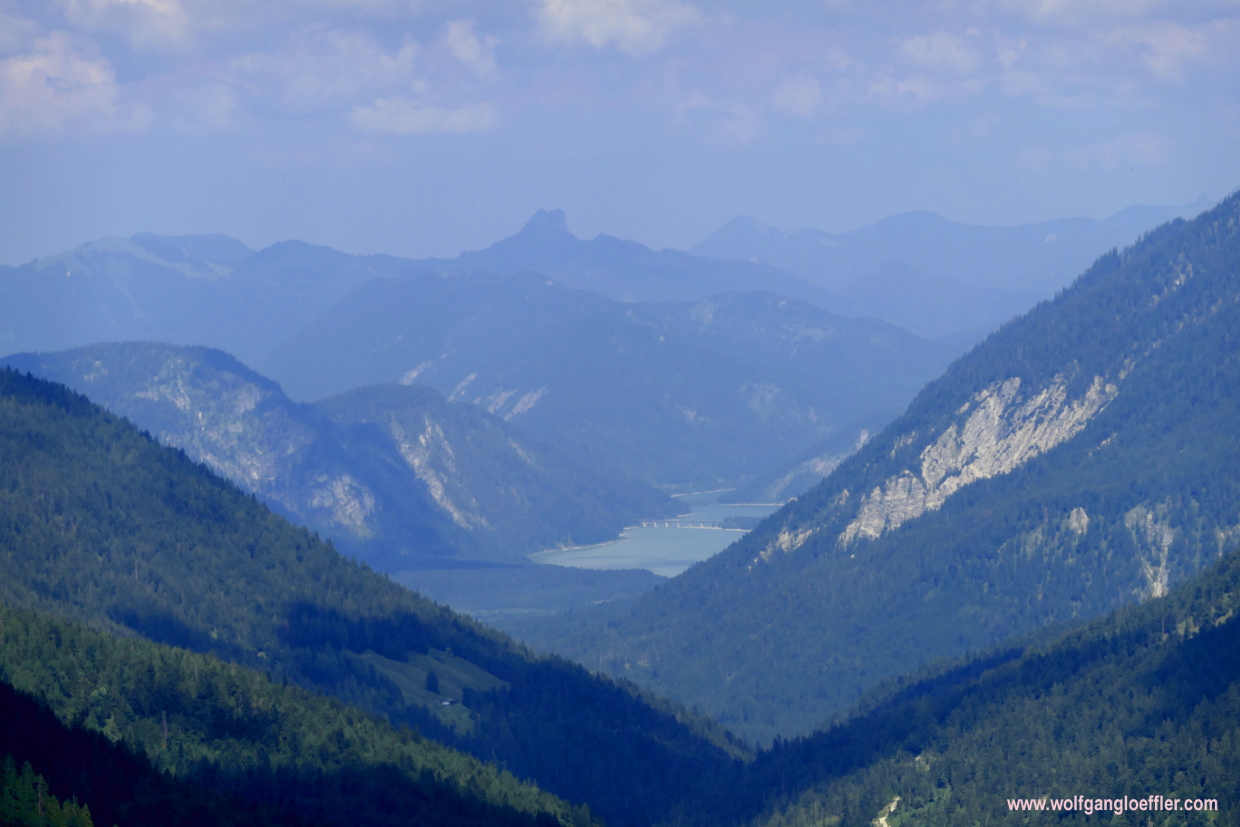
After two hours the path turns left. From this point I have a good view of the Sylvenstein reservoir in the far. The peaks are coming lower and don’t have those rock walls anymore. Here the trail leads back into the woods and still falls only slowly downhill. 15 minutes later I reach the Fischbachalm. There I can see the gravel road coming up which I would have walked when I hadn’t taken the Lakaiensteig. Two more reasons that speak for the trail I have taken. If I had chosen the gravel road I would have had to walk over this hard floor and I would have had another long ascent.

So I am standing in front of the next cabin. It’s already late in the afternoon and I still have to hike for about 1.5 hours before coming back to my car but I decide to sit down for a quick refreshment at the Fischbachalm. Today I won’t have to respect any bus or train schedules. I take a seat with a view of the Gumpenkarspitze. A pure delight! At the entrance of the hut I see that they sell home made products. They sure taste great. But today I won’t make my backpack any heavier anymore.

At the Fischbachalm then starts the part of the tour which the couple on the summit didn’t like that much. The rest of the tour leads over a gravel road which is the road to the alp at the same time. Most of it runs through dense forest but since it is rather broad it is also pretty sunny. The closer I am coming to the valley floor the hotter it gets. That makes this „stroll“ even more uncomfortable. The gravel heats up the surrounding even more. On the other hand it is rather pleasant to walk easily along this road after that strenuous ascent. Just before I reach my car this dark cloud froms over me announcing a storm. So I move a bit faster in order to reach the parking dryly.
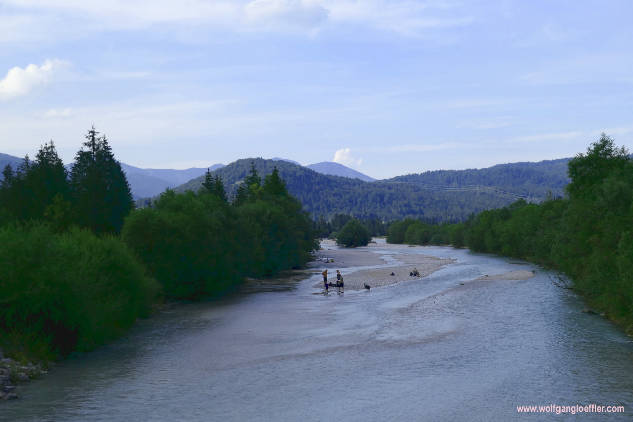
The cloud has moved away in the end and I come back without rain. In the Isar in Krün people are bathing. It’s 6 p.m. meanwhile and still pretty hot and humid. A perfect setting for such a refreshment. But after almost 10 hours hiking I just want to get home. I still have a 1.5 hour drive in front of me
This is the end of another fantastic tour. You will have to be in good shape to make it but it is worth the effort. I hope you liked my post and am looking forward to your feedback.


Kommentare