Crossing the Fockenstein

This tour is somewhat longer but from the Fockenstein you will have a great panoramic view. A part from the last tiny stretch before you reach the top and where you will have to scramble a bit there is are no difficulties and so almost everybody can go on this hike. Expect a great panoramic view over the Tegernsee and into the central Alps. You’ll even see the dominating summit of the Zugspitze in the far. You’ll have to walk a few miles if you follow my tour, but you can shorten it by descending the same way you came up the mountain from Bad Wiessee. If you want to do the tour following my footsteps, I do recommend that you take the train for your ride.
- total length: 12.2 miles (approx. 2.5 less, since I had to take a detour due to a blocked passage)
- elevation in the ascent: 2,900 ft.
- descent: 3,083 ft.
- duration: approx. 8 hours
Bad Wiessee, cute little town on the lake
May was wet and cool and so there was no chance to go on a long hike. When it finally got warmer and sunnier in June there was no holding me back at home and I had to go on a real hike. I took the train to Gmund at the Tegernsee and there I changed to the bus bringing me to Bad Wiessee. At the stop called Abwinkl I get of the bus and start the tour. You can get off already at the hotel „Bussy Baby“ and walk to the parking lot „Söllbach“ from there.
From the parking „Söllbach“ you will have to walk a steep road up to the Hotel Sonnenbichl. It sits a bit secluded right at the ski tracks which glow in fresh green now. The hotels terrace probably offers a great view across the lake and the mountains. Since it is still quite early and I have planned a rather long tour I just pass by the hotel. Next to the hotel is another parking lot for hikers where the forest road to the Auer Alm leads into the woods.
Through the valley of the Zeiselbach to the Auer Alm
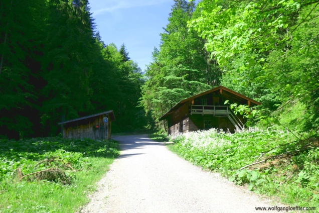
Along this gravel road I continue in a easy walk through the forest following the Zeiselbach. Allthough there are quite a few hikers around it is very quiet and apart from the burbling of the creek I hear only a lot of different birds. I change into my happy hiker mood quickly and the city is far behind me. My eyes are wandering from left to right in search of great motifs for pictures.
I am especially impressed by those huge fern bushes that are growing here. The road rises so slowly that I am wondering how I will ever make the 1,600 ft. that separate me from the Auer Alm. I fear that I will have a stretch with a very steep ascent on my way. But that’s not the cause. The temperature is very pleasant today and the road is mostly in the shade.
Just behind this cabin above the route runs along the creek again. After the heavy rainfalls of the past weeks it carries a big amount of water and I find a few rapids that give great shots. Up to now this tour is more like an easy stroll and no great mountain view either. They will come later, I hope.
After a short time the road ends in a grand turnaround point. I have to search a bit but soon I find the path leading to the Auer Alm. And here is the stretch that runs steeply up the hill. But not too steep and since I am still in the shade of the forrest it is still rather cool and not too strenous. About half an hour later I do reach the Auer Alm.
A mountain cabin with a great view
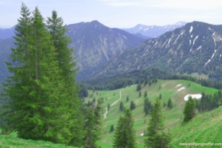
The cabin has a great location on a high plateau and here I do get the panoramic view I did miss up to now. After a 2 hour hike I am standing up here and look at the surrounding summits. To the south I can see the Hirschberg which I wanted to climb on my last tour. This didn’t happen since there was still too much snow. This view has to be enjoyed for a while and so I am looking for a free seat on the terrace. A non alcoholic beer and a snack. Life can be so beautiful.
Allthough it really is picture perfect here I do have to leave at one point. I still have planned a few hours of hiking. To begin with the 980 ft. climb to the summit. There are two possibilities to reach the Fockenstein. At the little chapel on it’s foot you can take a right and continue along a path that meanders along the mountain. I take the assumed easier way and continue direction Neuhüttenalm.
At the roadside I keep finding fascinating flowers. The snow masses of the last winter are finally gone and made place to the fresh green of early summer. Awesome. The road continues in a low rise along the summit of the Fockenstein. Suddenly a biker stops next to me and asks if she has reached the highest point. Honestly I don’t understand what she means and continue my way. Which highest point is she talking about? Only when she asks again I ask her what exactly she means. She actually meant the highest point she could reach with her bike on this tour. That she had reached. To get to the summit she would have to carry her bike.
I am somewhat proud of this shot of the butterfly above. Up to now I have never succeeded when trying to take such a shot. Since I keep stopping to take a few more of them I need a bit longer before I reach the Neuhüttenalm. This alp sits in a smal hollow between the Fockenstein and the Neuhütteneck summits.
Neuhüttenalm, another alp
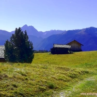
There still is a bit of snow. And I am only at 4,600 ft. elevation. But in May it did still snow up here. On the other hand I am impressed how fast the green is showing once the snow is gone. On this alp there are already cattle grazing. I haven’t seen any at the Auer Alm. At this cabin you can buy refreshments too. But the view back at the Auer Alm is way more spectacular. Just behind this cabin I see another chapel that sits a bit higher on the mountain.
Suddenly the sky is overcast. When I look back from where I came the sky is still blue but to the west it’s cloudy. Too bad. I would have loved to enjoy the sunshine during the rest of my tour. The summits of the Neuhütteneck and Fockenstein are linked by a ridge. I am turning to the right towards the Fockenstein.
A small path is winding in serpentines up the mountain. There are some orchids in full bloom. Those flowers do fascinate me as much as the mountain panorama around me. Usually I am walking in higher elevations and so I am impressed by the stunning views I have here. Under the clouds I have still a great view of the surrounding mountains.
Then I see the first gentian on the meadows. Again and again I have to admire this blue. Mother nature has ways to show her beauty. Slowly I follow the path towards the summit. Can’t be that far anymore. With those comfortable temperatures I don’t even sweat too much today.
A Summit with a great view
And then I reach the last stretch to the summit. Just a short climb through rocks separates me from the top. Nothing dramatic. You van easily make it. At some points I do need the help of my hands but that’s only a few minutes. Once you have reached the top you will be rewarded with a great view. To the east you can see the prominent summit of the the Wendelstein and a piece of the Tegernsee. To the west you can see the Zugspitze and the Karwendel mountains in between.
Here on the top of the mountain it is quite busy. I wasn’t the only one that decided to profit from the beautiful weather. You can reach the Tegernsee easily by public transportation and by car from Munich. Sure there are a lot of people around on a weekend. Despite the people up here I still find a place to sit down for a bit and enjoy the panorama.
Once I have left the summit it is getting calmer real quick. Most people walk back on the same way they climbed up the mountain back to Bad Wiessee. That is probaly due to the fact that most of them came by car. I do like to descent on another route than the one I took in the ascent. That’s more diversified. And if you ride the train to the mountains it is more sustainable anyway.
A detour on the descent
Soon I am back on a forest road and follow the signs direction Geierstein. As per my map there should be a path that brings me to this summit with a short ascent and then continue to Lenggries. On this route the descent isn’t much longer then my ascent from Bad Wiessee. There are a lot of trees lying around that broke under heavy snow during the last winter. Must of them are fir. Let’s hope that they plant some broadleaf trees instead. A mixed forest is so much nicer and more sustainable.
In the light forest there are flowers in bloom everywhere. That’s beautiful to look at. On this side of the Fockenstein the descent is very comfortable too. A short stretch is a bit steeper but runs along a gravel road too. So this hike is more like an easy stroll with a few more miles to go. By the end I did make a few of them.
On this pond above the route splits. To the right is the road leading to the Geierstein and to the left a road leading through the valley of the Hirschbach. I follow the signs to the Geierstein. On almost even terrain I continue through the forest on almost 1.5 miles before I reach the next turn. And there I am standing in front of a sign telling me that the path is closed due to broken trees. Just in front of me a guy ignores this sign and from the other side a couple is coming down the mountain. So I guess it’s not as bad and continue on my way. Just a few minutes later a mountain biker comes along my way and urges me not to continue. He says that the path is completely barred bay trees. I consider my options for a moment and decide to find another route.
So I walk back to the pond and hope to find an alternate path leading to the valley. On my map I can see a couple but unfortunately I can’t find them in the woods. When I am back at the pond I take the road leading through the valley of the Hirschbach which does lead towards the valley but direction to the mountain where I just came from. This feels like taking a detour. At least I am walking in the shade of the forest and do have enough energy to make the extra mile.
A surprisingly charming creek valley
About half an hour later I reach the valley floor and continue along the creek. This valley turns out to be quite beautiful. Through a sort of a canyon I am walking towards the valley openning. This creek carries a lot of water too and so I do find some great spots for pictures where the water runs over large stones towards the Isar.
The tour is dragging but since there is always something interesting to see along the road time is running quickly. The road is descending slowly and easy to walk. Again it feels more like a stroll than a strenouos hike.
All of a sudden I am standing in front of forest classroom. This is being used by schools for tuition purposes. Mobile phones can’t be used here and so the kids aren’t abtsracted during class. And the teachers can bring nature closer to the kids in a very ostensive way. I like that idea. And since they have to walk for about an hour before they reach this classroom they get some extra sport.
Hohenburg, castle and horses
Short time after I quit the forest and get to see the first farm houses and the Geierstein to the right. To the left there is the summit of the Seekarkreuz and Grasleitenkopf. And suddenly the sun is back. Can’t be that far anymore to the train station.
A few yards down the raod I reach Gut Hohenburg. A stud where the horses are being held adequately and where they have enough space to run around. When passing the compound I get startled for a moment. It looks as if there would be a zebra standing next to me. But I figure aout real quick that it is a horse that wears a coat in zebra colors including a hat.
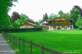
Right after the stud I come to the Hohenburg castle. These days it is home to a secondary school for girls run by the catholic church. Looks nice allthough I have seen more impressive castles. I have seen this house on other hikes form the far and was always wondering what it might be.
Soon after I am coming to the valley of the Isar and the town. About 30 minutes later I am standing at the train station. Actually I would love to have a fresh drink. But before I do that I check the train schedule and realise that the next one is leaving in 5 minutes. Good timing. After this long walk I am somewhaht tired and am looking forward to having a shower. Unfortunately the train stops in the middle of the woods just outside of Munich. Apparently the next station had been closed due to a police operation. So it takes a bit longer before I am coming home. Despite having run into unforeseen events this was a great tour and I am already looking forward to the next.
 wolfgangloeffler – weitgereist










Kommentare